
Another very warm mid-February day is in the forecast with near record to record highs expected across parts of west and west central Texas by later this afternoon. A series of cold fronts will arrive beginning tomorrow which will knock temps back down to near normal values for this time of the year for the first part of next week. But until then, we’ll be dealing with morning lows close to the highs we typically see at this time of the year. The big item in the forecast for this weekend will be the return of decent rain chances tomorrow and into the first of next week. Today and most of Sunday will remain quiet, but by Sunday afternoon and through the overnight hours into Monday, we’ll see much better rain chances develop. We’ll look at that further down in the blog.
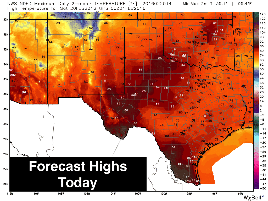
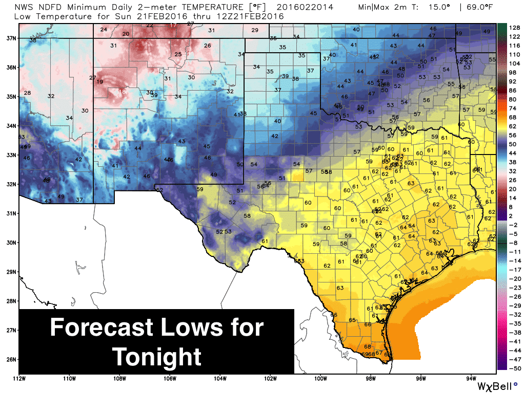
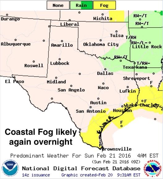
Copious cloud cover stretching diagonally across north, central and southern portions of the state will help keep highs today from ramping up to near record levels, but across west and west central Texas, we’ll see highs jump into the mid to upper 80s this afternoon as a surface high builds briefly across the region. Thankfully, increasing moisture across west central Texas and light winds will lessen the chance for wildfires across the region, but with dry conditions still present, we continue to encourage everyone to be mindful of anything that could cause a spark or flame. Across the rest of the state, we’ll see highs in the mid to upper 70s with a bit of a breeze. For tonight, lows will once again be well above normal from north/northeast Texas down to the coast…pretty much where the highs should be at this time of the year. For the panhandle and parts of the south plains, we’ll see lows closer to normal due to much drier air across the region. Coastal fog will also be possible again tomorrow morning.
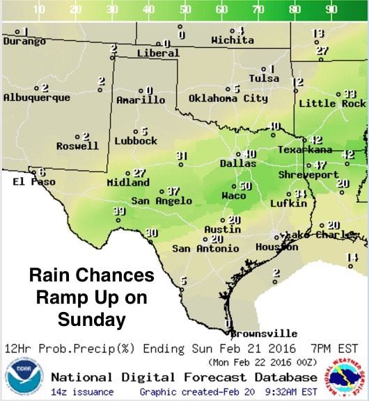
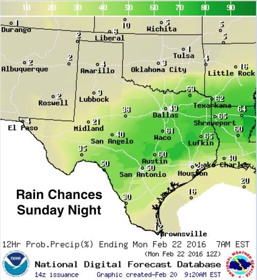
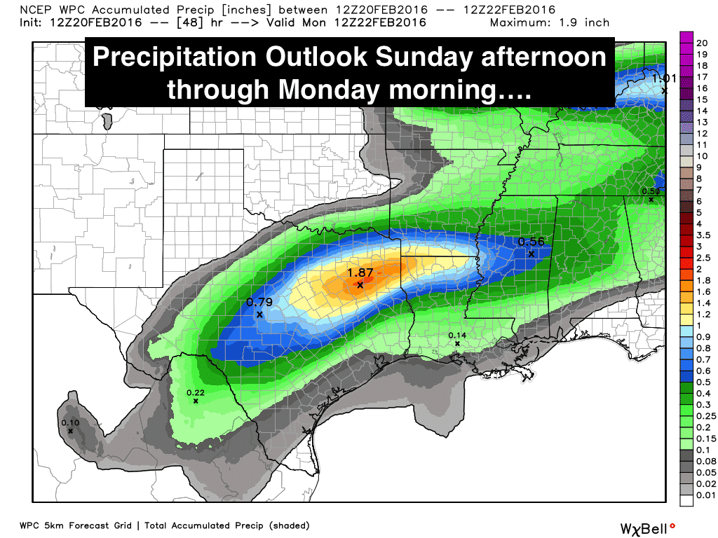
Dry air in the mid-levels of the atmosphere will keep rain chances at bay Rain chances increase tomorrow afternoon and into the overnight hours as our next cold front moves through tonight and eventually stalls across central Texas by late Sunday. Best chances for rain will begin late Sunday through early Monday morning as a stronger disturbance arrives and interacts with the stalled cold front. The heaviest rain will likely occur across central, southern north Texas and up into northeast Texas. Right now it looks like across across southern north Texas on up into northeast Texas could pick up a good inch or more of rain, with a few places picking up just over 2 inches. We certainly need that before we lose all the ground we gained this past year. Severe weather is not likely, but we could see a few thunderstorms develop with lightning and small hail being the biggest issues. We’ll be up keeping an eye on things just in case something goes crazy, but the likelihood of that is pretty low.


0 Comments