
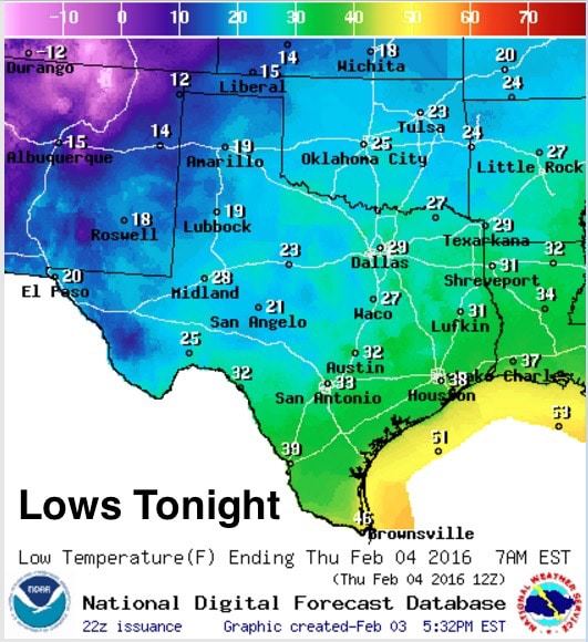
High pressure will settle in over the state for the next couple of days on the heels of today’s front. Clear skies overnight will give way to temperatures dropping down into the upper teens across the panhandle, upper 20s across north and northeast Texas, with mid to upper 30s across southeast and coastal Texas. Aside from some light snow across the northern panhandle this evening and overnight, conditions will remain chilly but calm with winds generally under 10mph.
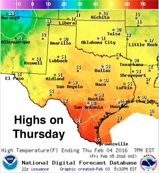
We expect to see a nice warmup tomorrow with temperatures reaching the low 50s across the panhandle, mid 50s across north and west central Texas, and upper 50s to mid 60s further south along the coast. Still a few degrees cooler than average for central and south Texas, but definitely pleasant with plenty of sunshine!
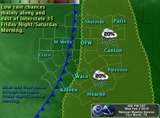
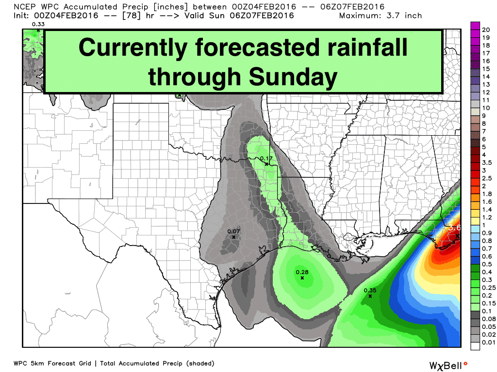
We will keep this quiet weather pattern until we head into late Friday night and early Saturday when we expect to see our next upper level low and weak cold front arrive which will generate rain chances across the mainly the eastern half of the state. The cold front that pushed through last night and this afternoon will have scoured out most of the moisture before this next system arrives, which leaves very little moisture for it to work with. As such, we’ll see only minimal chances of rain beginning late Friday and continuing on and off into Sunday, with the best chances looking to be east of the I-45 corridor.
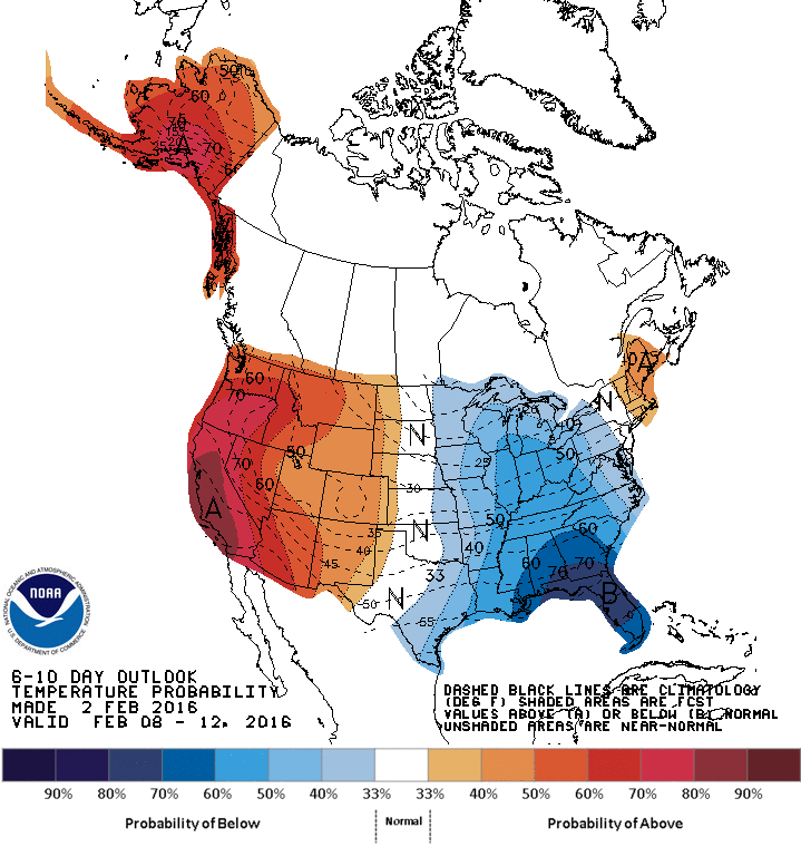
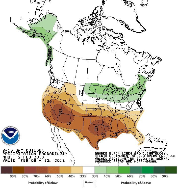
 A Look Ahead: After the weekend’s upper level system departs to the east by early Sunday, our state will be positioned between a deep trough of low pressure to our east and a strong upper level ridge to our west. Northwest flow in the upper levels across the state will allow a strong cold front to strike a glancing blow across the eastern half of the state with the coldest air shunted well east across the Mississippi valley region. It also looks like we’ll be locked in a predominantly dry weather pattern through next week. By mid-month, the long range forecast models are hinting at a bit of a pattern chance which may increase rain chances for the state, but it’s still too far out to be certain at this time.


0 Comments