
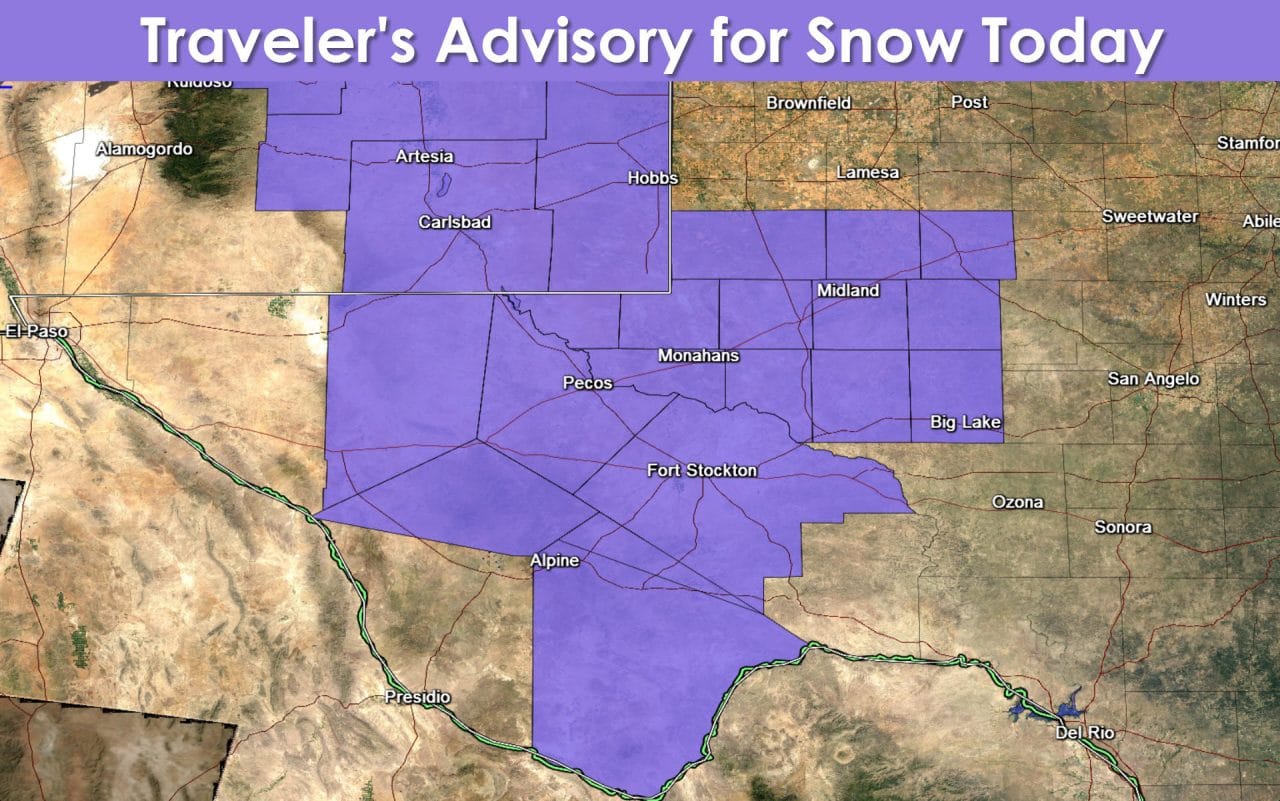
Precipitation will increase across the Permian Basin, West Texas, and the Big Country this afternoon. With surface temperatures expected to be in the 30s there will be the possibility of a rain/snow mix. Temperatures across the Permian Basin are expected to be slightly cooler. Its possible we could see more snow than rain. Snow accumulations of one to three inches will be possible. Some of that snow could accumulate on roadways resulting in slick conditions. The National Weather Service in Midland has issued a Winter Weather Advisory for much of the Permian Basin until this evening. If temperatures are a tad warmer than expected the chance for accumulating snow will diminish significantly. Likewise if we end up one or two degrees cooler than expected the snow accumulation totals will need to be increased. A dusting is possible across the western Big Country this afternoon but the primary precipitation type is expected to be rain.
Rain chances will continue much of the day and into tonight across Southeast Texas, the Coastal Plains, and into the Rio Grande Valley. It won’t be raining all day nor are we expecting severe weather. The highest rain totals – up to an inch – will be possible across Far Southeast Texas. Lighter totals from a trace up to locally half an inch will be possible across the remainder of the locations listed above. An isolated shower may make it as far north as Austin to Madisonville today. By tonight the highest rain chances will be confined to within about 75 miles of the coast from the Rio Grande Valley up through the Coastal Plains into Southeast Texas. Light rain/snow will remain possible through the early evening across the Permian Basin. By Wednesday the chance for precipitation will end except for the Rio Grande Valley where showers will remain possible.
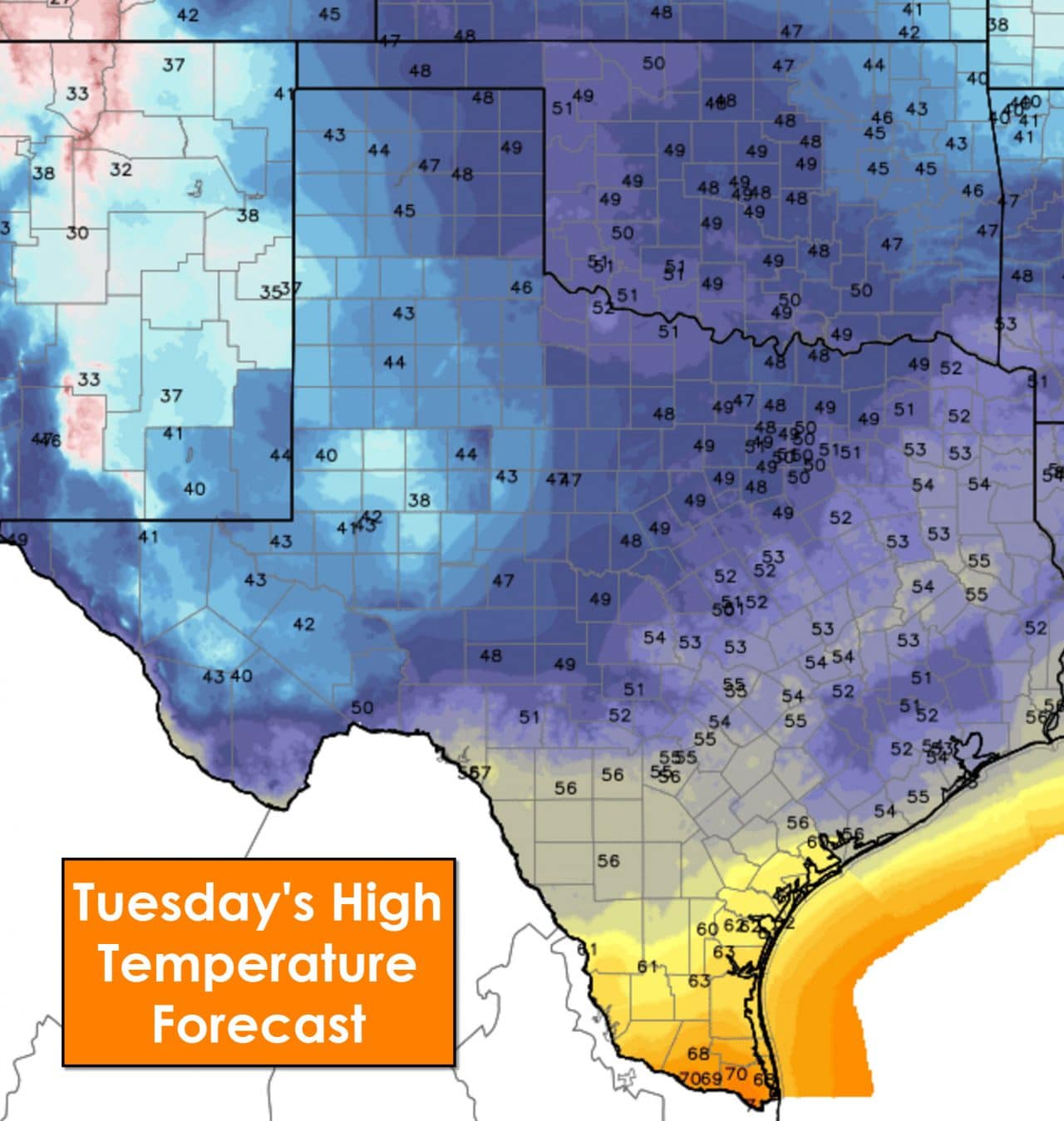
Much cooler weather will prevail across the state today after a cold front moved through on Monday. Temperatures will range from the upper 30s in the Permian Basin into the low 50s across North Texas, East Texas, and Southeast Texas. Deep South Texas and the Rio Grande Valley will be the only folks that continue to enjoy temperatures in the 60s. Don’t fret though because temperatures will quickly rebound upwards by tomorrow and for the remainder of the week.
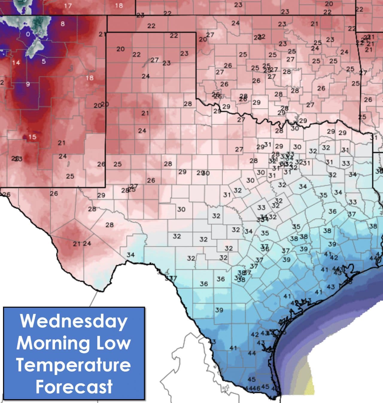
Low temperatures by Wednesday morning will be in the 20s northwest of a Fort Stockton-San Angelo-Denton-Paris line. 30s can be expected all the way south to Interstate 10 including San Antonio and the northern Houston metro. The Rio Grande Valley will even be relatively chilly with mid 40s tonight. If we end up with a snowpack in the Permian Basin today than the temperatures tonight will be cooler than shown here.


0 Comments