
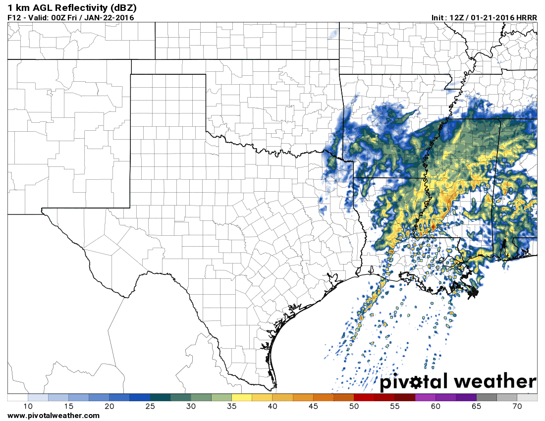
Our primary focus this morning will be on the severe weather threat in Far Southeast Texas through early this afternoon. The Storm Prediction Center maintains a Level 2 risk of severe weather along and east of a San Augustine-Lufkin-Livingston-Galveston line. A Level 1 risk runs along and east of Interstate 45 from Madisonville south to Houston. The main risk timeframe will be from about 10 AM through 3 PM. Sub-severe storms will be possible from now through mid-afternoon across Northeast Texas and East Texas. These storms will be elevated above a stable surface layer. A few stronger cores may produce small hail but otherwise the severe weather threat will be low.
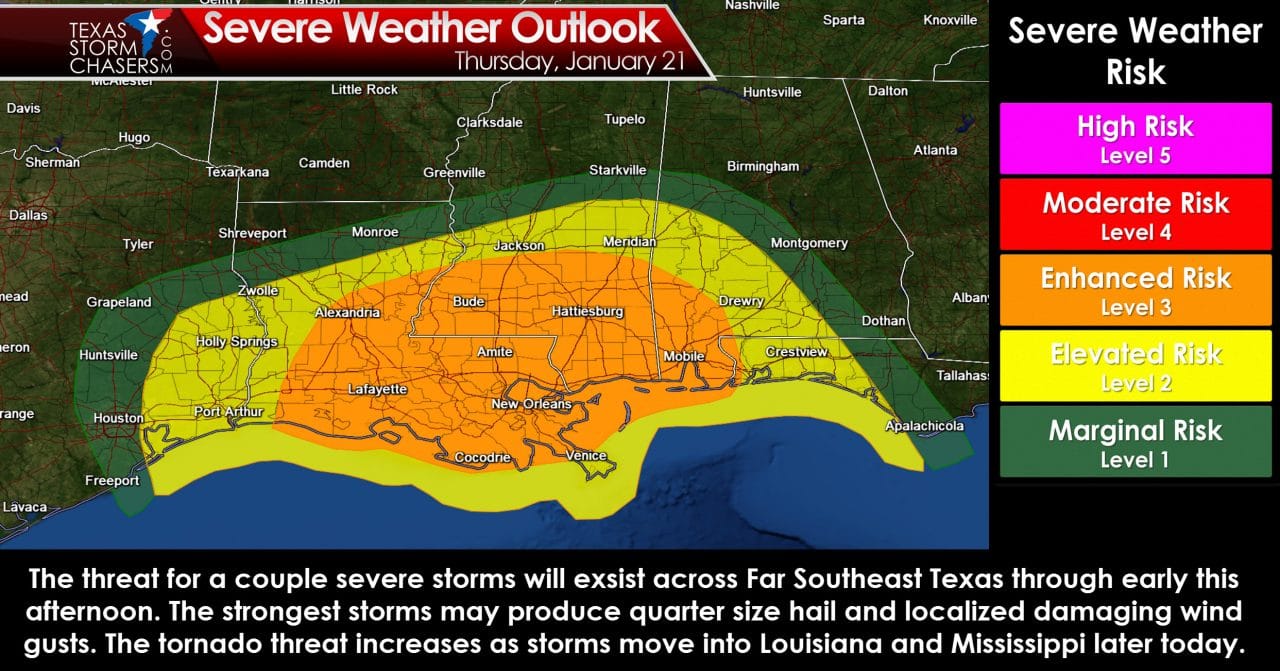
12Z HRRR – Simulated radar at 11 AM This Morning
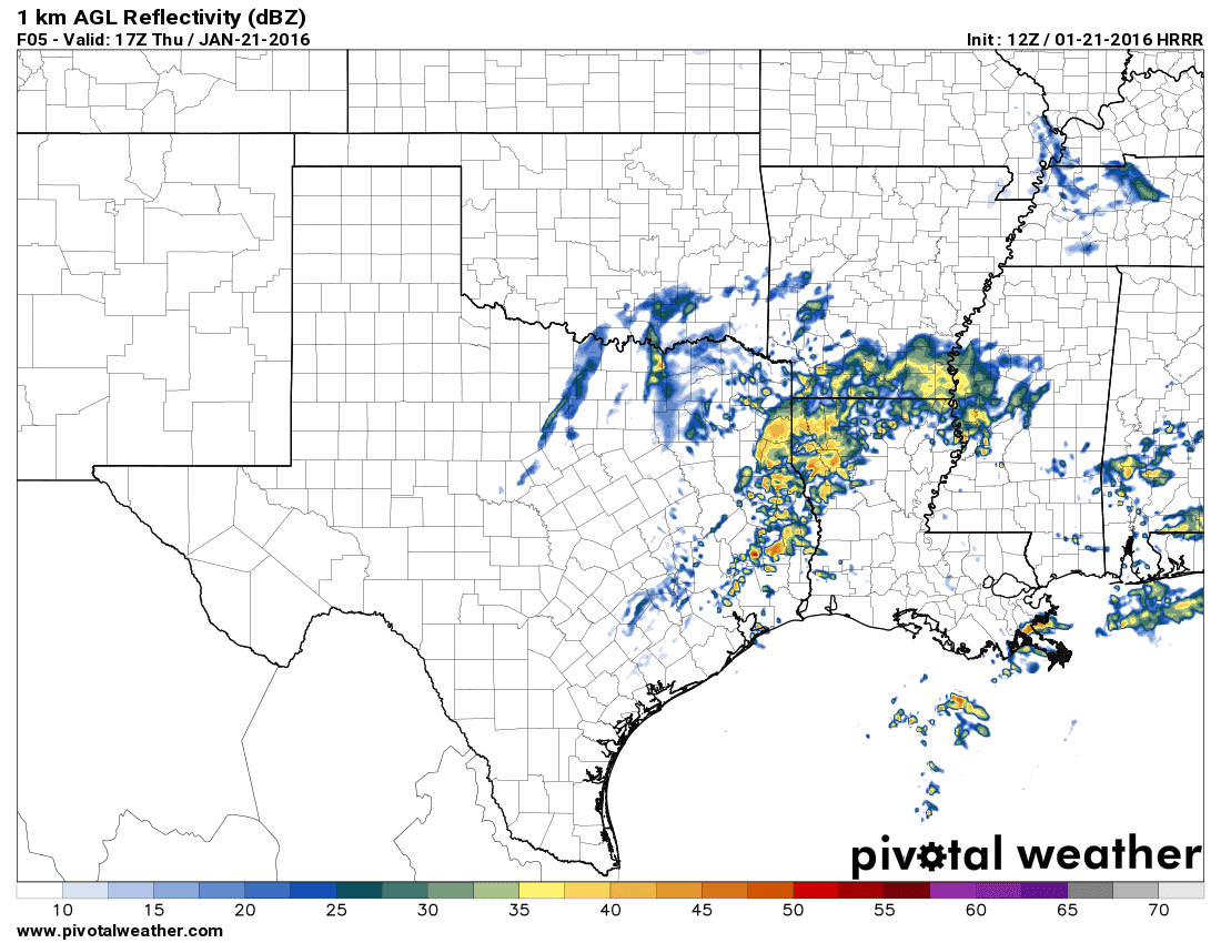
12Z HRRR – Simulated radar at 12 PM This Afternoon
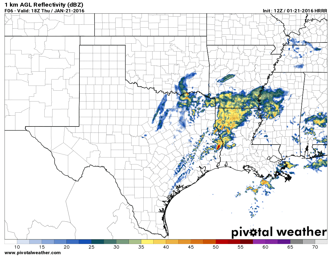
12Z HRRR – Simulated radar at 3 PM This Afternoon
Surface-based thunderstorms are expected to develop in far Southeast Texas later this morning. These storms may take a while to get their act together as they move east/northeast. For that reason I’m expecting the primary threat to be quarter size hail and localized damaging wind gusts. Most folks won’t be dealing with severe weather today – but we’ll have to watch out for a few discrete storms. We’ll have to watch any established supercell as it approaches the TX/LA border in case it tries to develop low-level rotation. As the storms move east into Louisiana and Mississippi by this afternoon they could become more intense with a tornado risk. Fortunately for our state the timing of the system will preclude a more significant severe weather risk.
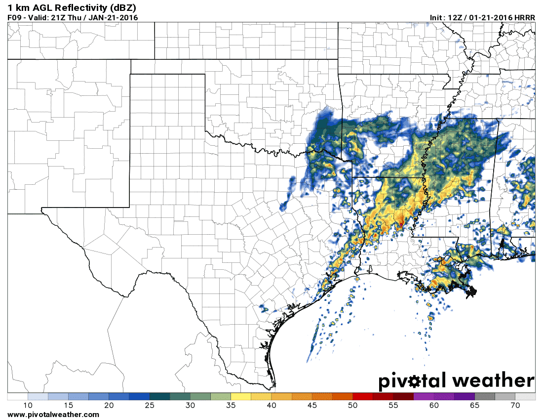
12Z HRRR – Simulated Radar at 6 PM This Evening
Showers and a few storms will remain possible through late this afternoon across Northeast Texas and East Texas. Some storms may produce small hail and localized heavy rain. A few spots in East Texas may pick up a quick half inch of rain before activity exists to the east by late afternoon. Tonight will be mostly dry across Texas.
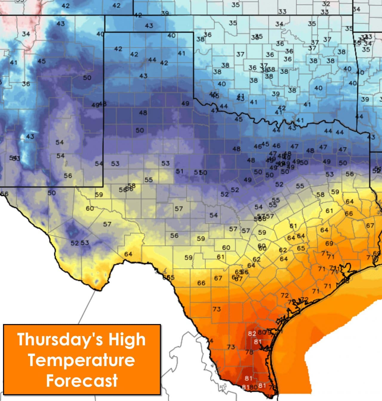
Some of these high temperatures will likely occur during the morning hours as a cold front pushes south today.
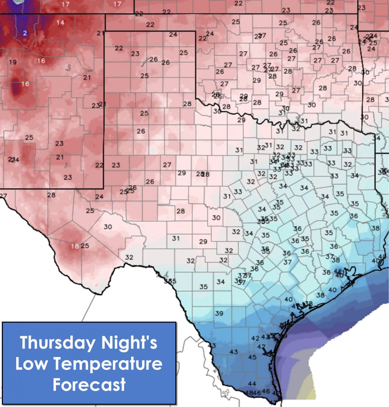
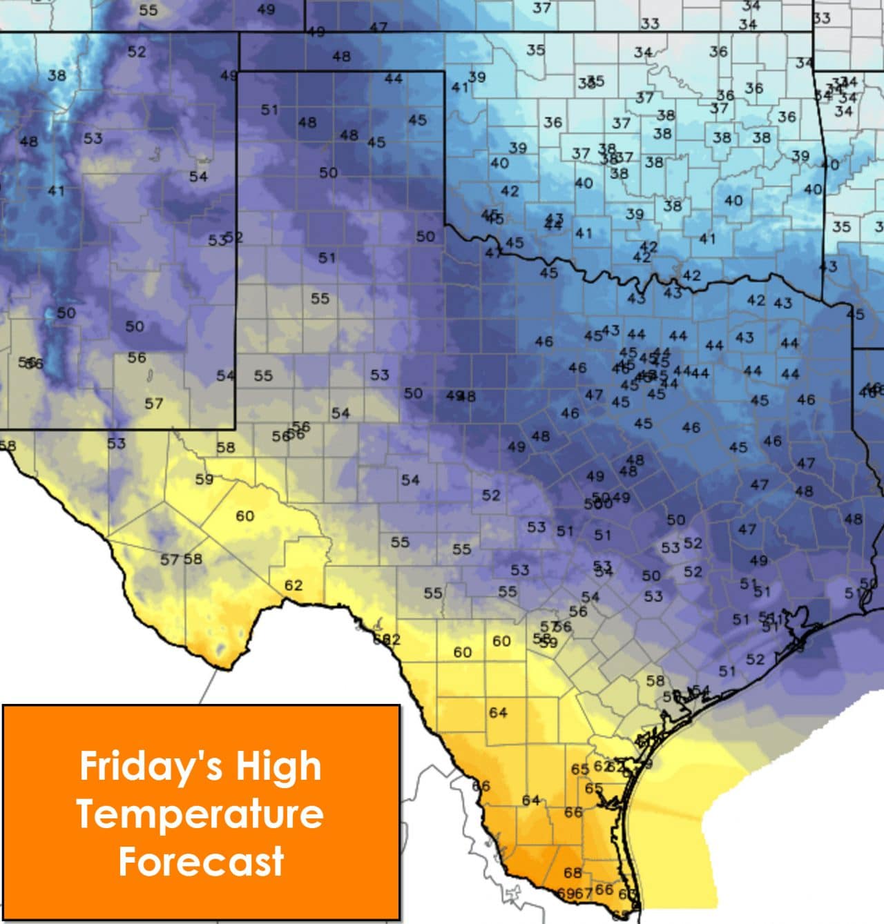
In the wake of the storm system a cold front will continue to push south across all of Texas. By tonight it should be into the Gulf of Mexico with north/northwest winds across all of Texas. Temperatures will be much cooler tonight and on Friday with low temperatures ranging from the mid 20s in the western third of Texas up to the mid 40s in the Rio Grande Valley. Cities along I-35 and I-45 will drop into the 30s tonight. Friday will be chilly unless you’re south of Interstate 10 where temperatures will at least make it into the 60s.


0 Comments