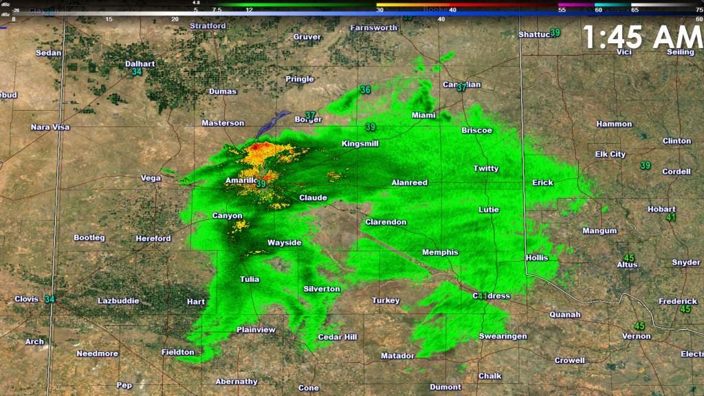
Light rain has begun to fall across across the eastern Texas Panhandle. Most precipitation is quite light at the moment. You might notice the radar is depicting an area of heavy precipitation right around Amarillo. That radar – located just northeast of Amarillo – is picking up melting snow. This phenomenon is known as bright banding and indicates the freezing layer is lowering. This process is due to cold mid-level temperatures being dragged down by the precipitation. The result should be a transition to a rain/snow mix over the next few hours. Surface temperatures will also dynamically cool allowing snow to accumulate on grassy surfaces. I believe one to two inches of snow may accumulate through sunrise across the eastern Texas Panhandle. Further west folks in Amarillo may end up with a dusting to an inch. Some travel issues may occur this morning but should quickly improve this afternoon after snow moves out.
The midnight run of the HRRR hourly weather model moves precipitation southeast into Northwest Texas after sunrise. A rain and snow mix is possible this morning across Northwest Texas. Some locations may pick up a dusting to quarter inch of snow accumulation on grassy surfaces. Surface temperatures will remain above freezing and no travel hazards are expected. Light rain will be possible by mid-morning in North Texas with a rain/snow mix along the Red River in Texoma.


0 Comments