
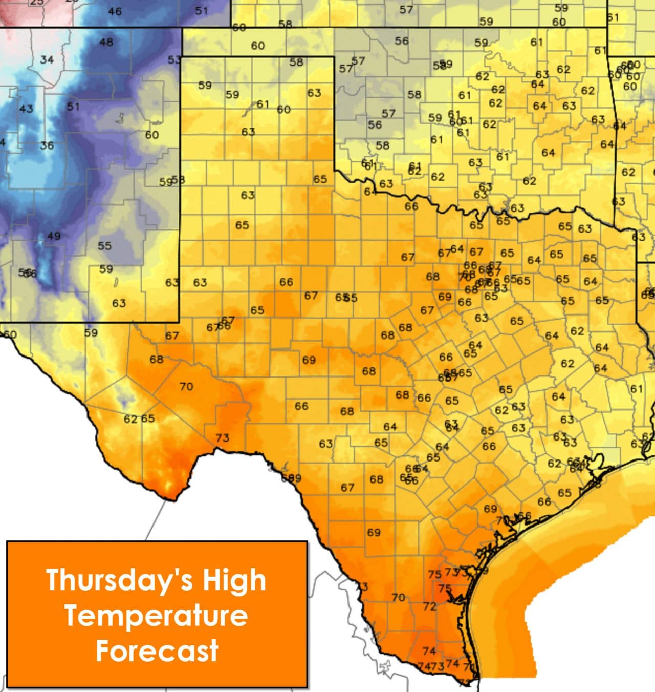
Temperatures will be quite warm this afternoon across all of Texas. In terms of specific locations this forecast is pretty easy with no sharp temperature contrasts. By this afternoon temperatures will peak in the 60s to 70s across the state. It’ll be fairly windy for the western two-thirds of Texas as winds get gusty out of the west/southwest. Skies will remain mostly cloudy from the Hill Country east through Central Texas and East Texas and points south from there.

Scattered showers and perhaps an isolated storm will be possible along the coast today and into the Coastal Plains and Southeast Texas. The most heavy and widespread activity should remain off the coast. By tonight most precipitation will have moved east of Texas but a few showers will remain possible east of Interstate 45.

Tonight’s low temperatures will very from the mid 20s in the Texas Panhandle and South Plains up to around 50 degrees along the coast and in the Rio Grande Valley. Those values are near or a few degrees above seasonal averages.
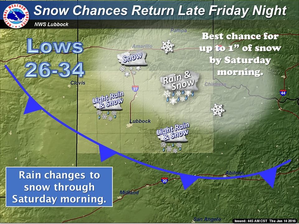
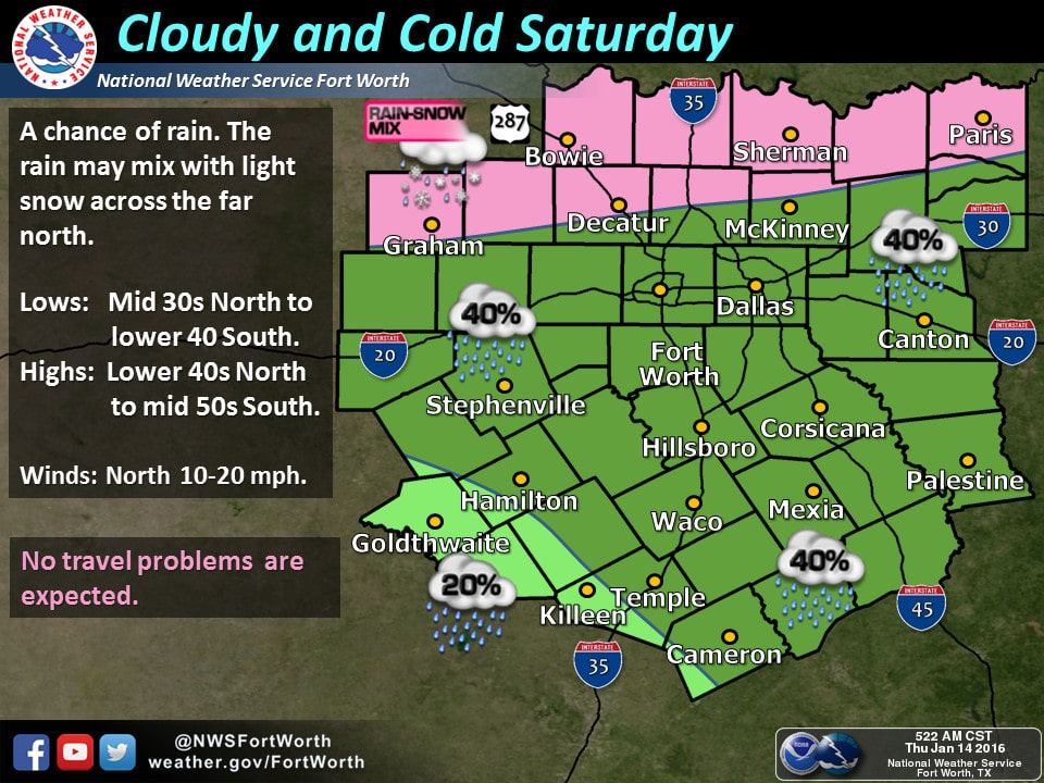
Our next round of precipitation will begin Friday Night and move southeast through Saturday. The area of precipitation won’t be particularly large and the eventual track will depend on a low pressure’s position. At this time it appears dynamic cooling aloft will support the possibility of a wintry mix or snow across the Texas Panhandle and portions of the South Plains and Big Country. Surface temperatures will be at or above freezing across the Big Country but temperatures aloft will still support some winter weather precipitation. Very minor accumulations will be possible on grassy surfaces but no travel issues are expected due to above-freezing surface temperatures. There remains uncertainty over where the precipitation will track and who will receive just rain or rain and snow. Future forecasts may require the introduction of a rain/snow mix into parts of North Texas. Regardless surface temperatures will remain above freezing and no travel impacts are expected in the Big Country or North Texas. We’ll talk more about the snow chances in a blog around lunchtime. There will probably be some forecast changes as we get into Friday.


0 Comments