
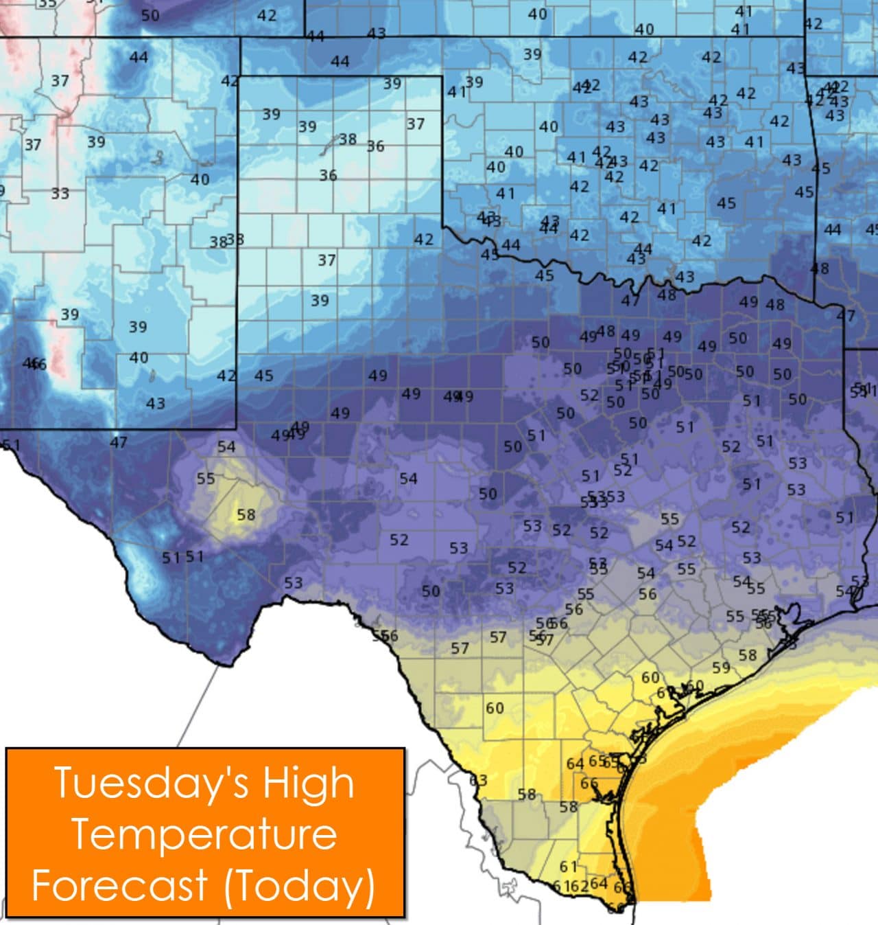
Temperatures will top out in the upper 30s today across the Panhandle and South Plains as light snow moves across the region. The Big Country, Texoma, and Northeast Texas will top out in the 40s. North Texas along and south of D/W into Central Texas, East Texas, the Concho Valley, and Hill Country will be in the lower 50s this afternoon. San Antonio (South-Central Texas), Houston (Southeast Texas), the Coastal Plains should all top out in the 50s. Corpus Christi, Brownsville, and McAllen get to enjoy warmer temperatures with mid 60s.
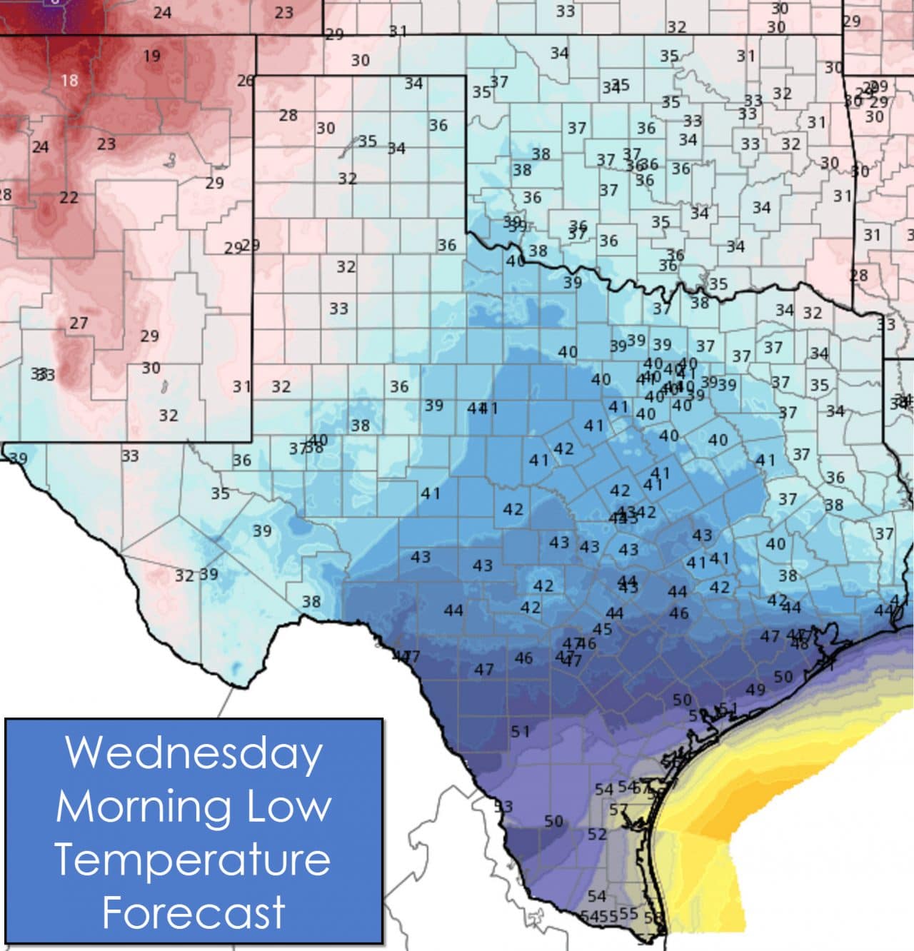
For tonight into the morning hours on Wednesday we’ll see temperatures drop of into the 30s across the Panhandle, all of West Texas, the Permian Basin, along with Northeast Texas and East Texas. North Texas, the Concho Valley, Hill Country, into South Texas, Southeast Texas, and the Coastal Plains will fall into the low to upper 40s. South Texas and the Rio Grande Valley will fall into the lower 50s by Wednesday morning.
 Click for full-size version[/caption]
Click for full-size version
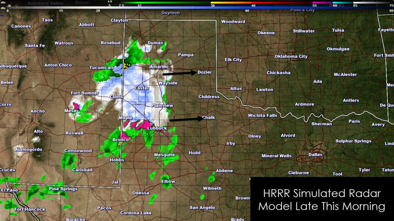
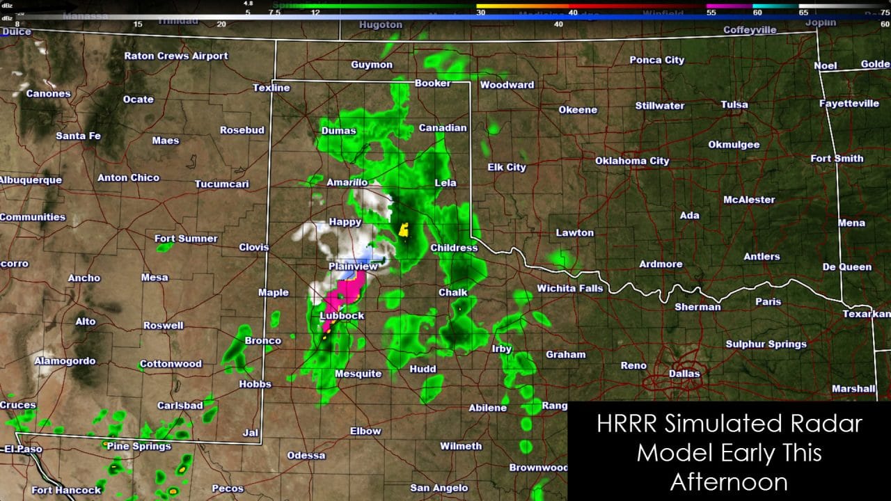
An area of light snow will move into the southern Texas Panhandle and northwestern South Plains later this morning. Temperatures will be near freezing and minor accumulations will be possible. Generally most snow accumulations in those two zones will remain under an inch but could result in some slushy roads. A winter mix is possible further south into the South Plains but temperatures should be above freezing – including in locations like Lubbock. As precipitation moves east early this afternoon it should change over to liquid rain as temperatures rise above freezing. Light snow will remain possible across the northwestern South Plains and southern Texas Panhandle. There may be a few hours of slick roads this morning and afternoon before it melts off.
The precipitation event on Wednesday and Wednesday Night will not feature a significant flooding concern, severe weather, or a winter storm. While there is plenty of moisture in place to support rain the atmosphere will be fairly stable. Because of the stable atmosphere we shouldn’t see much in the way of thunderstorm activity with this event. Much of Wednesday will feature drizzle or light mist from the Big Country and Concho Valley into South Texas, Central Texas, and North Texas. Rain amounts will be light. We should see an uptick in rain coverage during the afternoon hours on Wednesday along the Interstate 35 corridor from Southern Oklahoma south through South Texas into the Coastal Plains. Six hourly rain totals may approach a quarter to half an inch in some locations – steady but fairly light rain. Widespread light to moderate rain will move across Northeast Texas, East Texas, and Southeast Texas overnight Wednesday. Most rain should be out of Texas by late Thursday morning.
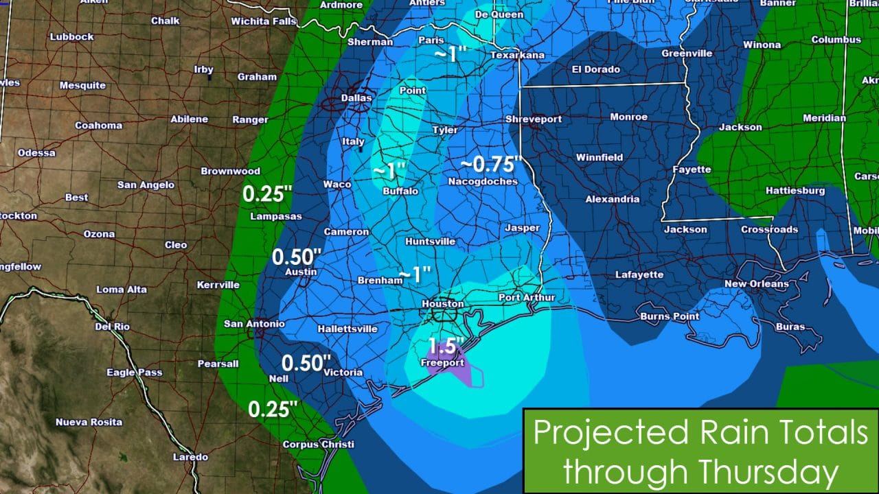
Overall rain totals should average between half an inch and one and a quarter inch by Thursday morning along and east of Interstate 35 from D/FW south to San Antonio. Localized rain totals up to one and a half inches will be possible across Northeast Texas, East Texas, into Southeast Texas. Rain totals will fall off quickly west of Interstate 35. Since we’re looking at a period of steady light to moderate rain versus a quick downpour the threat for flash flooding is low. Minor rises in rivers and lakes are possible but won’t compare to the issues we saw in late December. This portion of the event will feature all liquid precipitation with temperatures safely above freezing.
Temperature Outlook for this weekend and next week
A cold front will push south on Friday and Saturday. Temperatures south of the front will be above average with 60s and perhaps 70s. A quick return to reality will arrive with the front as gusty north winds bring temperatures back down into the 30s and 40s for the weekend. Temperatures will slowly rebound next week but should remain cool. There may be a couple oppurtunities for precipitation this weekend into next week and we’ll have to watch trends closely for any potential winter mischief.


0 Comments