
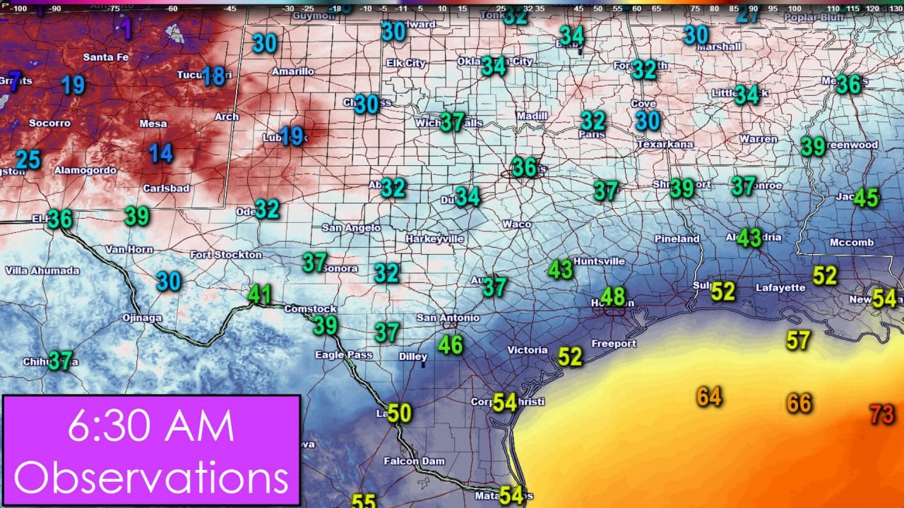
You can really tell where we still have snow on the ground this morning. Temperatures across the South Plains are frigid with readings in the mid and upper teens. Get away from the snow cover and temperatures quickly climb into the 30s. Folks from the Hill Country through Northeast Texas and points north are in the 30s this morning – nothing unusual for the last day of the year. The Rio Grande Valley, the Coastal Plains, and Southeast Texas are more mild with 40s to lower 50s.
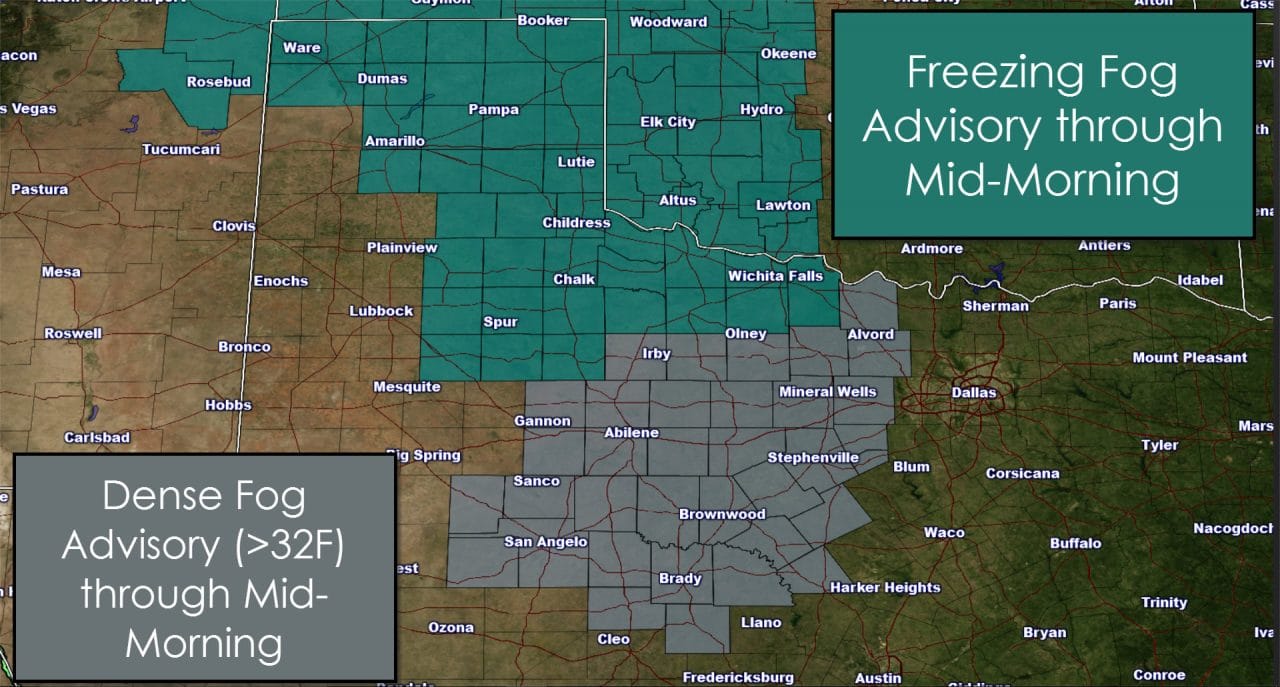
Dense fog is an issue once again especially across the Big Country, Northwest Texas, parts of the South Plains and Texas Panhandle. Folks below freezing across the Panhandle, South Plains, into Northwest Texas could have light ice accumulations on elevated objects from the freezing fog overnight. Keep that in mind if you’re out driving this morning since some bridges may be slick. We expect fog to mostly lift by mid-morning and temperatures should rise above freezing across all areas by the afternoon.
Click on this image for a full-resolution version
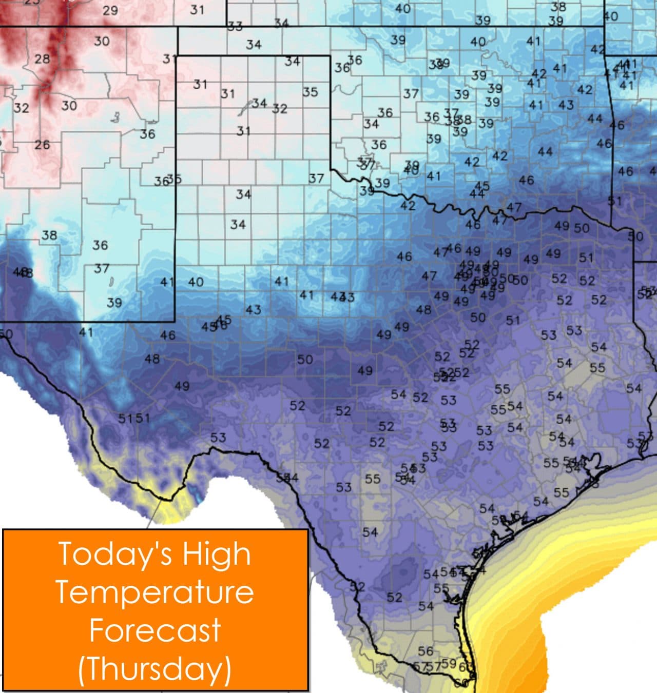
It won’t be a particularly warm day but it could definitely be much worse. Temperatures across the Texas Panhandle into the South Plains will struggle to make it to and just above freezing this afternoon. The snowpack continues to keep temperatures way down. Further south and east across the Permian Basin, Big Country, and Northwest Texas temperatures will get above freezing today with low and mid 40s the forecast highs. The Concho Valley, North Texas, Northeast Texas, East Texas, and Central Texas will top out in the upper 40s to low 50s this afternoon. The remainder of the state south of those regions will be today’s winners with mid 50s as the high temperatures. Brownsville and South Padre Island may barely make it up to 60 degrees this afternoon.
Click on this image for a full-resolution version
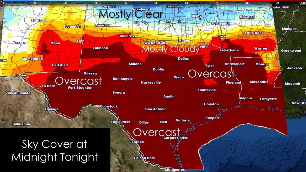
Cloud cover will be increasing throughout the day as an overrunning precipitation event begins to set up. Temperatures in the lowest few thousand feet remain cool but warm air advection above that cooler column will result in increased precipitation chances. It’ll be a chilly and overcast evening with only the Texas Panhandle likely to have partly cloudy skies by tonight.
Click on this image for a full-resolution version
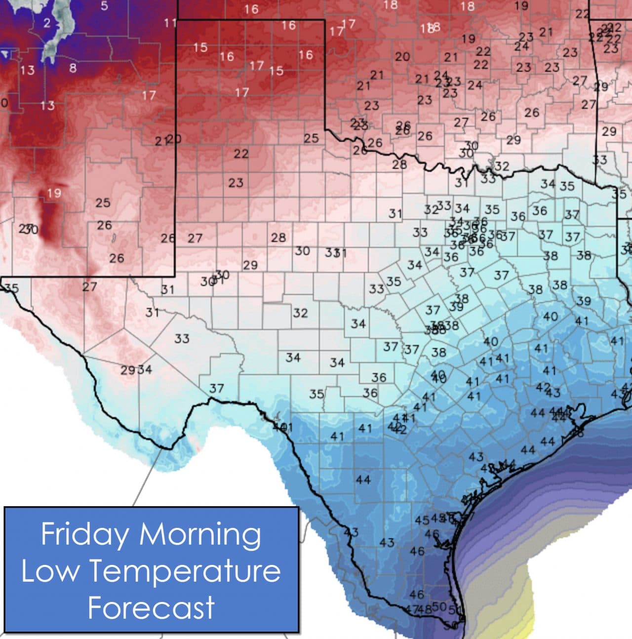
The low temperature forecast clearly reflects the cloud cover with the Panhandle falling back into the mid and upper teens. Southwest Texas through the Hill Country into the Brazos Valley will drop into the mid 30s to low 40s by Friday morning. The Rio Grande Valley will be the warmest, as usual, with lows right around 50 degrees. Winds will generally remain light under 10 MPH so we won’t have any substantial wind chills. Plan on bundling up tonight if you’re headed out for New Year festivities. As I said before though – it could be a lot worse in the weather department. ‘
Click on individual graphics for full-screen resolution
Precipitation chances ramp up tonight across the Rio Grande Valley, South Texas, Coastal Plains, and South-Central Texas. Much of tonight’s activity will be light. The highest rain chances will continue across the RGV and South Texas this weekend. Some heavier rains will be possible with locations receiving 1 to 2 inches of rain by Sunday. Rain chances will begin to diminish by Sunday morning before moving out entirely by Sunday afternoon. There is the potential that some sleet could mix in across the Hill Country with this event. Surface temperatures will remain above freezing and precipitation amounts will be light. Overall the winter-weather side of this system will be a low-impact event. Minor sleet accumulations could occur on elevated objects with perhaps some snow in Southwest Texas towards Alpine. We’ll address this concern later on after we get a good look at morning weather model data. It would take major changes to make much in the way of winter weather issues though.


0 Comments