
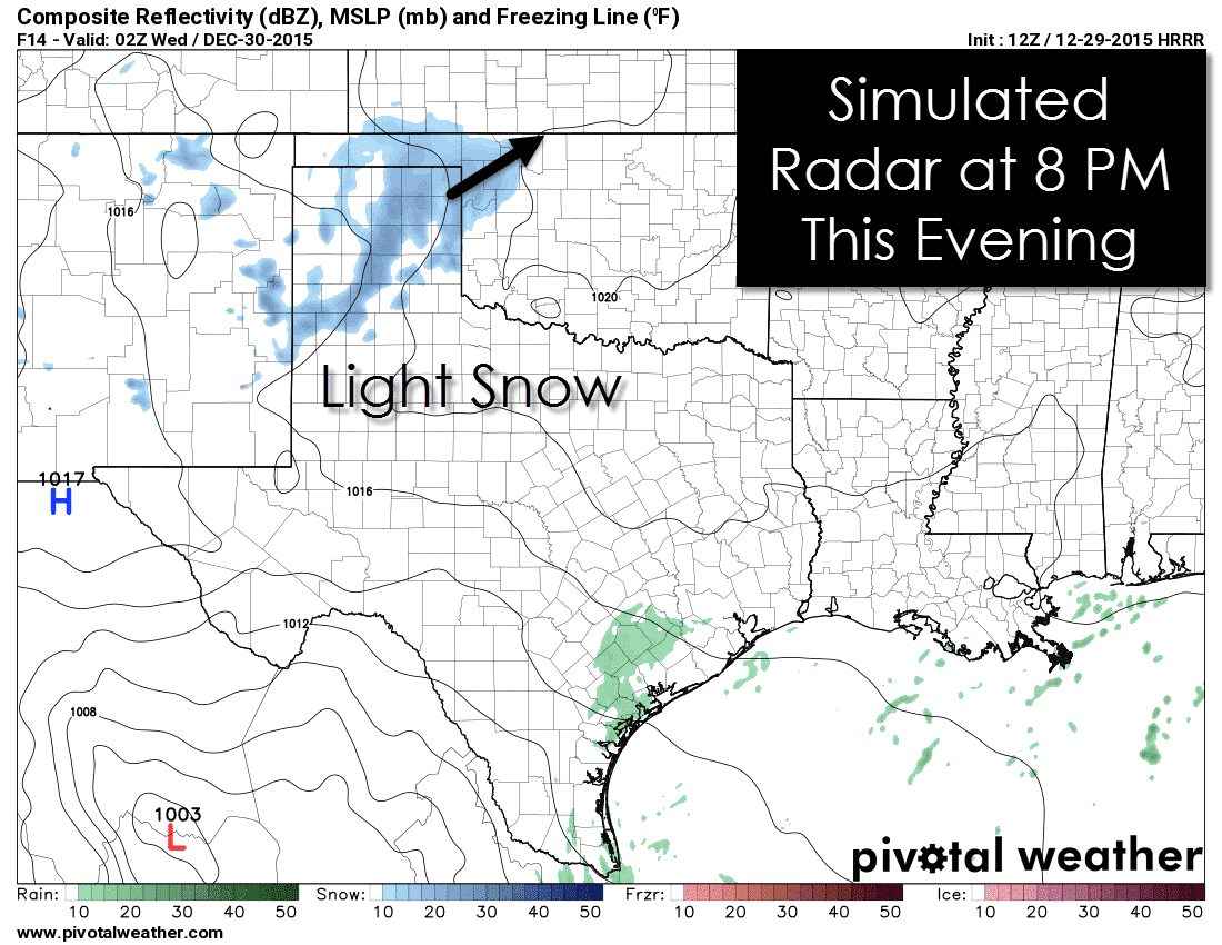
The primary forecast hazard for today will be the potential for light snow accumulations across the Texas Panhandle. A weak storm system will quickly traverse the region late this afternoon and this evening. As it does so an area of light snow will likely move across portions of the Panhandle. A few flurries could occur across sections of the South Plains as well. Most locations across the Panhandle will only receive a dusting to half an inch of snow. There is the potential for slightly higher amounts of snow if a heavier band sets up. Isolated snow accumulations up to two inches are possible which would accumulate on roads and may create slick conditions. Wind speeds will remain under 10 MPH so we won’t be dealing with blowing snow. Precipitation should move east of the Panhandle late tonight.
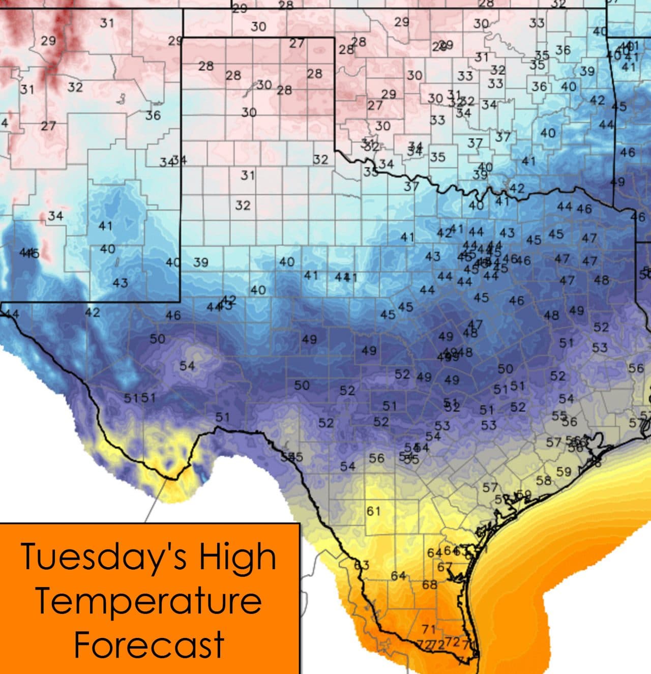
Temperatures will struggle to climb today in locations that have snow accumulations. The Panhandle, South Plains, Rolling Plains, and the Caprock will top out in the 20s to low 30s. Solar radiation should still allow for some melting before clouds start to increase this afternoon. Folks from the Permian Basin east through the Concho Valley, Hill Country, Central Texas, East Texas, and everyone north will be chilly today with high temperatures in the 40s to low 50s. If by chance you’re looking for warmer weather I suggest you head south to the Rio Grande Valley. Temperatures there will peak in the low 70s today.
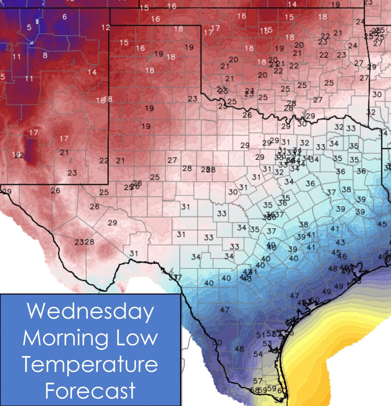
Temperatures tonight will fall below freezing across the Concho Valley, Big Country, Northwest Texas, Texoma, and western North Texas. South-Central Texas and Southeast Texas will drop into the low and middle 40s. The Rio Grande Valley will drop off into the 40s and 50s. Pockets of fog or mist are possible again tonight into early Wednesday.

0 Comments