
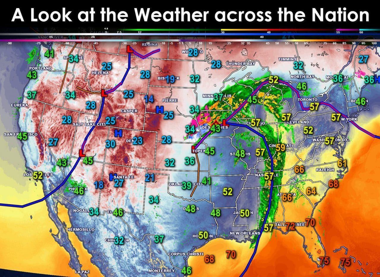
Good Monday Morning! The weather system responsible for severe weather, flash flooding, cooler temperatures, and a winter storm across Texas has pushed east of the state this morning. A look at the Nation shows the cold front has pushed east into Tennessee and Alabama this morning as the low pressure occludes north across Iowa. Chicago is quite warm this morning at nearly 60 degrees – well above what they would top out at during the afternoon hours. Cooler weather will spread into the Eastern United States today as the cold front pushes through. Meanwhile the next storm system located over Utah and Wyoming is setting up to bring a major winter storm to the Northern Plains. That system will pass well north of Texas.
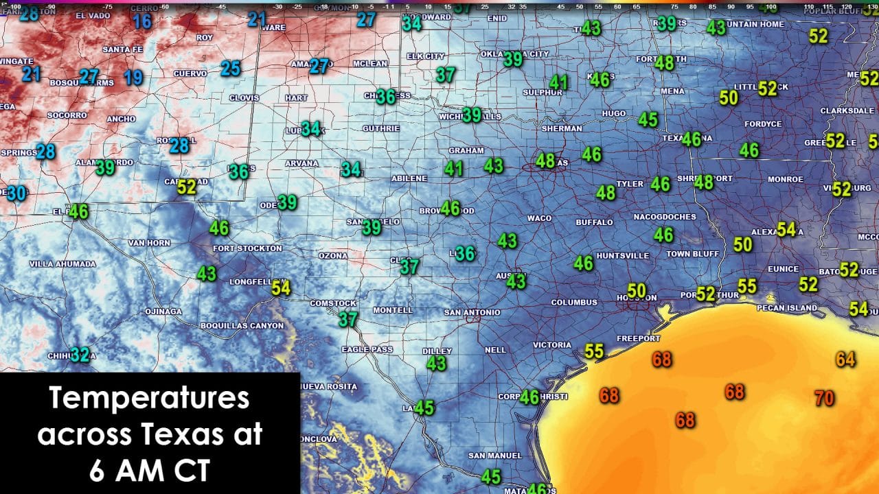
Closer to home temperatures really aren’t that bad for a December morning. A snowpack across the Texas Panhandle has allowed temperatures to fall into the upper teens and twenties this morning. The rest of Texas is generally in the 40s with a few low 50s mixed in. There may be a bit of a wind chill this morning though.

It certainly won’t take long for temperatures to warm right back up today. With sunny skies across all of Texas and southwest winds temperatures will return to above-average values once again. Even in the Panhandle where snow accumulated yesterday temperatures will climb into the 50s. I expect most snow will melt up there today so it’ll be even warmer on Tuesday. The rest of Texas will enjoy warmer weather with high temperatures climbing into the 60s and 70s. The Rio Grande Valley will probably make it into the lower 80s today. There will be a few cool fronts this week but no sign of any arctic air intrusion as temperatures remain at or above average.

Relative humidity values will drop this afternoon across the Permian Basin and Far West Texas. Combined with gusty winds and warm temperatures there will be an elevated danger of grass fires. We could see the grass fire danger spread across more of Texas this week as above-average temperatures help surface-fuels dry out.
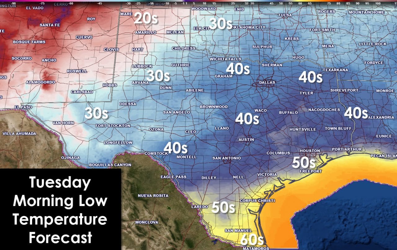
Clear skies and a dry airmass will allow temperatures to fall off tonight. The Texas Panhandle will fall into the upper 20s with any water from melted snow refreezing into a layer of ice – take note of that if driving tonight. The Permian Basin, Hill Country, and West Texas will drop into the 30s to low 40s. South-Central Texas, Central Texas, Southeast Texas, all the way up to the Red River will be in the low to upper 40s tonight. South Texas will fall into the 50s with a few low 60s expected in the Rio Grande Valley.
Rain chances will increase Tuesday and Tuesday NIght across East Texas and Southeast Texas. Heavy rain is not expected but a few folks may pick up a quarter to half inch of rain. Severe weather is not anticipated at this time. I hope you liked the new graphics we used in the blog this morning! We’re still refining the color tables and overlays. We hope to show you some more features of our new graphics system as time goes on.


0 Comments