
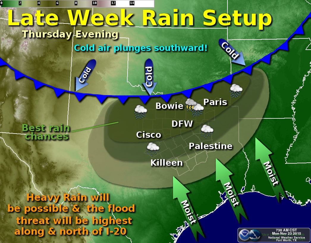
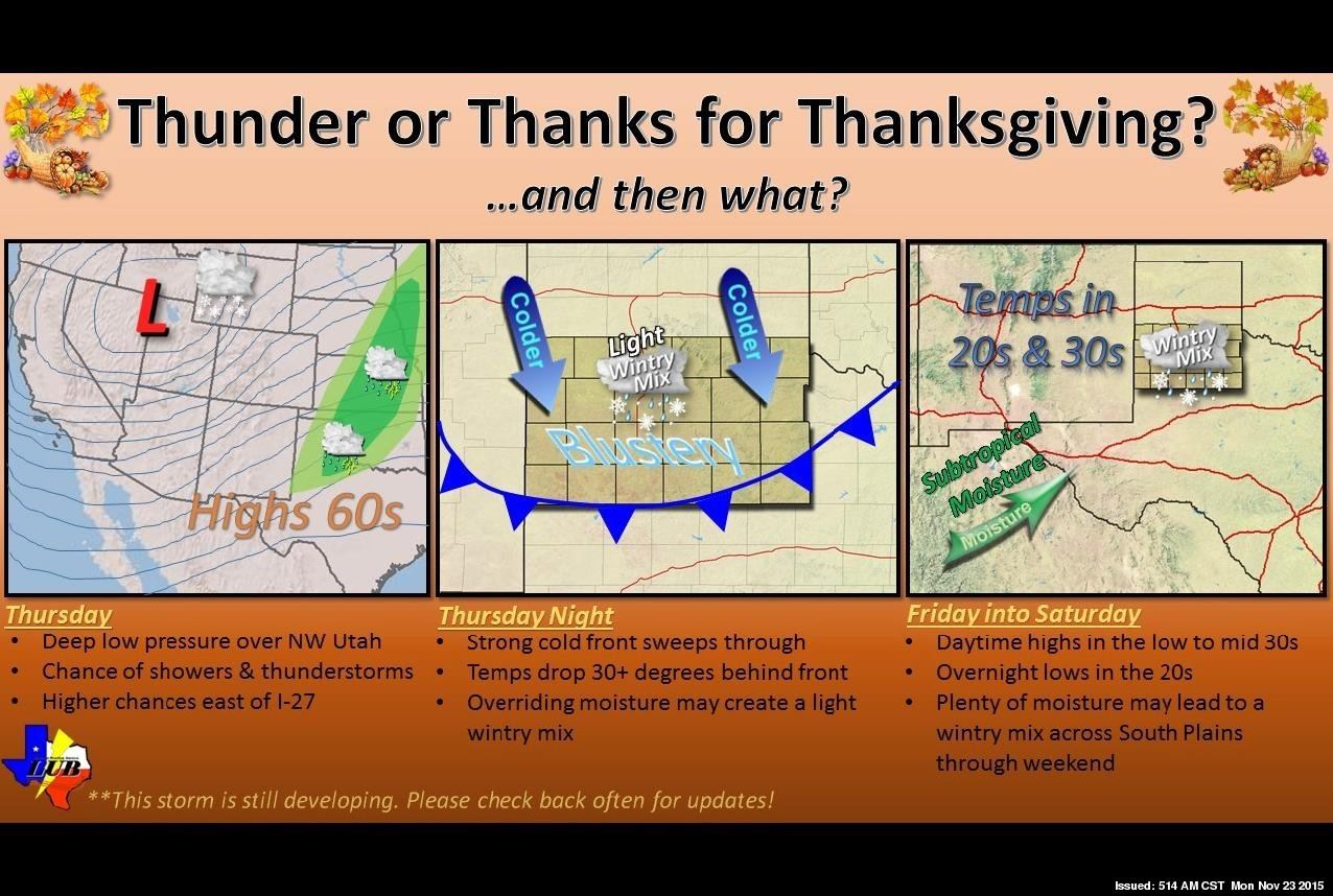
Wednesday is expected to be a decent travel day for most of Texas. It may get wet by the second half of the day in parts of Texas but we’re not expecting severe weather, heavy rain, or winter weather issues on Wednesday. By Thursday that will change as the potential for heavier rain increases. Rain chances will continue into Friday and Saturday, potentially Sunday depending on how things evolve. The heaviest rain totals for the upcoming event are anticipated to be from the Big Country and Northwest Texas east along the Red River through Texoma into North Texas and Northeast Texas. Some flooding issues can be expected but like the rest of the forecast we’ll have to wait on specifics until we’re closer. Likewise temperatures could fall below freezing in the Texas Panhandle and South Plains allowing for a switchover to freezing rain or sleet by Friday. Accumulation forecasts are extremely difficult five days in advance and even more uncertainty is thrown into the mix thanks to different model solutions. Moisture levels may be further enhanced to near/above record levels thanks to a very rare late season Pacific hurricane expected to develop soon. There is the potential for accumulating ice in parts of the Panhandle by Friday into Saturday – with associated travel disruptions possible. At this time temperatures are expected to remain above freezing across the remainder of Texas – so just a cold rain. This upcoming system is very dynamic and forecast adjustments are guaranteed. The only certain thing when forecasting weather in Texas (especially in the winter) is that nothing is certain. We’ll keep you updated!
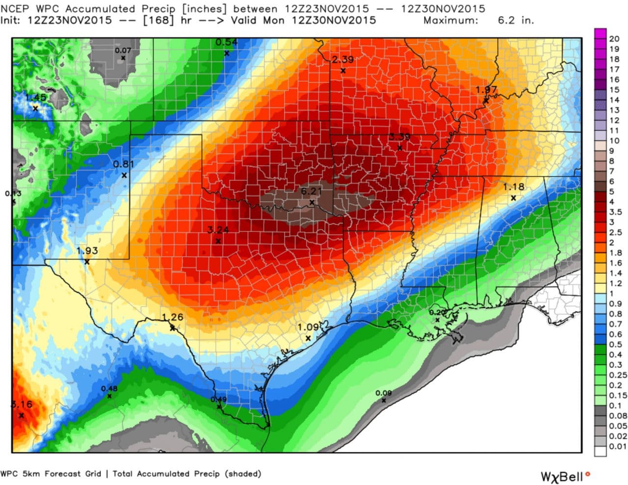
Current projections on rain accumulations through the weekend

0 Comments