

Enjoy your Friday because it will be the last day of warm weather for a while. High temperatures this afternoon will peak in the 80s in the Rio Grande Valley with upper 60s in the Texas Panhandle and Northeast Texas. Everyone in between will likely top out in the 70s. Those temperatures are at or a bit above average for late November – a treat compared to the forecast this weekend.
A strong cold front will begin pushing into the Texas Panhandle around 6 PM this evening. By Midnight it should extend from near Oklahoma City southwest to Altus and Childress west towards Plainview. The cold front should be arriving in the D/FW Metroplex around 5 AM on Saturday – same thing for San Angelo. It’ll continue to quickly move south pushing to the coastline by 3 PM leaving only the Rio Grande Valley in the warm sector. Temperatures north of the cold front will quickly fall into the 40s and 50s with blustery north winds. As the cold front passes a given location winds will become northerly with gusts up to 30-40 MPH. It will not be the most pleasant experience for outdoor events on Saturday. If you’re heading out plan on taking a coat.
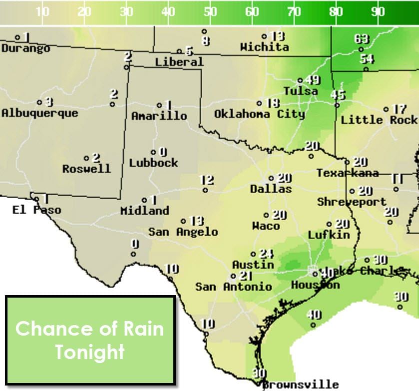
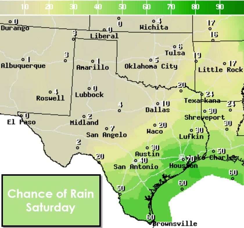

There will be a low chance for some sprinkles or light rain tonight across North Texas, Northeast Texas, and Central Texas. Slightly higher rain chances will exist overnight in Southeast Texas. Rain chances really ramp up Saturday morning in Southeast Texas and south along the coast into South Texas and the Rio Grande Valley. Severe thunderstorms are not expected and most rain will remain light. Localized rain accumulations of a quarter to half an inch will be possible in SOutheast Texas and near the coast. Rain chances will shut off by later afternoon and much cooler air ushers in from the north.
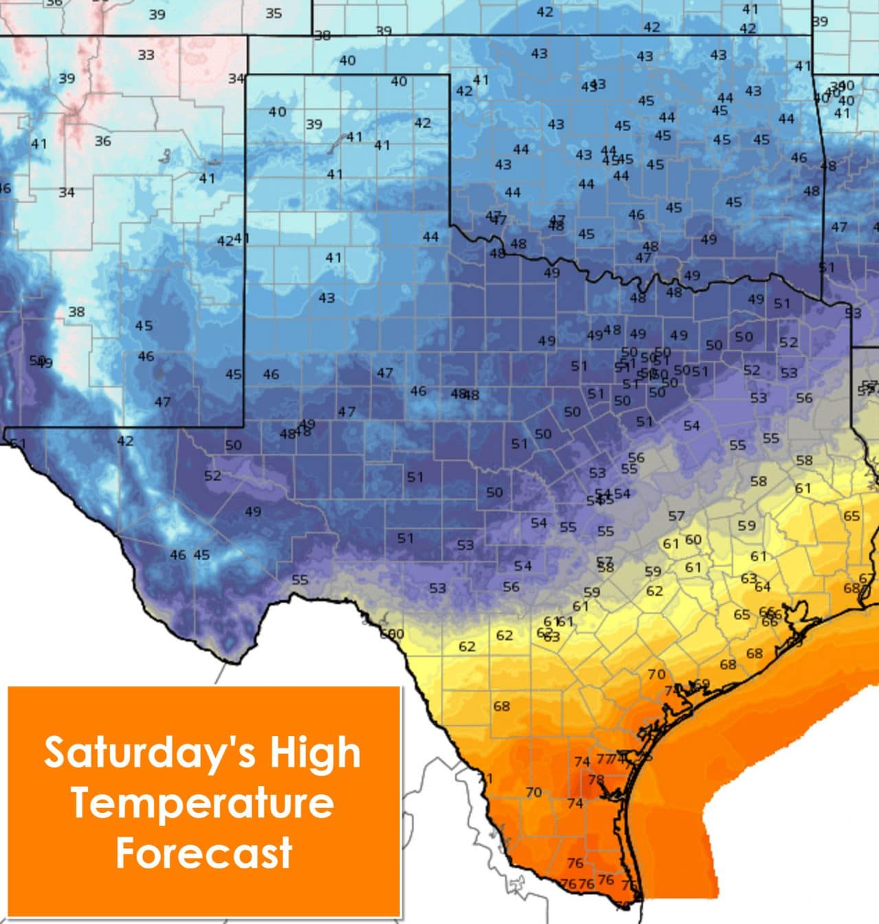
High temperatures on Saturday will generally remain steady state or slowly fall north of the cold front. Temperatures in Southeast Texas, South Texas, and the Rio Grande Valley will make it up into the 60s and 70s. Temperatures will fall quickly after the cold front arrives in the afternoon hours. The high temperatures shown here may occur in the late morning or early afternoon before falling. That is especially true for Southeast Texas and South Texas – including the I-10 cities.
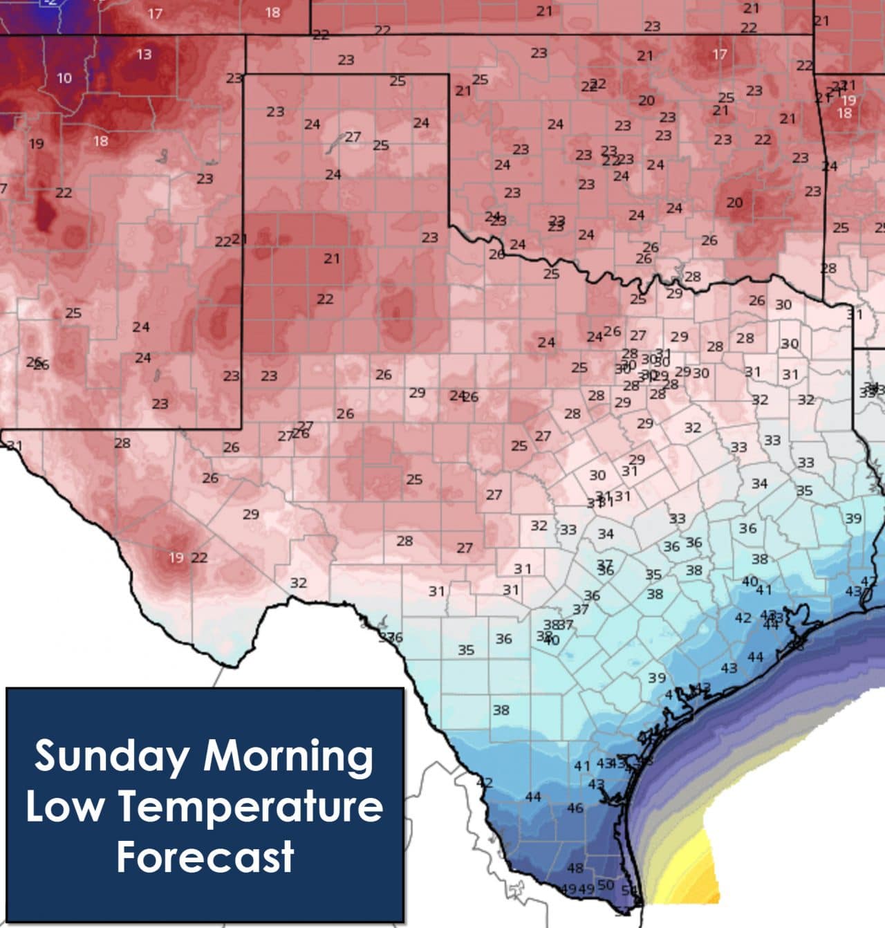
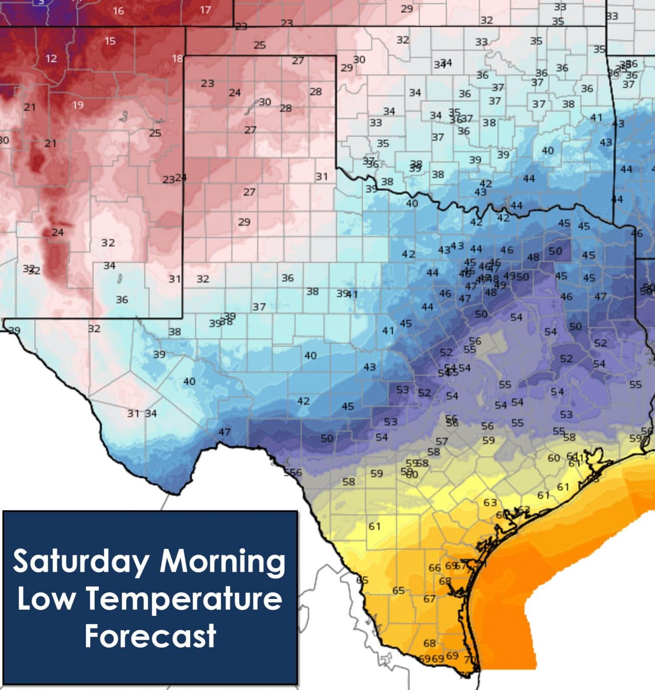
Sunday morning will bring the first freeze of the fall to much of the Big Country, Concho Valley, North Texas, Northeast Texas, and possibly Central Texas. Temperatures will be well below freezing in the Texas Panhandle, South Plains/Rolling Plains, Northwest Texas, and Permian Basin. A few of the coldest spots could fall into the upper teens as winds become much lighter and skies clear. 30s to mid 40s are expected across Southeast Texas, South Texas, and the Rio Grande Valley.

Temperatures will rebound slightly on Sunday but it will still be a chilly day across all of Texas. Gone are the 60s and 70s. They’ll be replaced with upper 40s to upper 50s. The coldest spot looks to be in North and Northeast Texas where temperatures will struggle to hit 50 degrees on Sunday. Winds will be much more manageable than on Saturday so the day itself should be a tad nicer.
Thanksgiving itself has the potential to feature fairly warm temperatures with rain chances. A powerful cold front looks to push in on Thanksgiving Night or Black Friday with continued rain chances. The Friday-Sunday period next week has the potential to feature an interesting setup so we’ll have to keep an eye on it. Expect forecast adjustments as we get closer.


0 Comments