
Click the image for a larger version.
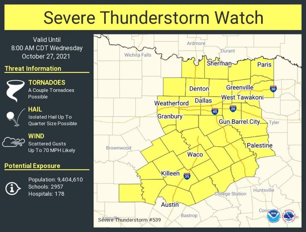
As promised, a new severe thunderstorm watch has been issued for much of North Texas and Central Texas. This watch runs through 8 AM and includes Weatherford, Grandbury, Killeen, Temple, Waco, the D/FW Metroplex, Sherman, Paris, Greenville, West Tawakoni, Gun Barrel City, and Palestine. I would not be surprised to see other watches for the Brazos Valley, Southeast Texas, and the Hill Country later this morning.
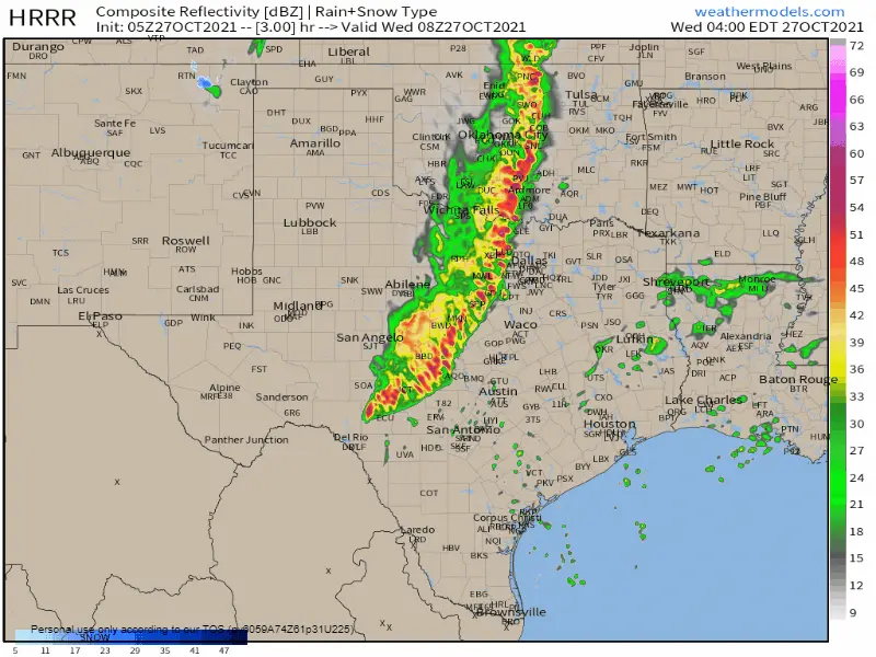
Click the image for a full-screen version. Simulated weather model radar from 3 AM through the early afternoon.
Strong to locally severe thunderstorms extend from Ringgold to Mineral Wells to Brownwood to Menard to Sonora. The strongest storms are located in the northern half of the squall line. As a whole, the squall line is moving east at 30 miles per hour. The squall line will be moving east into the D/FW Metroplex over the next ninety minutes – or by 3 AM. It looks like a two-hour window around 5 AM is good for Waco, Austin, and San Antonio. Paris, Tyler, and northwest of Houston around 7-8 AM.
Not all storms will be severe, but some likely will be. Damaging straight-line winds over 60 MPH and small hail are the primary severe weather hazards. A low threat for brief tornadoes does exist. We’ll be here and will be doing live video updates throughout the morning. Those are automatically posted to the weather blog and mobile app.


0 Comments