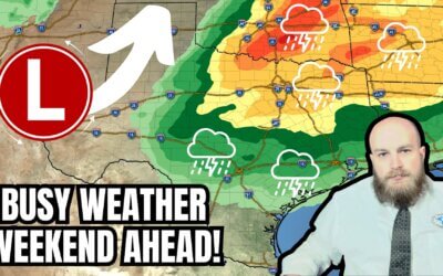
Multiple opportunities for rain will present themselves across Texas through early next week. Our stormy weather is being caused by an upper-level storm system across the southwestern United States. That system keeps shooting smaller pieces of lift over Texas about every twelve hours. The result is the continuation of rain chances through the weekend. It will not rain in all of Texas all weekend, nor will everyone get hammered by heavy rain or thunderstorms.
Scattered severe storms with damaging hail will be possible this afternoon and evening across the Edwards Plateau, Hill Country, South-Central Texas, into the Coastal Plains, Coastal Bend, and South Texas. Isolated severe storm potential may extend into Southeast Texas. Like yesterday’s storms in Texoma and North Texas – some storms may have baseball-sized hail – or worse. Localized damaging wind gusts and a tornado can’t be ruled out. A more limited chance for the same kind of stormy mischief may occur again Saturday afternoon in those same regions. A slowly moving cool front will be the primary focal point for those stronger storms.
We’re expecting multiple rounds of rain from this morning in the Texas Panhandle, West Texas, and Permian Basin – to again Saturday for those same regions and a good chunk of the northern half of Texas. Severe thunderstorms are far less likely compared to areas farther south. Hopefully, we can get some beneficial rain!
Two to four inches of additional rainfall is possible by Monday morning across the Edwards Plateau and Rio Grande Plains, eastward through South Texas, the Coastal Bend, South-Central Texas, Hill Country, Brazos Valley, and Southeast Texas. Another way to put it: Del Rio through Eagle Pass and Laredo—east through Austin, San Antonio, George West, Corpus Christi, Victoria, College Station, Lufkin, Houston, Galveston, and Beaumont. Localized flooding may occur, especially farther east, where soils are more saturated.
Higher rain chances by Sunday evening into Monday look across the Permian Basin and Big Bend regions of Southwest Texas. Parts of the state farther east may get a period of drier weather. The chance for some precipitation will likely expand back east beginning Tuesday as we shift into a new weather pattern. A strong cold front may arrive in Texas late next week.
My FREE & AWESOME weather app for radar/alerts/more: https://texasweather.app/
My website, also with radar: https://texasstormchasers.com
The 24/7 Texas weather tracker & music: https://www.youtube.com/watch?v=lNZuPEWS5AI&t=0s
Storm chaser videos: https://www.youtube.com/texasstormchasers
Facebook: https://www.facebook.com/TxStormChasers
TikTok: https://www.tiktok.com/@texasstormchasers
X (Twitter): https://twitter.com/TxStormChasers


Did you know Texas Storm Chasers has a free mobile app? Track the Texas weather all in one place! Search for Texas Storm Chasers where you download your apps.