
Today’s weather story will be continued cold air advection. Most folks in Texas are under northerly winds this morning. Meanwhile, temperatures up in the Dakotas are fifteen degrees below zero. We won’t be getting anywhere that cold way down here in the south, but Tuesday morning will still be on the cool side. Focus tomorrow will shift to precipitation that will continue through Thursday.
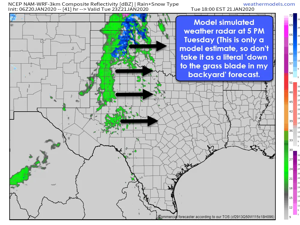
A model simulated weather radar at 5 PM Tuesday (This is only a model estimate, so don’t take it as a literal ‘down to the grass blade in my backyard’ forecast.
Precipitation will move east into the Texas Panhandle, West Texas, and the Permian Basin tomorrow afternoon. A majority of the precipitation will fall as cold rain. However, temperatures are borderline supportive of some wet snow in the Texas Panhandle. Minor accumulations of wet, slushy snow may occur in the Texas Panhandle Tuesday afternoon into early Tuesday evening.
Rain will continue moving eastward and be on the Interstate 35 corridor from Oklahoma City to D/FW, south through Austin and San Antonio, to Laredo tomorrow evening. Rainfall amounts will generally range from one-tenth of an inch up to three-tenths of an inch west of Interstate 35. A band of precipitation will continue moving east Wednesday morning with high rain chances across Northeast Texas, East Texas, Southeast Texas, all the way down into South Texas and the Rio Grande Valley.
Northeast Texas snow chances Wednesday morning
There is some concern that Northeast Texas could see an hour or two of wet snow Wednesday morning. Snow potential will depend on how much dry air is in place beforehand and how much evaporative cooling occurs as precipitation begins.
As precipitation begins to fall in a dry airmass, it evaporates – and that process acts to decrease temperatures and increase moisture. When surface temperatures are in 34-38 degree range, and evaporative cooling takes place, we can sometimes see temperatures drop to 32-33 degrees. Evaporative cooling can result in precipitation falling as snow instead of rain, at least initially.
Even if evaporative-cooling potential Wednesday morning in Northeast Texas, we’ll still see any snow change back over to rain after one or two hours. Minor accumulations of wet snow cannot be ruled out on grassy surfaces *if* the scenario, as mentioned above, plays out. However, the changeover to rain would quickly melt any snow accumulations.
Rain should move out of South Texas and the Rio Grande Valley by dinner-time Wednesday. Those in the eastern third of Texas (generally from D/FW to Austin points east) could stay wet through Thursday morning as another upper-level storm system quickly swings by. Severe thunderstorms are not expected on Tuesday or Wednesday.
I can’t rule out a strong thunderstorm in the Upper Texas Coast Thursday morning or early Thursday afternoon. The potential for stronger storms on Thursday will depend on the track of a surface low near the coast. If that low moves inland, we would see a more unstable airmass make it onshore. If the low remains off-shore, so would the threat of stronger storms.
It’s a soaker!
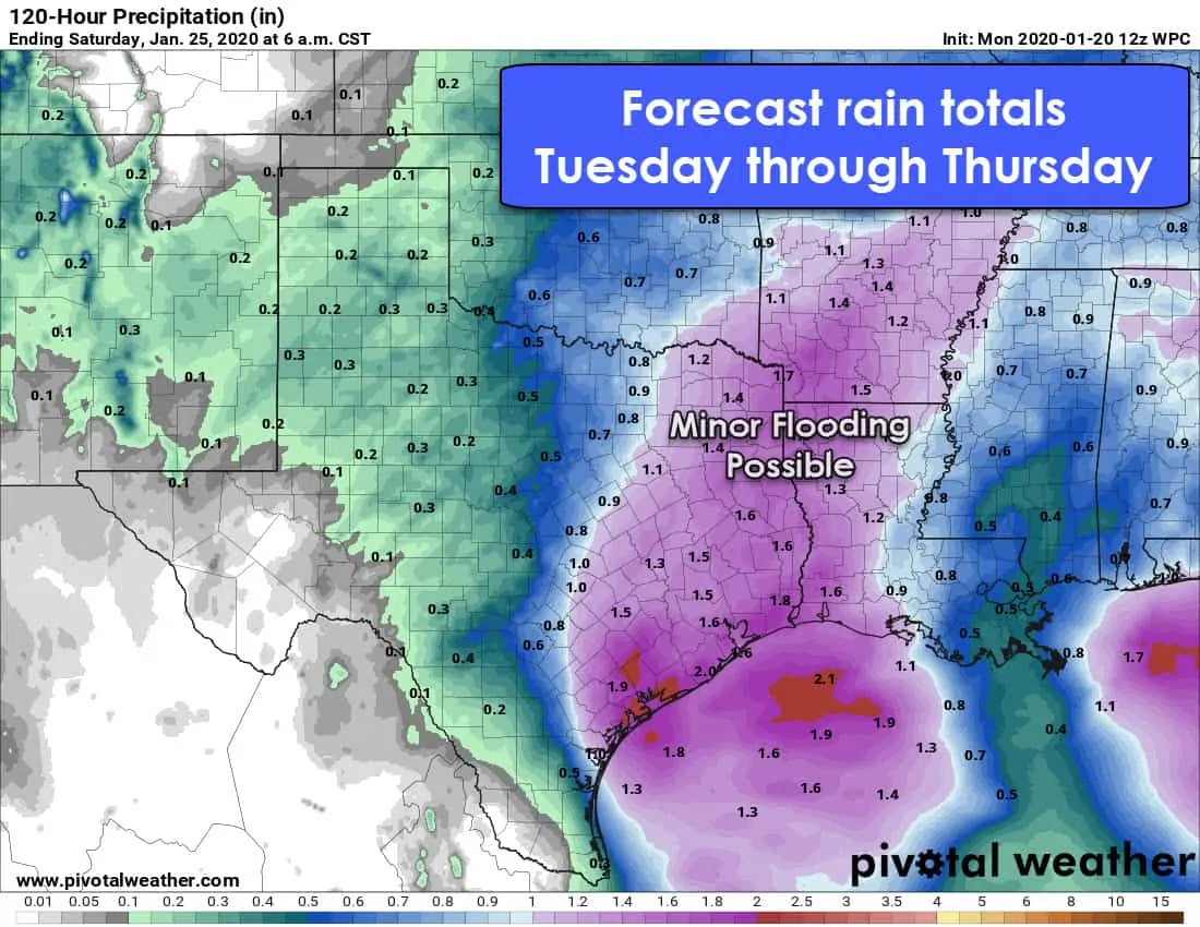
Forecast rain totals through the end of the workweek from the Weather Prediction Center. Click on the image for a larger version.
Rain chances will end across the eastern third of Texas Thursday afternoon. Overall rain totals should average between one-half inch and one inch near Interstate 35 from San Antonio north to the Red River. The most torrential rains are forecast across Northeast Texas, East Texas, the Brazos Valley, Southeast Texas, back down into the Coastal Plains. Those regions will average between 1-1.5 inches of rain. Locally higher rainfall amounts exceeding two inches are possible. Given saturated soils from last week’s storms, we could see some nuisance flooding develop. Still, major/widespread flooding is not anticipated.
Warming up and staying dry this weekend
Several days of calm weather are forecast after that with moderating temperatures. The upcoming weekend should feature temperatures five to ten degrees above January standards along with no chance of precipitation. Next week could bring a continuation of precipitation chances. However, extended-range weather models are still iffy on if a pattern change will occur.


0 Comments