
It’s been a long hot and humid summer. However, we’re starting to see some light at the end of the tunnel. Sure, it’s still going to be hot for a while, but at least we have some weather to discuss. Perhaps even a glimpse at our first more impressive fall cool fronts in the extended range? Let’s dive into it!
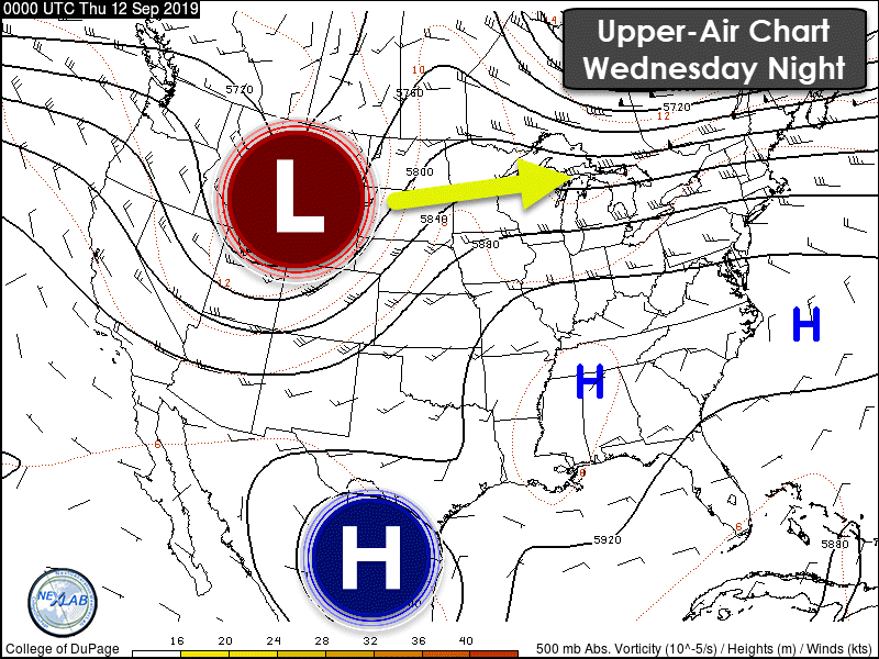
I always like to take a look at what’s going on now in the atmosphere before we begin to discuss the future. An upper-level ridge continues and is located across the Rio Grande Valley northeastward into the Southeastern United States. That’s also commonly referred to as the ‘summer heat dome’. A trough is digging into the Northern Plains. A northwesterly flow on the back-side of that area of low pressure will bring a weak cool front into our neck of the woods tonight and on Friday.
A weak cool front will be moving through the Texas Panhandle, West Texas, Northwest Texas, and Oklahoma today and tonight. The front itself won’t be in much of a hurry. Our primary focus in regards to the front will be the scattered to numerous thunderstorms it is expected to bring.

The Storm Prediction Center has hoisted a level one risk of severe weather for this afternoon and evening across portions of the Texas Panhandle, West Texas, the Caprock region, extending northeast into Central Oklahoma. A level one risk means there is a five percent chance of severe weather occurring within 25 miles of any given point. A severe thunderstorm is defined as a storm producing a) quarter size hail and/or b) wind gusts over 58 MPH. Obviously a tornado would also qualify a thunderstorm to be severe – but we’re not expecting tornadoes today.
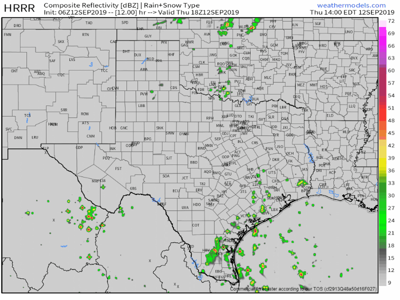
Simulated weather model radar from the 1 AM run of the High-Resolution Rapid Refresh (HRRR) model. This simulation runs from 3 PM this afternoon until 7 AM Friday. Please keep in mind that this is only one model simulation – and shown here for an example of timing/location purposes only. Mama nature doesn’t read our maps.
Given the lack of a strong cap in place today and tonight trying to forecast convective evolution with high-resolution weather models is going to be difficult. I’m only showing one such model here as an example of how thunderstorms may evolve today and tonight. I would not at all be surprised if things transpire a bit differently in terms of where the highest storm coverage ends up or specific timing. Storms that develop will tend to move east/southeast, but they won’t be in any hurry. The highest coverage this evening and overnight is expected to be across the Texas Panhandle, West Texas, extending northeast near the cool front into Oklahoma. Localized flash flooding is also a threat given slow-moving storms, the potential for some folks to get more than one round of storms, and an abundant amount of moisture in place.
Unfortunately, the cool front won’t make it too far south on Friday before it stalls and washes out. Continued rain chances today through Friday across the coastal regions of Texas will be thanks to typical daytime heating processes (afternoon popup storms). Monsoonal moisture will also allow for scattered thunderstorms this afternoon across the Trans-Pecos. Rain chances on Saturday will be confined to the Borderland and the immediate coast. We could see some uptick in rain chances on Sunday in the Rio Grande Valley, Deep South Texas, along with the remainder of the Texas Coast.
Tropical Mischief Brewing in the Eastern Gulf of Mexico This Weekend
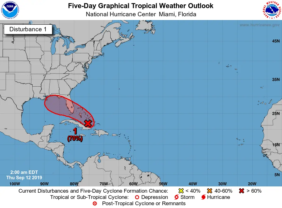
A tropical disturbance is located just northeast of Cuba this morning. It is producing a large area of showers and thunderstorms. Conditions are anticipated to become favorable for this system to develop this weekend as it moves into the eastern Gulf of Mexico. At this time we are not anticipating direct impacts from this system to Texas. Those from New Orleans east to Florida should keep an eye on the forecast through the weekend and into early next week. Should this system attain tropical storm status it would be named ‘Humberto’. Not shown on the graphic above is another tropical disturbance located over the far East Atlantic. That will probably become a formidable hurricane as it moves west next week – and that may end up becoming an issue for the East Coast of the United States in the 10+ day timeframe. We’ll discuss both systems in greater detail as they each actually develop.
Extended Forecast
A southerly flow is expected to develop across the western Gulf of Mexico and into Texas early next week. That would result in isolated to scattered thunderstorm chances across the eastern half(ish) of Texas. Look at it this way – it beats being directly under the heat dome and dealing with triple-digit heat. It would still be warm, but at least you’d have the chance of getting a cooling rain shower. There are some small indications in weather model voodoo land (one to two weeks away) that we may finally have our first true ‘fall’ cold front around Sunday of next weekend. That would bring a much drier airmass and a welcome relief from all the humidity. It’ll happen at some point, but I can’t guarantee models are right about it being late next weekend. Either way – the next several days across most of Texas will continue to be hot.
Remember: You can keep tabs on storms using our free HD interactive weather radar right here on our website.


0 Comments