
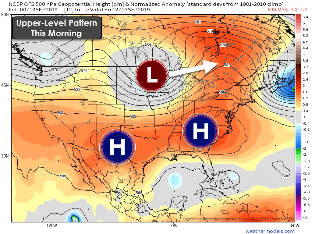
An upper-level storm system moving east across the Northern Plains helped push a weak cool front south into the Texas Panhandle on Thursday. Storms that fired up on that front last night helped push an outflow boundary farther south. Otherwise we remain under the influence of high pressure – also known as the heat dome.
Good morning and congratulations on surviving another work week. Even if you don’t work a typical Monday to Friday gig one can look forward to the weekend’s break from rush hour. A weak cool front and an outflow boundary from overnight thunderstorms have pushed south into the Permian Basin and Big Country. Winds behind that boundary are generally out of the north. However, winds are already starting to back to the southeast across the Panhandle. That’s a good indication that the front itself is just about done and should become stationary later this morning. Conditions are a few degrees cooler north of that front/outflow boundary. Once the front/boundary stalls it’ll likely start sagging back north this afternoon before mixing out (dissipating) completely.
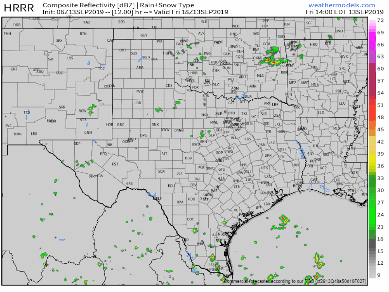
Simulated weather model radar from early this afternoon through the mid-evening.
Day-time heating, a negligible cap, along with plenty of moisture should allow isolated to scattered thunderstorms to fire up this afternoon in the proximity of that boundary. Current indications are the highest chance for spotty storms will be in the Permian Basin, Big Country, Northwest Texas, eastward into western North Texas and Texoma. That may shift a bit north or south depending on where the boundary actually stalls out. Regardless, a few stronger storms may briefly produce wind gusts over 50 MPH and frequent cloud to ground lightning. Thunderstorm activity is expected to dissipate by 10 PM.
Saturday looks to be a mostly dry day with the exception of the Rio Grande Valley. We’ll get a break from the monsoon rains that have impacted the western third of Texas this week – and we should keep most showers/storms off the coast (with the exception of far South Texas and the RGV). It’ll be a hot day with temperatures peaking in the 90s across most of Texas. Humidity may be a bit lower which would be welcome.
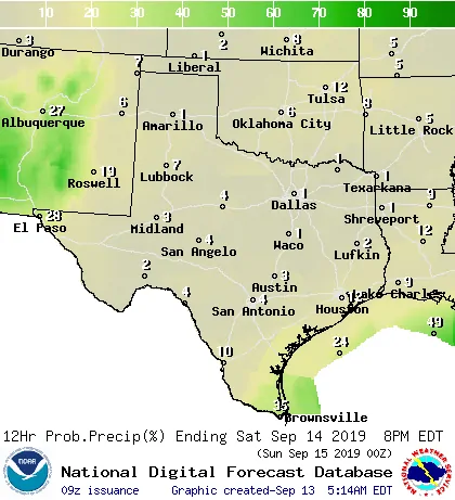
Chance of rain on Saturday
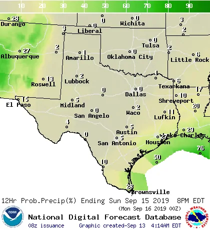
Chance of rain on Sunday
Increasing southerly winds will bring back coastal rain chances on Sunday. It appears that the highest chance for scattered thunderstorms will be in the Rio Grande Valley, South Texas coast, northeastward through the Coastal Bend and into the Coastal Plains. Rain chances may not make it too far inland on Sunday. That’ll have to wait until the start of the upcoming work week and beyond.
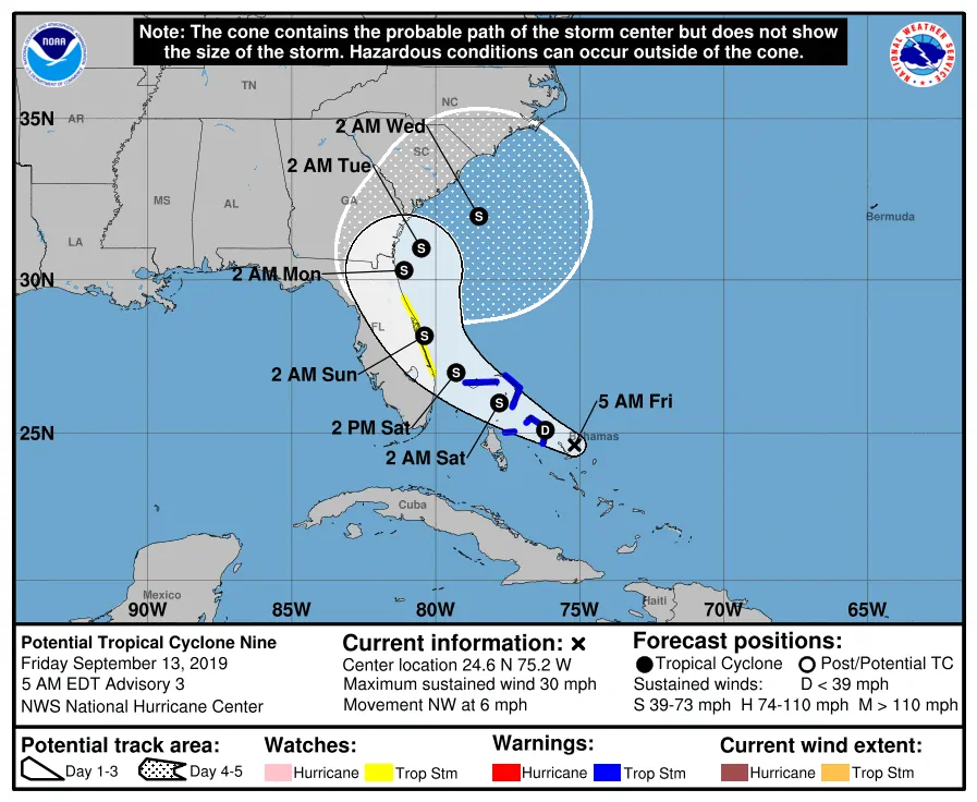
Invest 95L/What will become ‘Humberto’ is located over the Bahamas this morning. The system itself continues to produce a large area of thunderstorms. It does not yet have a defined low-level circulation – a requirement to be classified a tropical cyclone. That’s good news for the Bahamas as they really didn’t need another hit. This system will likely organize enough to become a tropical depression or tropical storm by Saturday. After that time it’ll pull a ‘Dorian’ in terms of passing near the east coast of Florida before taking an abrupt turn north and northeast. It could be approaching hurricane strength by early next week as its off the Southeastern United States coast. This will not be a threat to the Gulf of Mexico or Texas.


0 Comments