
Severe Thunderstorm Watch #351 has been issued for portions of the Edwards Plateau and South Texas until 2 AM Monday. This watch includes Uvalde, Lytle, Eagle Pass, Pleasanton, Dilley, Cotulla, Beeville, Laredo, Alice, Zapata, and Falfurrias. It does not include Rockport, Corpus Christi, McAllen, or any of the Rio Grande Valley. The strongest storms this evening could continue to produce damaging straight-line winds over 60 MPH and quarter to ping-pong ball size hail. Flash flooding may become a greater concern later this evening if the number of storms increase and/or their forward rate of speed decreases. Remember – straight-line winds can produce tornado-like damage. Jenny has a more detailed updated posted here.
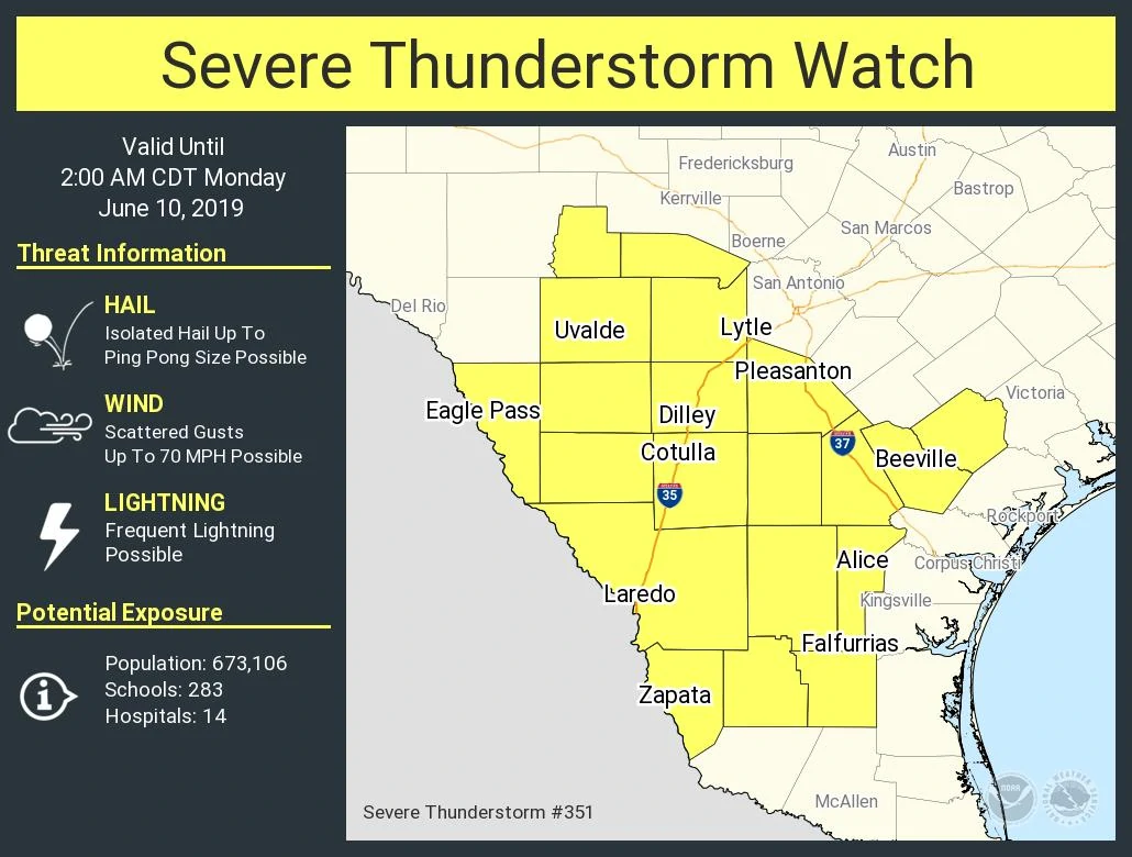
   Severe Thunderstorm Watch Number 351
   NWS Storm Prediction Center Norman OK
   835 PM CDT Sun Jun 9 2019

   The NWS Storm Prediction Center has issued a

   * Severe Thunderstorm Watch for portions of
     South Texas

   * Effective this Sunday night and Monday morning from 835 PM
     until 200 AM CDT.

   * Primary threats include...
     Scattered damaging wind gusts to 70 mph possible
     Isolated large hail events to 1.5 inches in diameter possible

   SUMMARY...Long-lived MCS with embedded supercells across
   south-central Texas will push southward across south into perhaps
   Deep South Texas tonight. While overall severe threat should
   gradually diminish, the risk for mainly severe wind gusts sh


0 Comments