
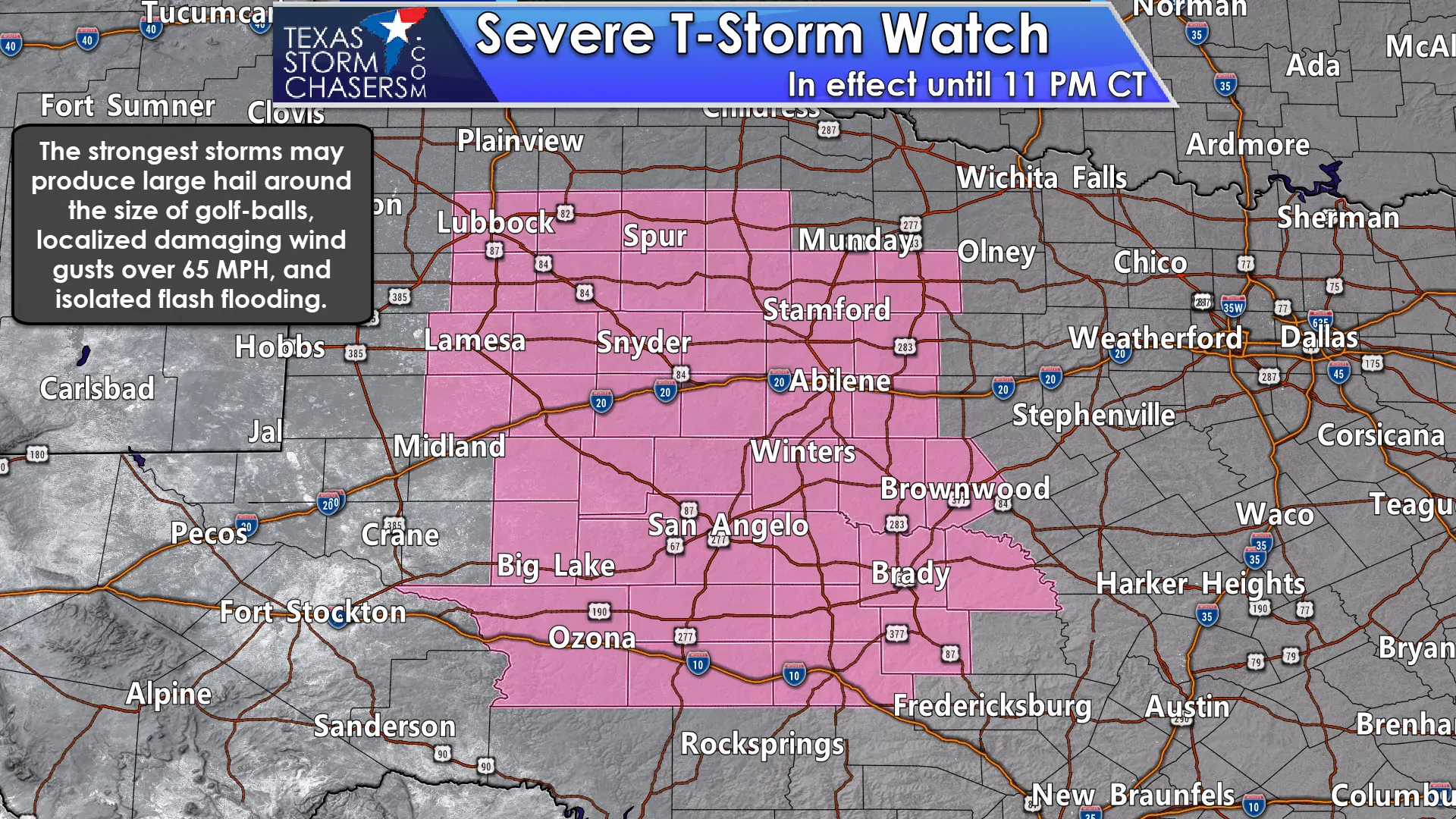
A severe thunderstorm watch is in effect until 11 PM for portions of West Texas, the Big Country, and the Concho Valley. This includes Lubbock, Lamesa, Spur, Snyder, Stamford, Abilene, Winters, Brownwood, Brady, San Angelo, Big Lake, and Ozona. The strongest storms this afternoon and evening may produce 2″ diameter hail, localized damaging wind gusts over 65 MPH, very frequent cloud to ground lightning, and isolated flash flooding.
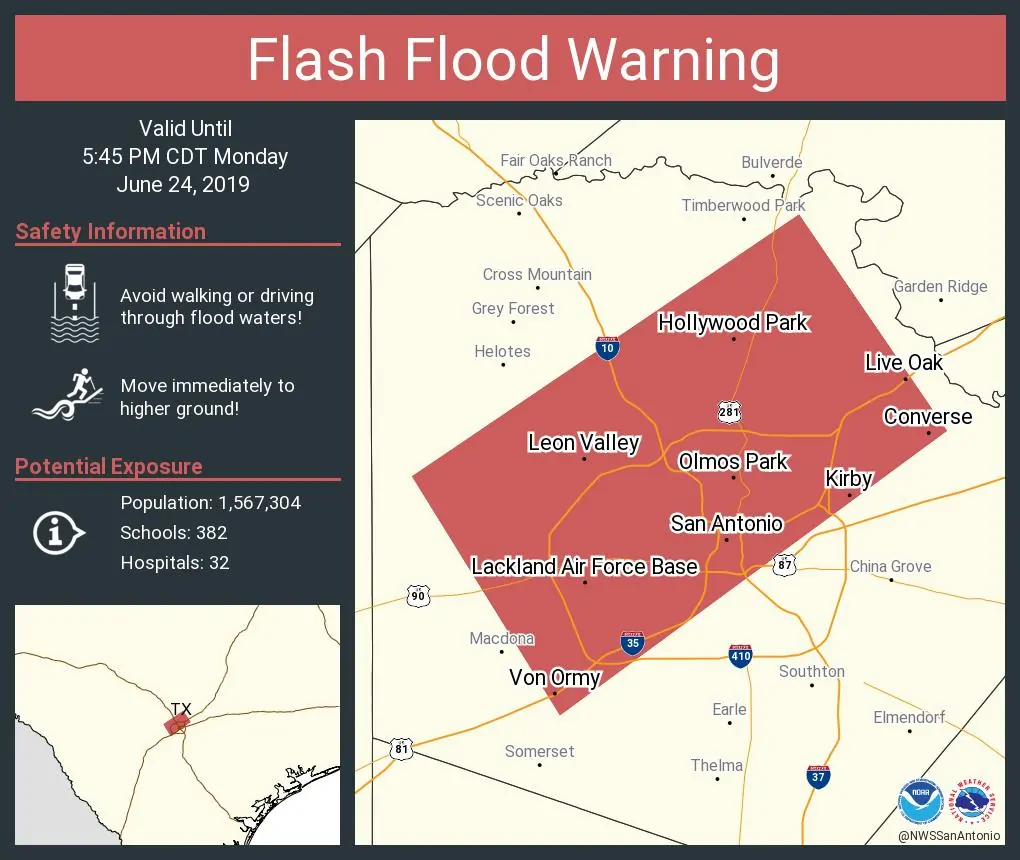
Ongoing thunderstorms across South-Central Texas are not related to this severe weather threat. Those storms currently impacting the San Antonio metro northeast to Luling are producing heavy rainfall, localized wind gusts up to 55 MPH, and quite a bit of cloud to ground lightning. Those slow-moving storms over San Antonio are causing flash flooding. All of this activity should slowly move southeast this afternoon while weakening. Isolated popup storms are possible across South Texas, but those are also more of the ‘summer afternoon popup storms’ we typically deal with. A larger area of rain is ongoing in the Gulf of Mexico off the Coastal Plains.
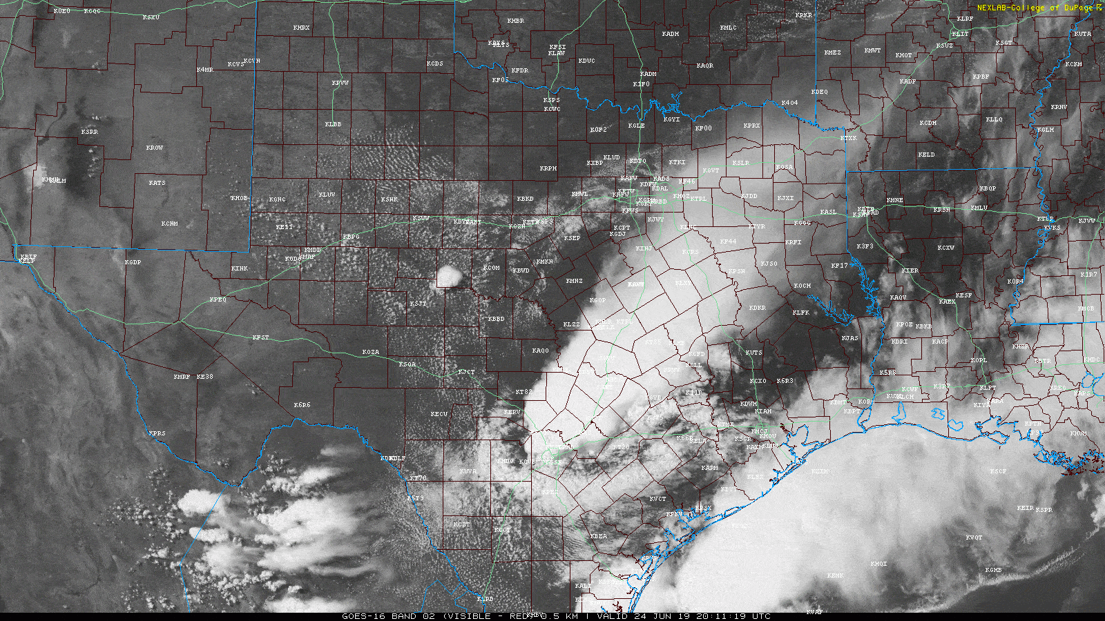
Our focus in terms of an organized severe weather threat will be back in West Texas, the Big Country, and the Concho Valley. A supercell thunderstorm has quickly initiated 20 miles northeast of San Angelo or just southwest of Ballinger. That storm ‘split’ with the right-mover moving south/southeast toward Vick and Paint Rock. The northern split is moving north toward Winters. Visible satellite imagery shows other thunderstorms starting to quickly develop northwest along a boundary from Big Spring to near Andrews. Storms will generally move slowly to the east/northeast. Splitting storms will perform similar movements like the one northeast of San Angelo. The ‘right-movers’ will move south/southeast while the left-movers will move more north. Storms won’t be moving very quickly today.
We should see thunderstorm coverage start decreasing after 9-10PM as the cap strengthens. Some storms could make their way toward western North Texas late this evening, but they won’t make it too far before they’re squashed by the cap. We may see a few storms approach the Edwards Plateau tonight from northern Mexico. If that occurs some storms may be strong.
You can keep track on storms across Texas with our free HD interactive weather radar here on our website and in our free mobile app.
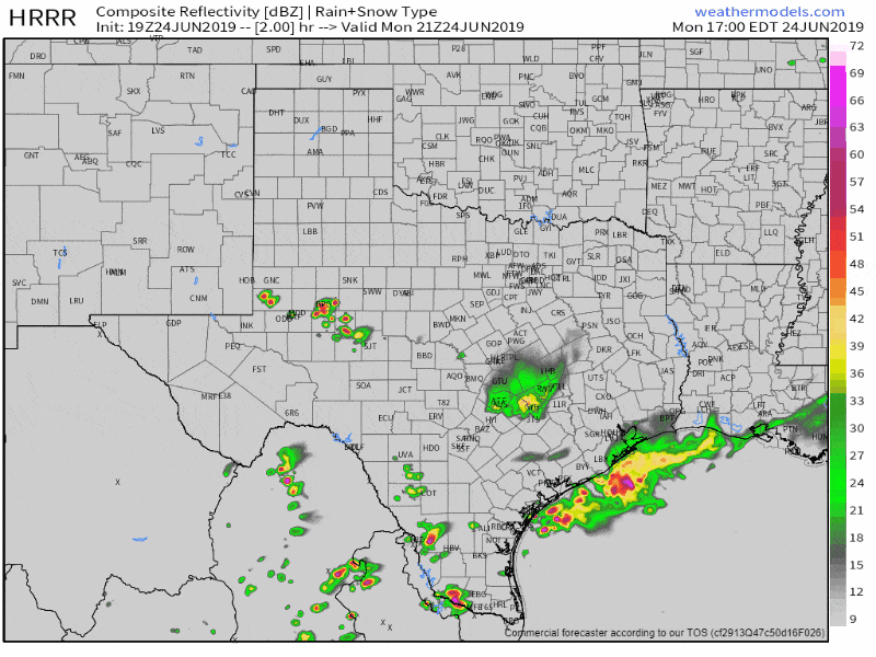
Simulated weather model radar from 4 PM through 1 AM this evening.


0 Comments