
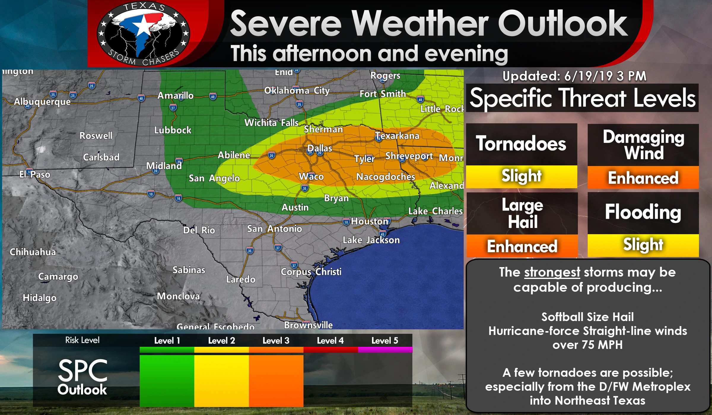
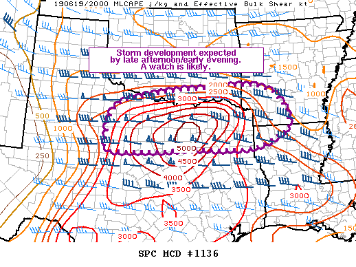
Explosive thunderstorm development is anticipated across portions of North Texas and Northeast Texas in the coming couple of hours. We’re already starting to see signs of initial development across Denton, Cooke, and Grayson counties in the form of agitated towering cumulus. That indicates our cap is just about gone, and with stronger upper-level lift arriving by 5-6PM, we should see supercell thunderstorms rapidly form. The strongest storms could produce giant hail up (baseball to softball size, perhaps larger), hurricane-force straight-line winds over 75 MPH, and the potential for a few tornadoes. Not all storms will be that intense, but we’ve certainly got the airmass to support very severe thunderstorms. Storms will generally move off to the east, but some may move more southeasterly too. Individual storms will have the highest threat for giant hail and a few tornadoes. Those that grow upscale, or exhibiting ‘bowing’ structures, will have the higher threat of destructive straight-line winds over 75 MPH, but wind-driven large hail and brief tornadoes will remain possible. A severe weather watch will likely be issued shortly for North Texas, Northeast Texas, and portions of Texoma. Remain weather aware this afternoon and evening. I’ve included a video briefing that discusses the severe weather threat and timing over the next few hours. We’ll be conducting rapid-fire updates on our social media accounts as the event starts to unfold. You can also view those real-time updates here on our website and in our free mobile app. Our interactive weather radar will also be a great tool to keep an eye on today.


0 Comments