
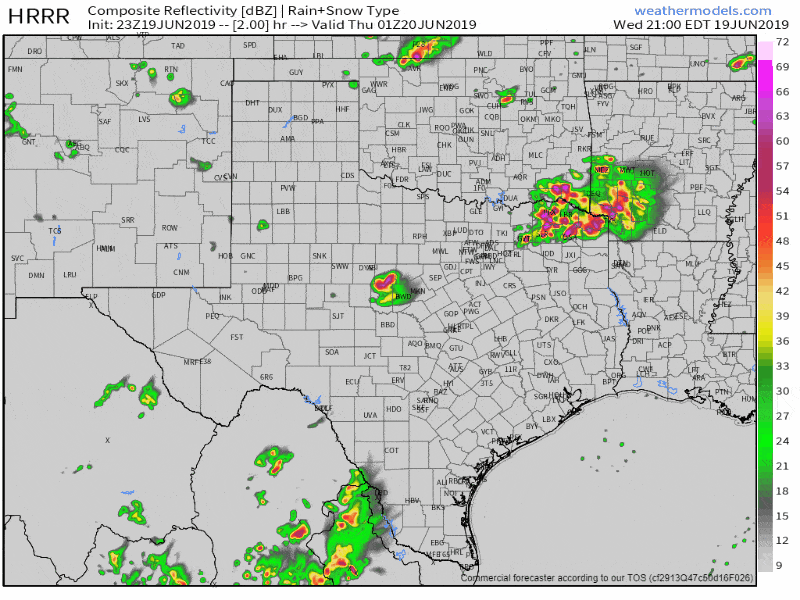
We’re watching two regions for ongoing severe thunderstorms. The first is across Northeast Texas where multiple storms are moving east or east/southeast. The strongest of those storms may be capable of producing very large hail, 70 MPH winds, and even a tornado. The second region is back west into the Big Country and eastern Concho Valley. A few severe storms are producing golf ball size hail and are moving east. One storm may impact Brownwood by 8:30 PM.
Simulated weather model radar from 8 PM through the late night hours. This is only a simulation, and weather models don’t usually get it completely right.
Finally – while quiet now, there are indications that new isolated or scattered storms could impact North Texas after 8 PM (8-11PM). If those storms develop they could quickly become severe with a threat of large hail, damaging winds, and even a tornado. This potential is due to an arriving upper-level wave of lift. Indeed, satellite imagery shows cumulus clouds growing agitated again just north and northwest of the D/FW Metroplex. We’ll also have to watch those storms out by Abilene as they make their way east toward western North Texas. Those in North Texas shouldn’t let their guard down just yet. A tornado watch remains in place until midnight. I can’t guarantee we’ll see new storms develop in North Texas this evening, but there are still signs we could have some boomers fire up later this evening. If nothing else fires we’ll still have to deal with that activity out in the Big Country. That could be near the D/FW Metroplex (I-35 corridor in North Texas) around 10-11PM.
You can keep tabs on the storms using our free HD interactive weather radar at texasstormchasers.com/radar.


0 Comments