
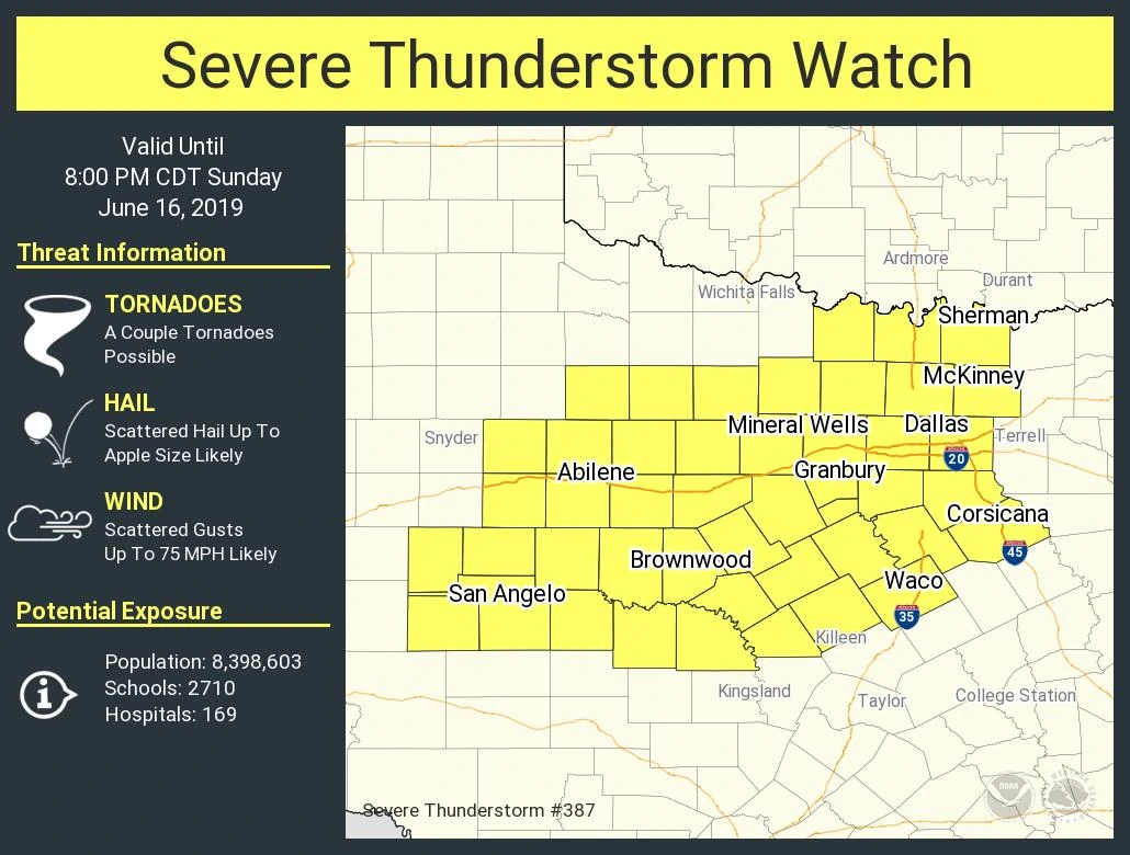
A severe thunderstorm watch has been issued for portions of the Concho Valley, Big Country, and much of North Texas until 8 PM. This watch includes San Angelo, Abilene, Brownwood, Mineral Wells, Granbury, Waco, Corsicana, Sherman, and the entirety of the D/FW Metroplex. A severe thunderstorm watch means conditions are favorable for the development of severe thunderstorms, including large hail, damaging winds, isolated tornadoes, and localized flash flooding.
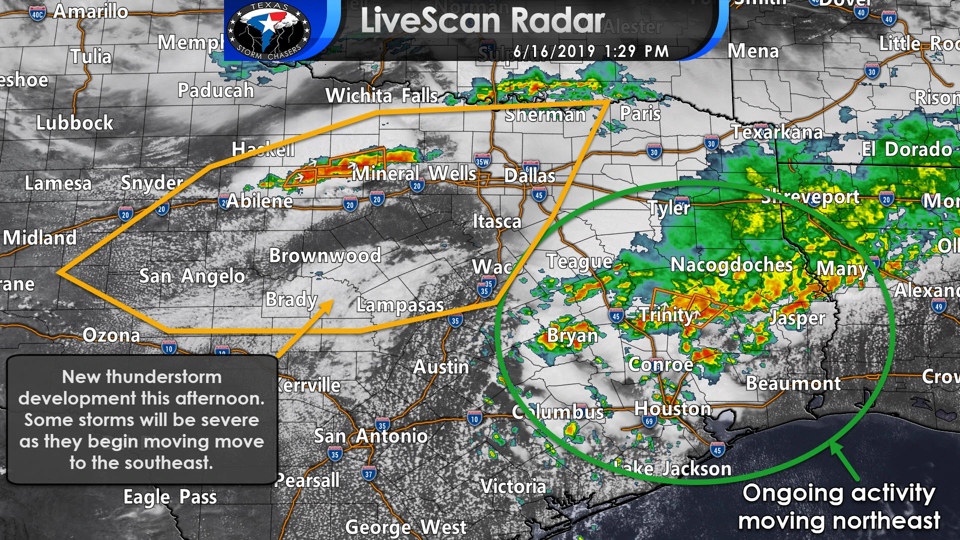
The strongest storms could produce very large hail up to the size of tennis-balls and localized wind gusts over 70 MPH. The potential for hurricane-force straight-line winds over 75 MPH may increase by the early evening hours as a large line of thunderstorms organizes and begins pushing southeast. That line would have the potential of impacting portions of North Texas, Central Texas, the Hill Country, and the Brazos Valley this evening. Very large hail and a low threat of a tornado would also be present in more supercelluar storms.
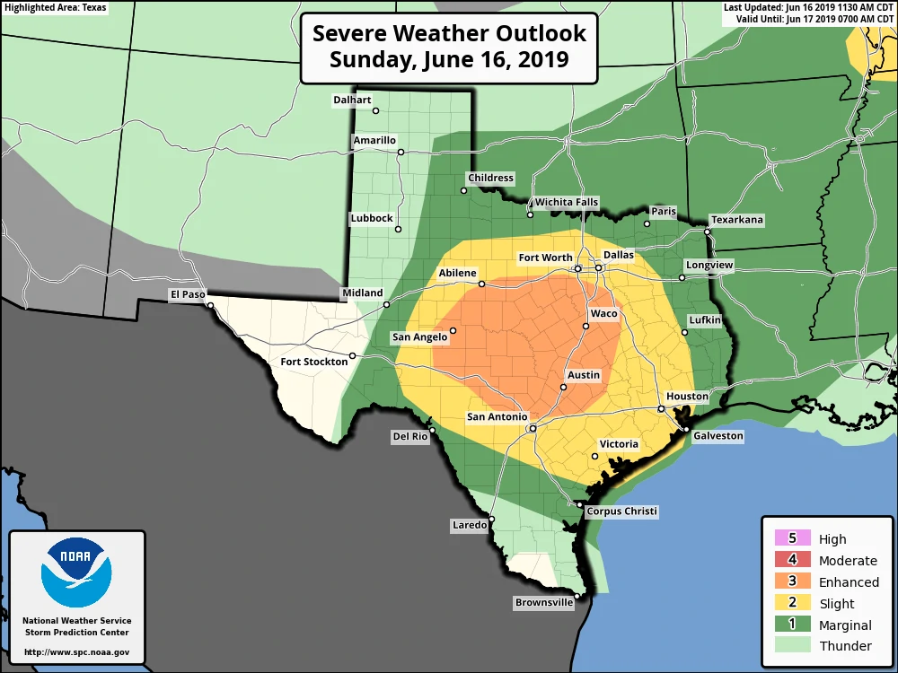
I would expect additional severe thunderstorm watches to be issued for the Hill Country, Central Texas, and the Brazos Valley later on today. Once storms organize into a squall line or a large cluster they may continue moving southeast tonight all the way to the coast. That means we’ll have to watch for the threat of damaging straight-line winds and hail past the Brazos Valley into South-Central Texas, the Coastal Plains, and into Southeast Texas overnight.


0 Comments