
It was a dark and stormy night for the Coastal Plains and Southeast Texas. Multiple severe storms dropped quarter to softball size hail and produced over five inches of rain in one hour in portions of Harris County. As you might expect flash flooding ensued and numerous streams became raging rivers. I’m a bit wary of how much hail damage the first light will reveal this morning. I have a feeling last night may have been one of the more costly Southeast Texas hailers in a long while.
Anyway, those storms moved off the coast by 1 AM leaving a large area of rain in its wake. A big player in yesterday’s event was a slow-moving cool front. Those north of the front is enjoying unseasonably cool temperatures this morning. The Texas Panhandle has dropped into the middle 30s with 40s and lower 50s south into the Hill Country and North Texas. That isn’t something to write home about in March but certainly isn’t too common in mid-May.
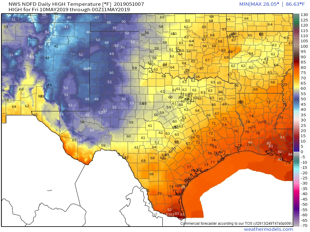
Today’s High Temperature Forecast (click the image for a full-screen version)
High temperatures this afternoon will struggle to make it into the lower 50s across the Texas Panhandle and West Texas. Some folks will likely stay in the 40s all day with wind chills a few degrees cooler than that. Yup! I’m talking about wind chills in May. The 50s to lower 60s are expected across Texoma, North Texas south into the Hill Country. Those wanting a return to spring only need to drive south of the stationary cool front. Southeast Texas, the Coastal Plains, Coastal Bend, and Rio Grande Valley will be in the 70s much of today with tropical moisture in place.
It’s going to be a fairly dreary day regardless of which season you’re emulating today. Scattered showers and thunderstorms will increase in coverage throughout the day across the state as waves of upper-level lift moves overhead. Unlike the last two weeks, we’re not expecting much (if any) severe weather threat today or tonight. A few storms could produce small hail, but the atmosphere is going to be fairly wiped out in the instability department.
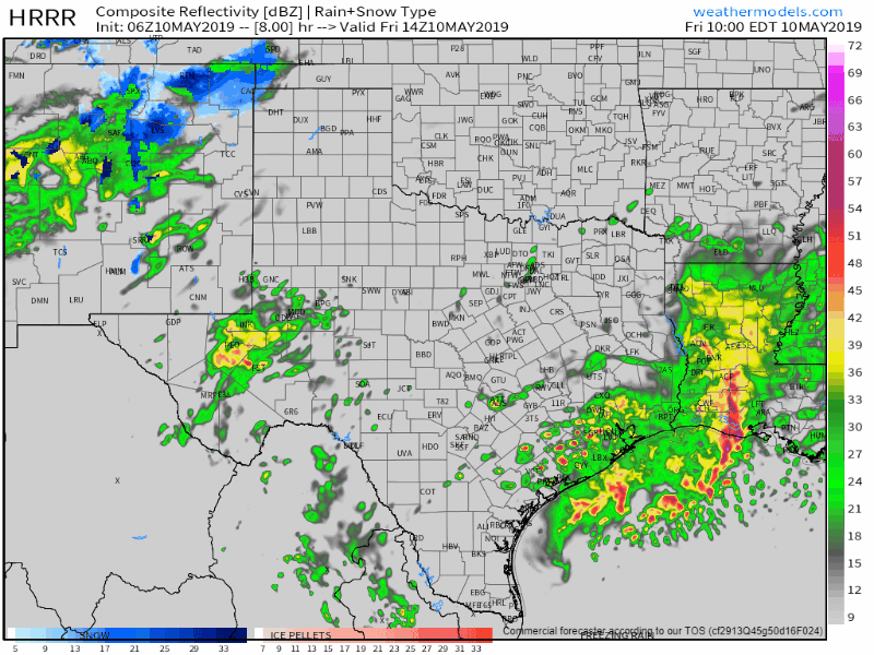
Simulated weather model radar through today and into Saturday morning
Moisture won’t be lacking though, so downpours are probable. Localized flash flooding of low-water crossings and streams could occur in areas that have already dealt with heavy rainfall over the last week or two. Widespread flash flooding is not expected. Tonight is looking wet across the eastern two-thirds of Texas with numerous showers and some thunderstorms.
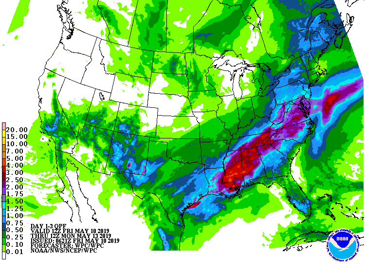
Additional potential rain totals this morning through Sunday night. These are regionally-based. Some will see less, some could see a bit more. Keep in mind that it won’t take much (if any) new rain to cause additional flooding in the hardest-hit areas.
Saturday will bring more chances for storms. We’ll have to keep an eye on East Texas and Southeast Texas as some stronger storms may return to the forecast. Localized flash flooding will continue to be a threat as any shower/storm could produce heavy rain. We’ll get more specific on Saturday’s forecast a bit later on today once we get a clearer picture on where certain weather features will set up.


0 Comments