
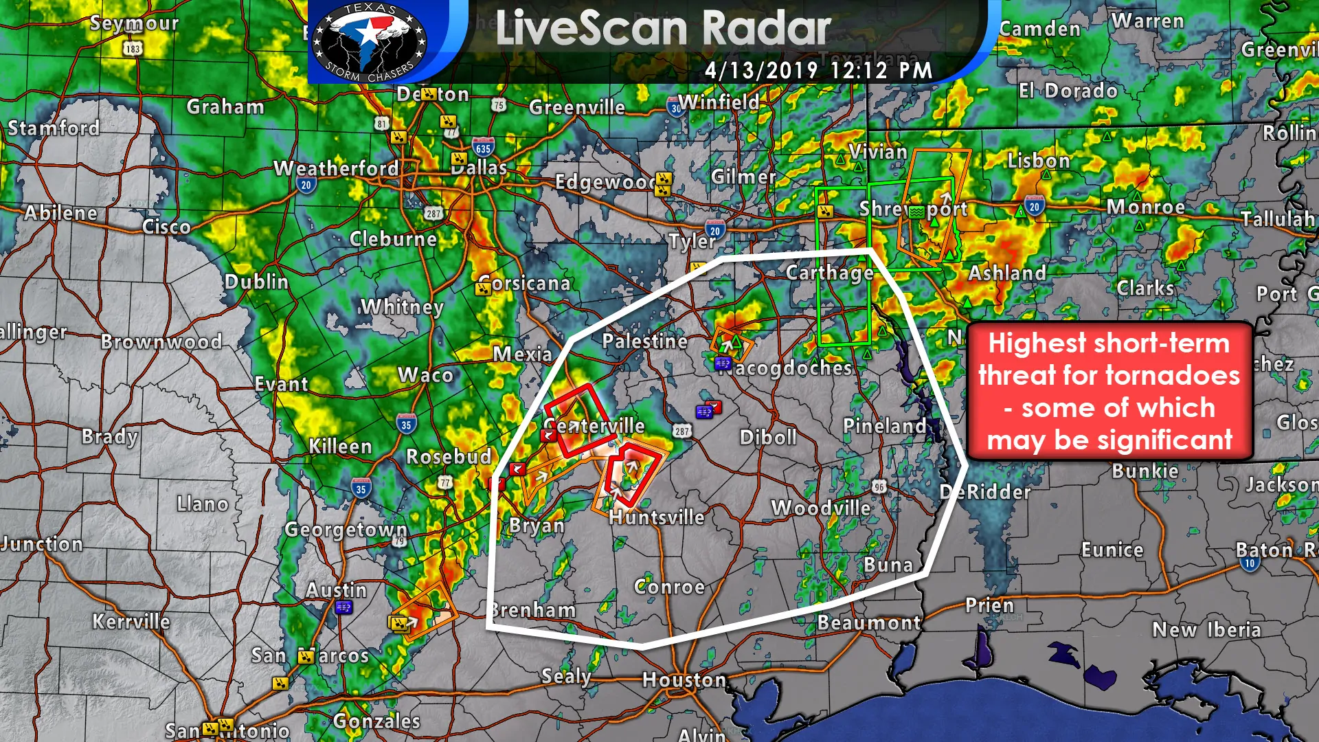
Multiple tornadoes have occurred over the last hour from Robertson County east to Houston County. We’ve heard of major damage in Franklin and Robertson counties along with in Houston County. Given these reports along with several hours of additional activity expected we’re anticipating a tornado outbreak across East Texas this afternoon. Additional storms may develop, move northeast, and become severe. All modes of severe weather are possible. Strong, long-track tornadoes are possible with the most intense storms this afternoon in East Texas, generally south of Interstate 20. This is a particularly dangerous situation and folks need to stay weather aware! Hopefully, we can get by the rest of the afternoon without any more major tornadoes, but ingredients are in place to support rouble. The highest tornado threat will be south of a warm front – that continues to move north across East Texas this afternoon. We believe it’ll try and make it up toward Interstate 20 or just south of there. The threat for tornadoes will decrease after 5-6PM as low-level wind shear decreases. However, storms may continue with a threat of hail, damaging winds, and isolated tornadoes until the mid-evening hours.
We’ll be doing live coverage on our social media platforms as severe weather continues this afternoon. You can track storms using our free HD interactive weather radar here.


0 Comments