
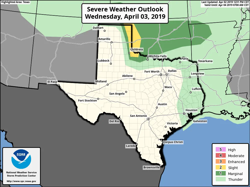
Wednesday’s severe weather outlook
There will be an opportunity for a few severe weather chances in the coming days. We’ll start off with a chance of one or two severe thunderstorms in the eastern Texas Panhandle tomorrow afternoon. Moisture levels are going to be modest, but there may be just enough to fire off a couple of high-based supercells just east of a dryline. At this time it looks like the dryline will be across the eastern Panhandle, but if it were to be a bit slower, it could be closer to the central Panhandle instead. Regardless, if we do get any storms to fire up tomorrow afternoon they’d be capable of producing large hail, localized damaging wind gusts, and wildland fires assuming there are lightning strikes outside of precipitation cores. Anything that gets going will move off to the east/northeast into Oklahoma by the early evening. Paige and I are planning on chasing.
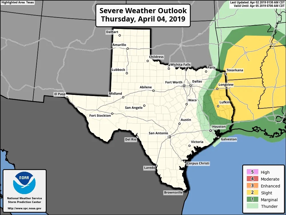
Thursday morning’s severe weather outlook
We’ll then move into Thursday with a low-confidence forecast, but the potential for some hailers during the morning hours on Thursday. Weather model data is showing considerable uncertainty so we do expect some changes to the forecast as we get closer. Thunderstorm chances are anticipated to increase after sunrise east of Interstate 35 across Northeast Texas and East Texas. Most models are not showing much surface-based instability but do show considerable instability in the mid-levels. That would keep the threat of tornadoes very low, the threat of localized damaging winds on the lower-side, and a threat of large hail with the stronger storms.
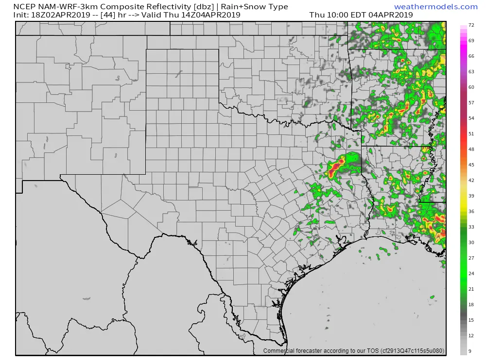
18Z NAM3KM – Simulated weather radar at 9 AM Thursday **shown for example purposes only, this data will likely change by Thursday morning**
The lack of surface-based instability strongly suggests storms would be ‘elevated’, thus the concern being hail with the strongest storms. Gusty winds would also be possible. Storms that did fire up would move east into Lousiana by the early afternoon hours. Additional storms would fire up during the late afternoon hours, but that would be east of Texas. We’ll be able to be more specific tomorrow once weather model data (hopefully) begins to converge on a solution.
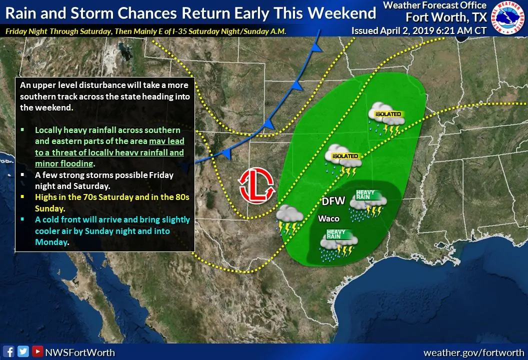
Showers and thunderstorms become far more likely as we head into the weekend. This weekend’s system will be more of a heavy rain producer versus a severe weather event. We can’t rule out a few severe storms since this is April, but it looks like this will be a gullywasher versus a big hailer/spinny wind of doom event. A few inches of rain (1-3″) will be possible.


0 Comments