
Hello from a gravel road off Highway 380 east of Decatur. I wanted to provide a quick update on our overnight expectations while I await a severe storm to get closer from the west. Subsidence (sinking air) and a weak cap helped to prevent organized thunderstorm development along the dryline until after 6 PM. That helped suppress some of the ‘giant hail’ potential, which is preferred to one that would have produced a billion dollar hail event.
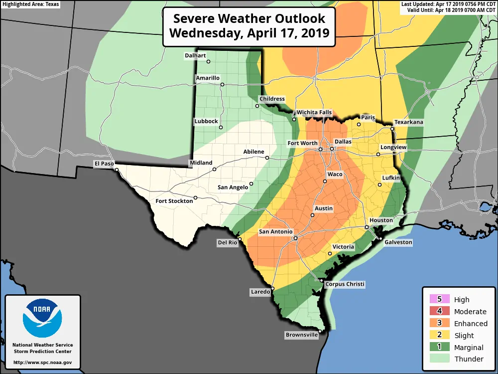
Severe weather outlook for the evening and ovenright hours
We’re now seeing lift increase along the dryline. That lift is allowing for thunderstorms to increase in coverage and intensity from Gainesville to Decatur, with another line from Gordon to Commanche to Goldthwaite to Brady to Menard to west of Junction and to the west of Del Rio. Essentially, we now have storms quickly firing up on the dryline from the Oklahoma border south to the Mexico border. That’s the ‘main show’ overnight that’ll move east overnight and impact the eastern third of Texas.
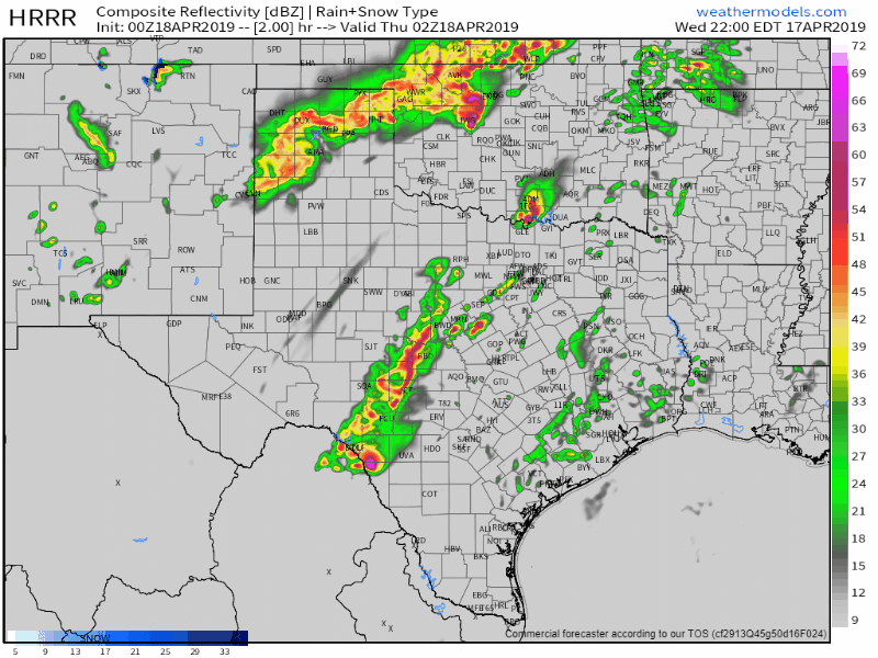
0Z HRRR: Simulated weather radar from 9 PM into Thursday morning. While this model may not get the specifics drawn correctly, it helps to provide a timeline.
Stronger storms over the next several hours within that line may exhibit supercelluar characteristics with a threat of very large hail, localized damaging winds, and perhaps an isolated tornado. There are indications that the squall line itself may become much more organized in the wind department as it moves into South-Central Texas and the Brazos Valley overnight. We have a concern that brief tornadoes may occur along with damaging straight-line winds and large hail. As we progress toward a more linear mode versus supercelluar we should see hail sizes come down.
Flooding will be possible across East Texas, the Brazos Valley, and Southeast Texas overnight into the morning hours on Thursday. We’re out on the road chasing this evening. We will be unable to post many updates.


0 Comments