
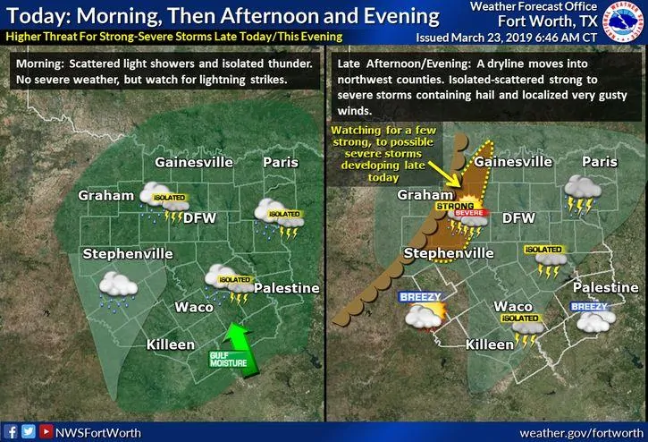
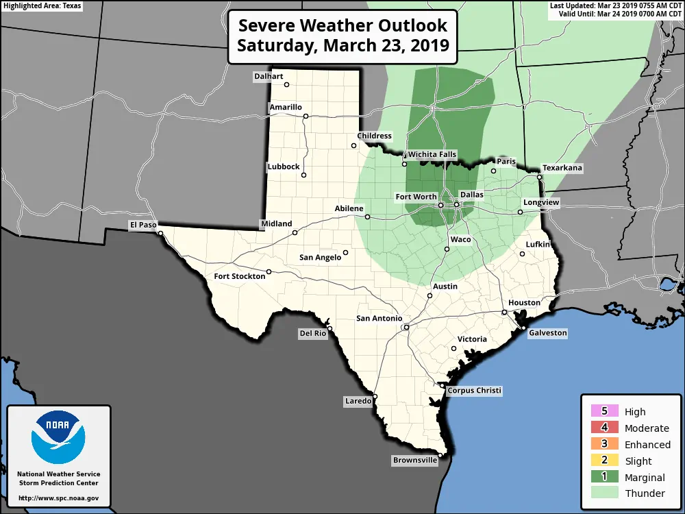
A Marginal Risk (Level 1) for severe weather has been outlined today for portions of north central Texas up into southern and central Oklahoma. Ongoing storms this morning across far north Texas and the Red River Valley region, and also east/southeast of the DFW metroplex, should remain sub-severe with mainly a threat of lightning and periods of heavy rainfall and gusty winds. This activity will continue to move off to the north/northeast through the morning hours and is anticipated to have moved well north and east of the north central Texas region by noon. After that, we’re anticipating a lull in storm activity during the afternoon hours. By late afternoon into the early evening hours, current forecast models shows the potential for some strong to severe storm development along a dryline which is expected to move near the Highway 281 corridor just west of DFW…with the strongest storms trekking east across the northern DFW and Red River counties during the late evening. At this time, forecast confidence is not very high with regard to severe storm development or coverage during the late afternoon and evening hours…so this will be a scenario which we will carefully monitor throughout the day for any changes and updates. Should the trend for strong to severe storms continue or increase, we may see later updates from the Storm Prediction Center include an update to a Slight Risk (Level 2). With any storms that do develop later this afternoon and evening, large hail will be the main threat along with gusty winds and frequent lightning. The tornado threat is low, but cannot be completely ruled out.
Main forecast takeaways for this afternoon and evening for residents west, northwest and north of the immediate DFW metroplex:
Monitor the forecast later this afternoon and evening
Have a way to receive weather warnings if you have outdoor plans this evening
Monitor local media for the latest updates should storms develop in or near your location


0 Comments