
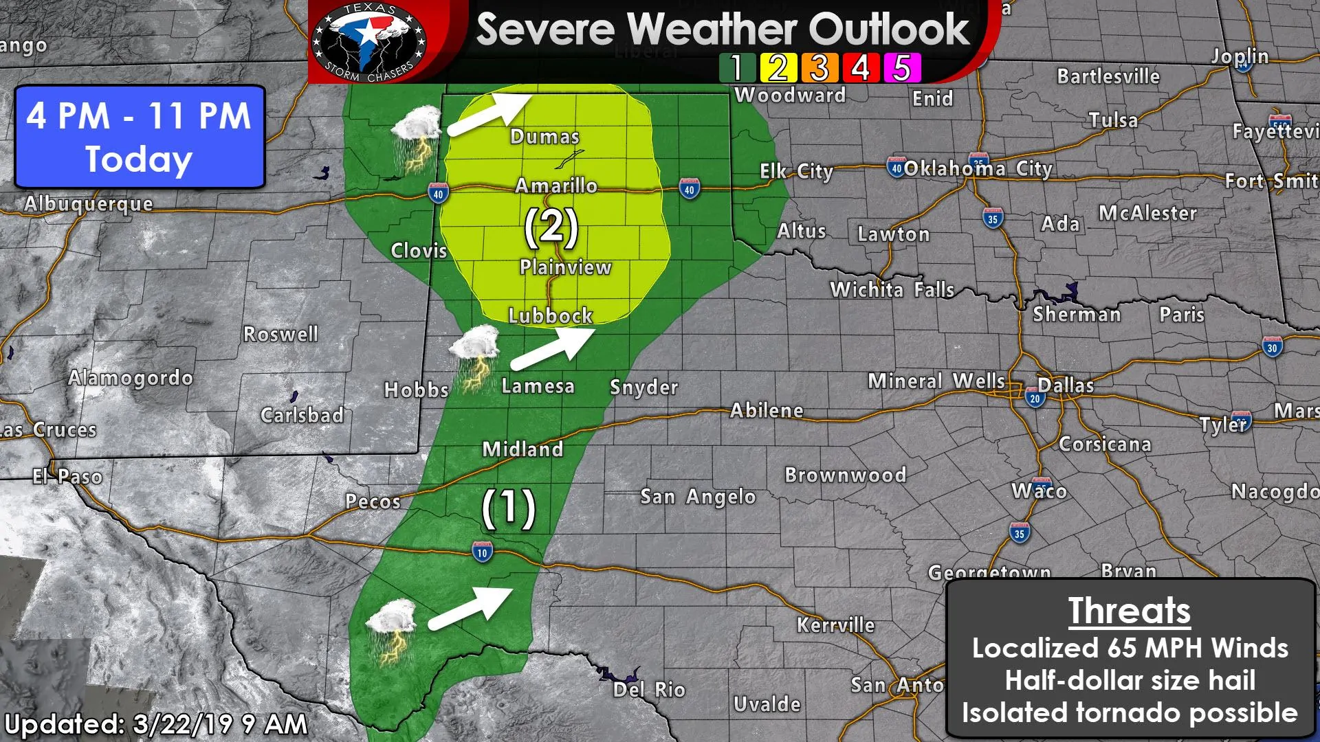
Spring is upon us and we have an early season severe weather threat this afternoon and evening across the Texas Panhandle, and to a lesser extent, across West Texas south into Southwest Texas. A level two risk of severe weather, the standard risk level, is in place for the western and central Texas Panhandle south down Interstate 27 to Lubbock. This relatively small zone has the highest relative potential of seeing large hail and localized damaging winds this afternoon with a few semi-discrete supercell thunderstorms.
An isolated tornado cannot be ruled out. A line of strong to occasionally severe storms will move from west to east this evening. Those storms could produce localized damaging wind gusts up to 65 MPH and perhaps a couple of brief spin-up tornadoes. Instability levels drop off across the eastern Texas Panhandle, hence the diminishing chance of severe weather. However, storms still may be producing some hail and gusty winds as they move into western Oklahoma tonight.
We’ve got a level one risk of severe weather that extends south through the eastern Permian Basin into Southwest Texas. The potential of seeing thunderstorm developing is lower due to less upper-level lift and a stronger cap. However, we may see one or two storms fire up during the late afternoon hours. Those could produce hail before they weaken a few hours after sunset. We’ll have to keep an eye on storms that fire up off the higher terrain in Mexico this afternoon. There is a chance those storms could congeal into a small cluster that moves east into the Edwards Plateau this evening. Those would possibly be strong with some hail and gusty winds.
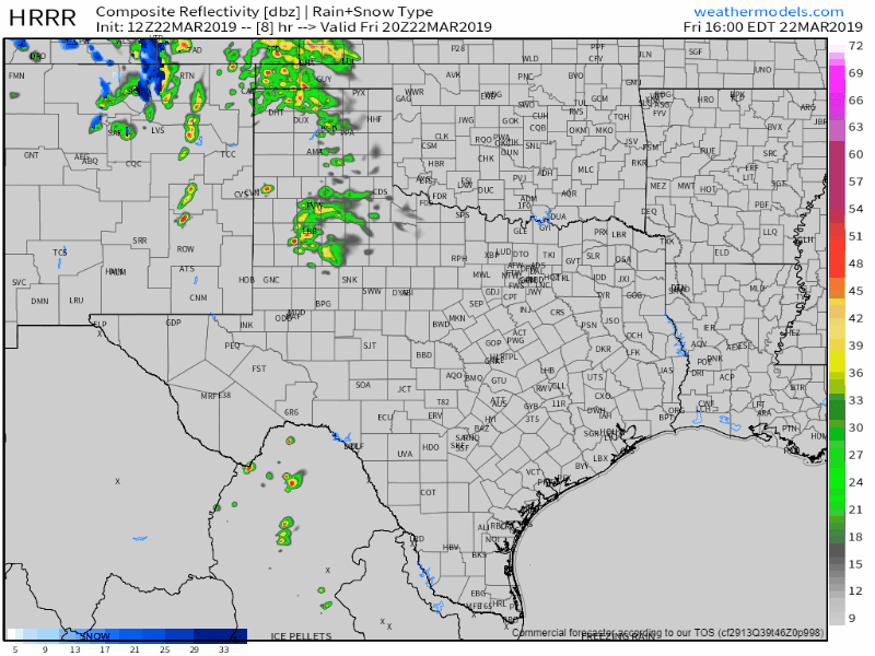
12Z HRRR: Simulated weather radar from 3 PM this afternoon through the early morning hours Saturday. Remember, this is only a simulation!


0 Comments