
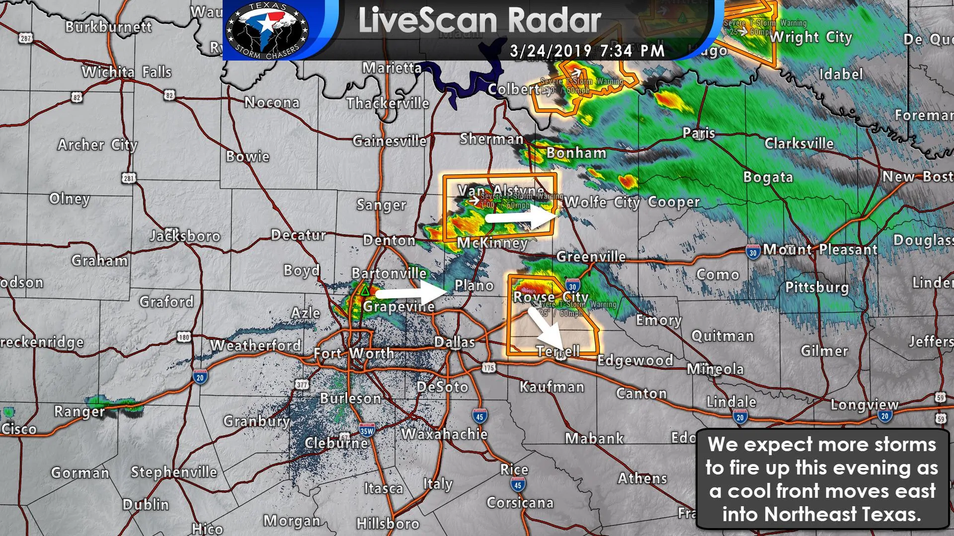
Scattered severe thunderstorms are impacting the D/FW Metroplex all the way northeast to Illinois as a cool front moves southeast. We’ve had significant hail damage from eastern Denton County through Collin County over the last hour. Storms are a bit more behaved at the moment, but we still have several storms capable of producing large hail. New storms are firing up along the front itself from Anna southwest to Haslet. Those storms are moving east and could become severe over the next hour with large hail and damaging winds.
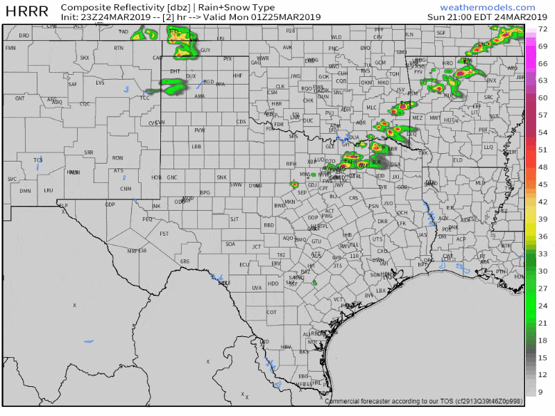
23Z HRRR: Simulated weather model radar from 8 PM through 6 AM tonight. Keep in mind this model is just a guesstimate and won’t get it completely right. Still, it gives a general timeline.
We still expect additional storms to fire up later tonight in Northeast Texas, along with the ongoing activity in North Texas moving east into Northeast/East Texas. The strongest storms may remain severe well into the evening with a threat of large hail and damaging wind gusts. A brief tornado cannot be ruled out, but tornadoes aren’t high on the threat list tonight. We may see a small line/cluster of storms in Northeast/East Texas tonight. If that materializes we’d be watching for a bit higher risk of damaging winds in addition to the hail.
We’re posting frequent updates on our Twitter account along with our other social media platforms. You can keep track of the storms using our free HD interactive weather radar here.


0 Comments