
A line of strong to locally severe storms extends from Texarkana to Jefferson to Longview to Jacksonville to Elkhart to Centerville to just north of College Station to Lexington to Elgin. The strongest portion of the squall line is generally from the Arklatex southwest to Jacksonville. Those severe storms are capable of producing damaging winds up to 65 MPH and small hail.
- 62 MPH wind gust in Longview just around 3:15 AM as the line of storms rolled through.
- Multiple reports of power outages across East Texas.
Movement with the squall line over the Arklatex to Interstate 20 is east at about 45 MPH. Farther southwest the storms in the Brazos Valley are generally moving east/southeast at 35 to 40 MPH. Small hail and gusty winds are possible with those storms.
We anticipate a weakening trend with the storms in a couple of hours as they start to outrun the better upper-level dynamics and we get closer to sunrise. However, a line of showers (perhaps with some embedded thunderstorms) will likely move across Southeast Texas later this morning.
Our main concern will be the next couple of hours with the squall line in East Texas. Luckily, that’ll be moving east into Lousiana by 4:30 AM.
Strong winds are occurring back west in North Texas along with reduced visibilities from blowing dust. Those are not related to the ongoing thunderstorm activity.
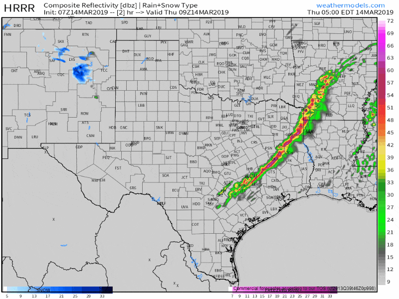
7Z HRRR: Simulated radar from 4 AM to 7 AM this morning showing the general expectation of weakening as we approach sunrise.


0 Comments