
Most folks may not realize this but modern meteorology is still a relatively new science (60-80 years old)) I say that as a convenient segway into today’s somewhat surprising thunderstorm coverage across Southeast Texas. Sometimes the weather can still surprise us, and that was evident today thanks to a ripple of energy aloft that allowed for thunderstorm development. Showers were certainly in the forecast, but we didn’t expect activity to grow intense enough to reach into the sub-freezing airmass aloft.
Alas, that little ripple of lift did allow thunderstorms to grow taller and into an airmass that supported small hail. That’s why we ended up having several semi-discrete storms produce all that small hail this morning and afternoon. That energy has now moved off to the east and subsidence (sinking air) behind it has reduced shower/storm coverage this evening. Sometimes even the best weather models can’t resolve small ripples of energy skirting along in a fast jet-stream.
Chance of rain/storms on Tuesday and Wednesday
After tonight’s short-lived break we’re going to see an uptick in shower and thunderstorm coverage on Tuesday. Coverage is expected to be greater in coverage than today. The highest chances for rain will be across Southeast Texas with lower coverage farther north in East Texas. It won’t be raining at one spot all day nor is everyone guaranteed to get a soaking. Isolated to scattered showers and storms will continue into Tuesday Night. We may see a lull on Wednesday, but another round of showers is possible Wednesday night across Northeast Texas and East Texas.
More hail on Tuesday?
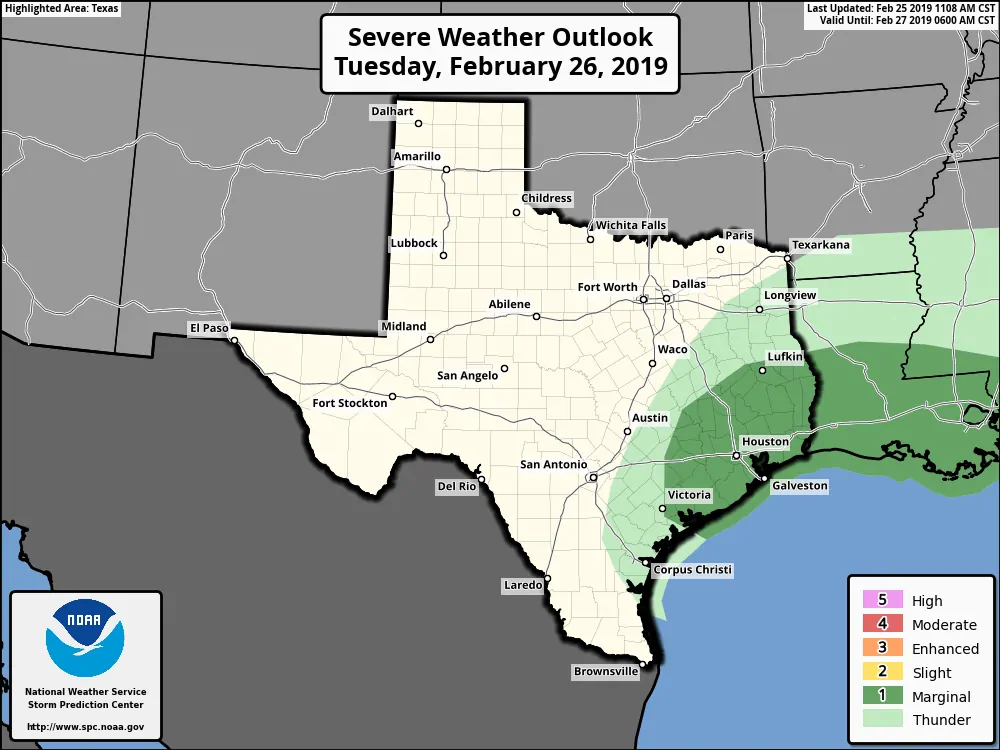
A level one risk of severe weather is in place for Tuesday across the eastern half of the Coastal Plains, the Brazos Valley, all of Southeast Texas, and portions of East Texas. A level one risk is the lowest on a five-level system. It means that strong storms are possible with the chance of isolated severe storms capable of producing quarter size hail. Most storms tomorrow will likely remain sub-severe, but like today, copious amounts of small hail are possible with stronger updrafts. The risk of hail will decrease by the early evening.
Wednesday and beyond for Texas
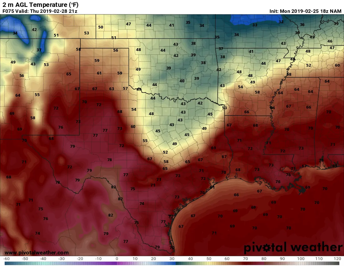
18Z North American Model: Surface temperatures at 3 PM on Thursday.
The focus will be on a cold front that will arrive in parts of the Texas Panhandle to Texoma on Tuesday and Wednesday. It’ll stick around through Thursday before lifting north as a warm front on Friday. This front will stall at some point on Wednesday with a shallow arctic airmass behind it. Temperatures south of the front and across a majority of Texas will be above-average with 60s-80s.
Those north of the front will see temperatures in the 30s and 40s. A sharp gradient can be expected, so the location of where the front eventually stalls out will have a big impact on temperature forecasts.
We’ll all experience a warm-up on Friday with temperatures across Texas peaking in the 60s, 70s, 80s, and even a few 90s. That’s ahead of our *true* arctic outbreak that begins to arrive Friday night in the Panhandle and spreading south through much of Texas on Saturday. Unlike the mid-week shallow airmass, this weekend’s will be a full-fledged visit from Canada with a full suitcase. Indications are that below-average temperatures may stick around into the second week of March.
With any long-duration cold airmass, we need to watch for any potential winter mischief. There aren’t any major winter weather events grabbing our interest at this time, but there may be a few minor instances of winter mischief early next week. We’re watching it!


0 Comments