
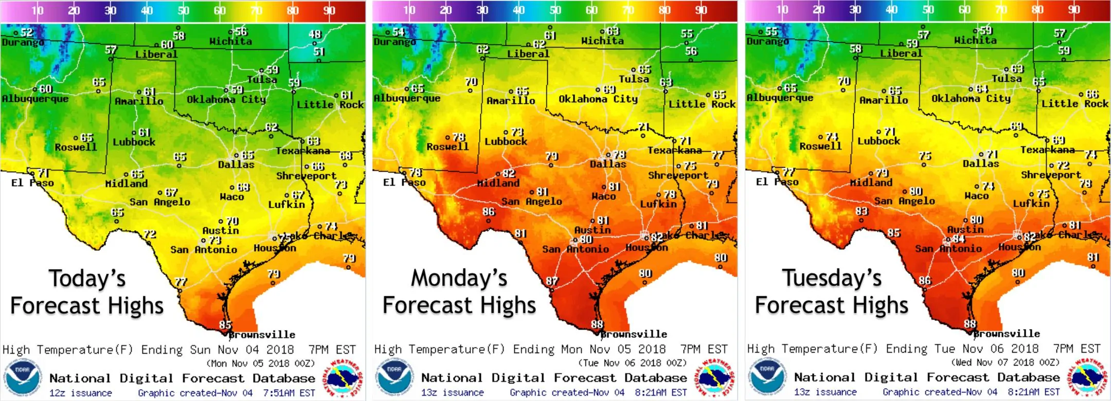
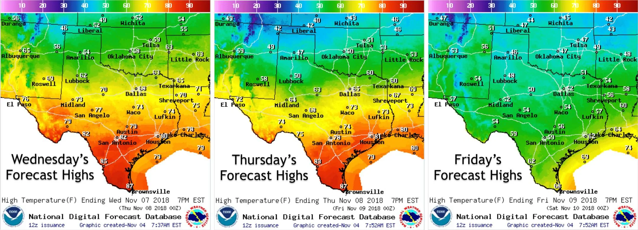
Good morning and happy Sunday! I hope everyone remembered to turn their clocks back by one hour this morning. Yesterday’s cold front continues to work its way south this morning with rain and showers beginning to come to an end for coastal southeast Texas. Overall, temps today will be a little cooler than yesterday, but conditions will be very pleasant for outdoor activities throughout most of the state. We’ll see a bit of a warming trend Monday through Tuesday with temps ranging from the high 60s and low 70s up north to upper 80s down south before our next cold front arrives late Wednesday into Thursday. By Thursday, and especially by Friday, we’ll see temps dropping back to below normal for this time of the year and this trend of cooler conditions is expected to continue into next weekend as well. Tis the season for roller coaster temps!
The threat for scattered strong to severe storms returns tomorrow for portions of far east/northeast Texas as another upper level disturbance swings across the south central plains. By and far, the highest risk of severe weather will remain well east of our state across portions of the lower Mississippi Valley and parts of the Ohio Valley, but we could still see this system squeak out a few severe storms tomorrow afternoon and evening before the system shifts east. Damaging winds and quarter size hail will be the main threats across the eastern 1/4 of the state through the late evening hours. The tornado threat is low, but non-zero, so be sure you have a way to receive severe weather alerts should any be issued for your particular location. 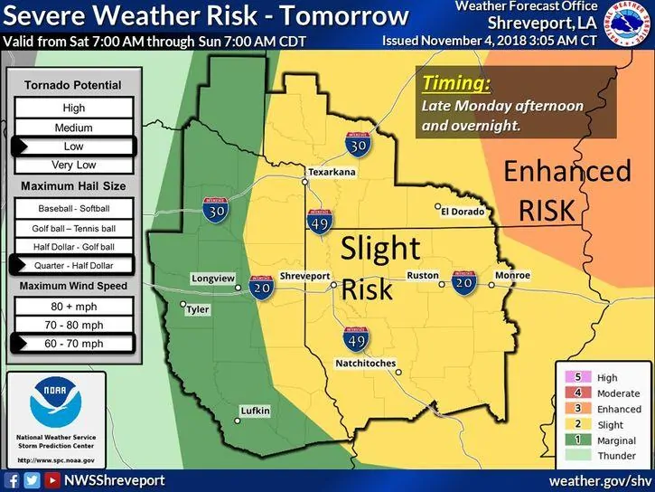
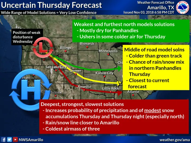
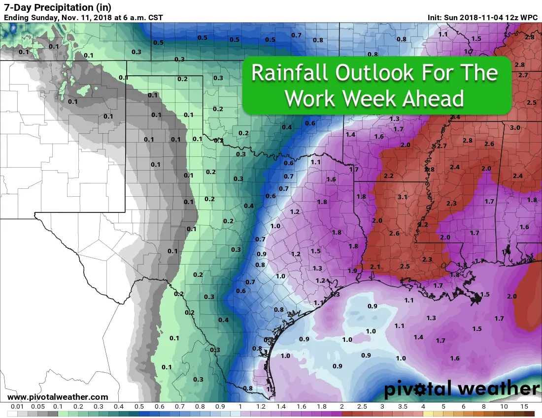
Once we get past Monday, the threat for rain pauses until late Wednesday and into Thursday with the arrival of our next strong cold front. As you can depict from the work week rainfall outlook graphic below, a majority of the precipitation that falls late this week will be confined to the eastern 1/3rd of the state. Those of us in central and north central Texas are happy to share as we’re still dealing with saturated soil. Behind the front on Thursday, the current forecast for the panhandle region calls for the possibility of some wintry precipitation mainly across the OK panhandle and far northern Texas panhandle. However, there are some forecast models showing the possibility of freezing precip with light snow from around Amarillo northward. Then again, some models are keeping the area completely dry and cold. That said, we’ll continue to monitor the panhandle outlook for later this week and keep you up to date if wintry mischief looks to be more problematic. For the remainder of the state, just a chilly rain expected behind the front Thursday and through Thursday night. We’ll continue to follow the forecast and provide updates as we get further into the week!


0 Comments