
At least two tornadoes have occurred in the last two hours immediately south of the D/FW metroplex. The first produced damage at Waxahachie High School just northwest of town off 287. The second, moments ago, was just east of Hillsboro. That second tornado may have been a rather significant one based off radar data and storm chaser reports. The threat of severe weather will likely expand east into portions of East Texas over the next two hours. A warm front is located roughly along Interstate 20 in East Texas. Surface-based instability and wind shear along and south of this warm front support a continued severe weather threat as storms move in from the west. The strongest storms may produce damaging wind gusts over 60 MPH and isolated tornadoes. Hail hasn’t been reported much today, but can’t be ruled out. Remember – have a way to receive weather warnings!
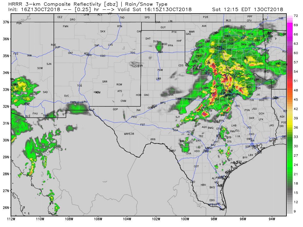
The High-Res Rapid Refresh (HRRR) model is also in agreement that the threat for severe storms may continue into East Texas this afternoon. Not all storms will be severe and not all storms will be tornadic, but today’s storm history shows we must remain vigilant through the afternoon hours. Additional storms may attempt to develop west of the ‘main show’ in Central Texas that we’ll also have to watch.


0 Comments