
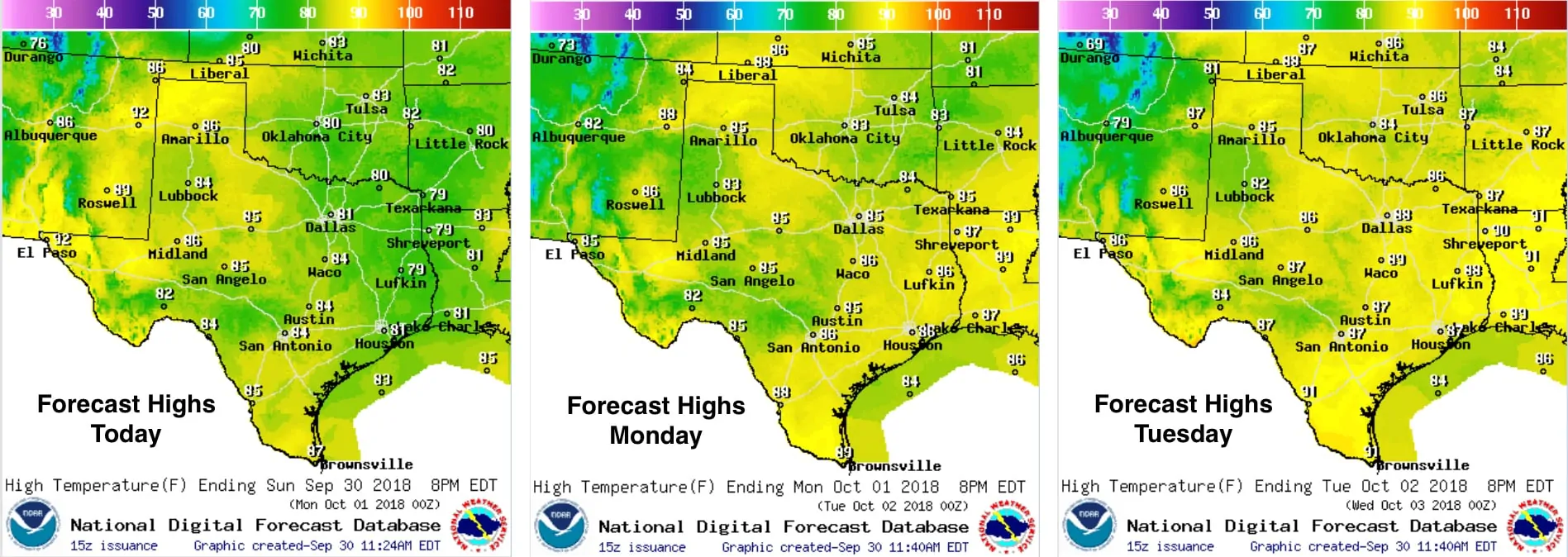
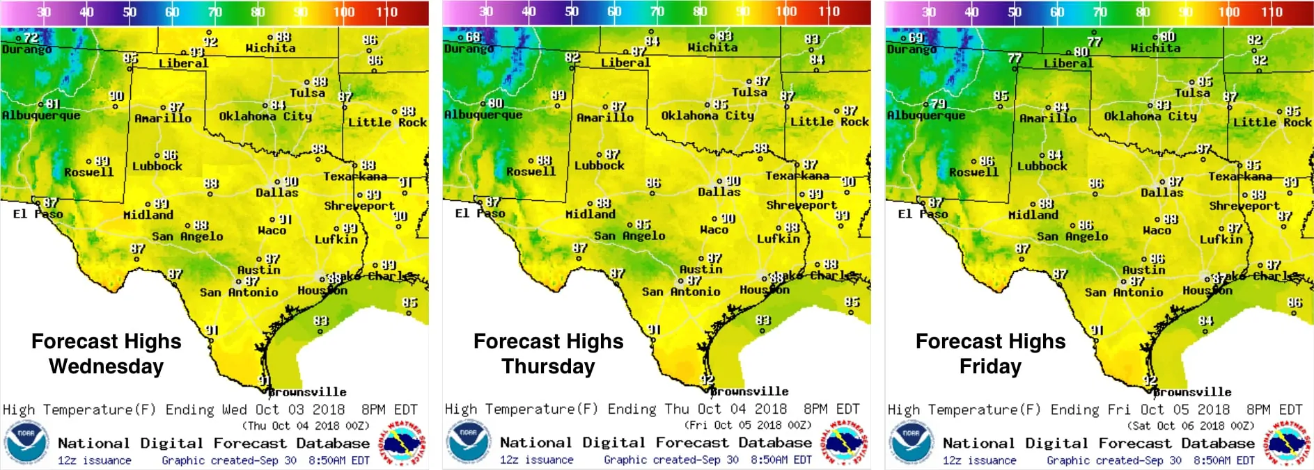
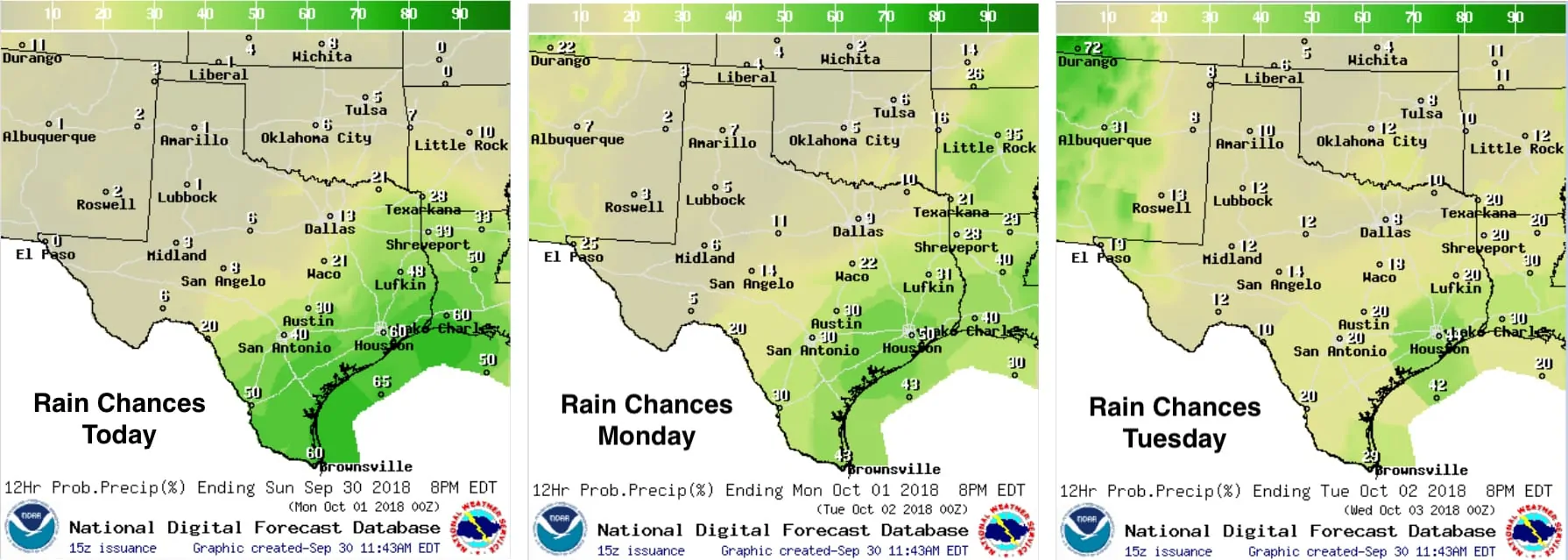
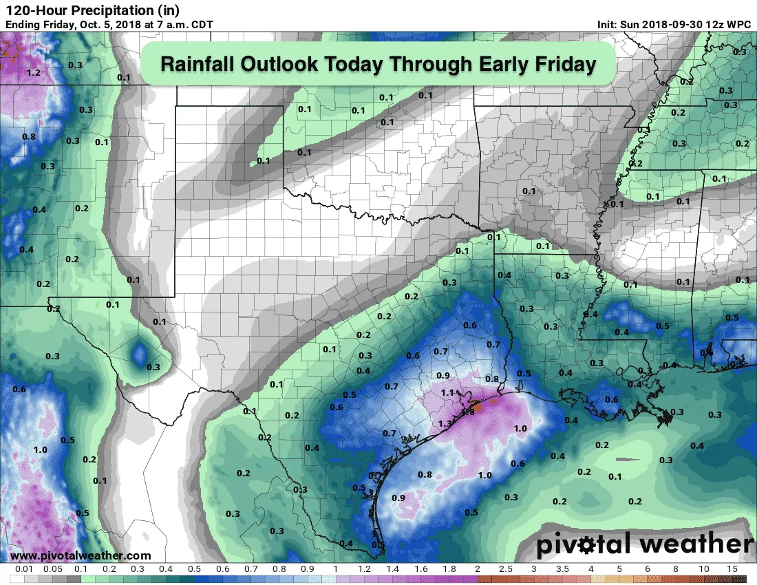
After last week’s nice early fall cold front, southerly flow this week will bring warm and sticky conditions back into the forecast. Highs will end up well above normal across the panhandle and portions of northern Texas by mid week; however, folks closer to the coast will see temps closer to average due to cloud cover and daily chances for rain and a few storms. Thankfully, no threats of excessive rainfall, so chances for widespread flooding like we saw across north Texas last week will be very low. The severe weather outlook for the work week ahead is also low with just general showers and a bit of thunder from time to time across the southern half of the state. Rain and storm chances look likely to return to parts of the Texas panhandle by next weekend, and we could see a few strong to severe storms in the region, but at this point, it’s too far out to be certain of the forecast details. We’ll keep you up to date as we get further into the week ahead. As for additional fall cold fronts…so far, not seeing hints of anything significant in the next 5-7 days. The long range forecast models are hinting at a front arriving early next week, but we’re not seeing enough run to run consistency between the two major long-rang models to place any bets just yet. This is the time of year when we begin to see these frontal passages occur more frequently, so we’ll be monitoring that as well as I’m sure many of you are ready to kick some of this heat and humidity out of here and get back to sweater weather!
Temperature Outlook for the Work Week Ahead
Current Forecast Rainfall Chances
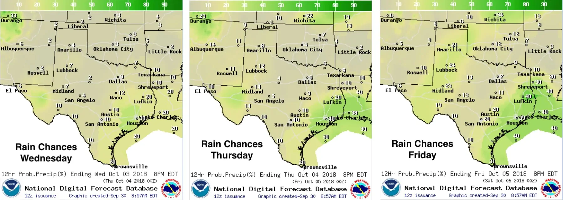
Quantitative Precipitation Outlook Through Early Friday


0 Comments