
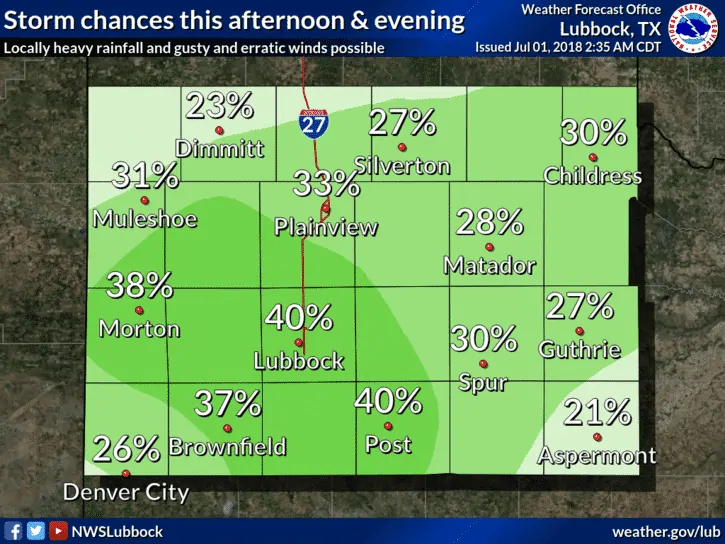
This morning, a cold front is working its way across northern Oklahoma and into the Texas panhandle region. By later this afternoon, the front is expected to stall out and be located across the southern panhandle up into parts of northwest and north Texas. With little else in the upper atmosphere to generate lift, this frontal boundary is expected to be the focus point for the development of scattered strong to severe storms later this afternoon as we reach peak daytime heating. The main threats will be damaging downburst winds, hail, frequent lightning and isolated heavy downpours. Any activity that develops is expected to quickly die out after sunset and loss of daytime heating. Highs today across the state will be quite warm with widespread readings in the upper 90s to low 100s. Thankfully, the heat index values will not soar much above the actual temperatures, but nevertheless…it’s still quite warm and anyone planning outdoor activities this afternoon will need to stay hydrated and observe all heat precautions.
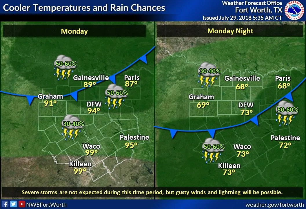
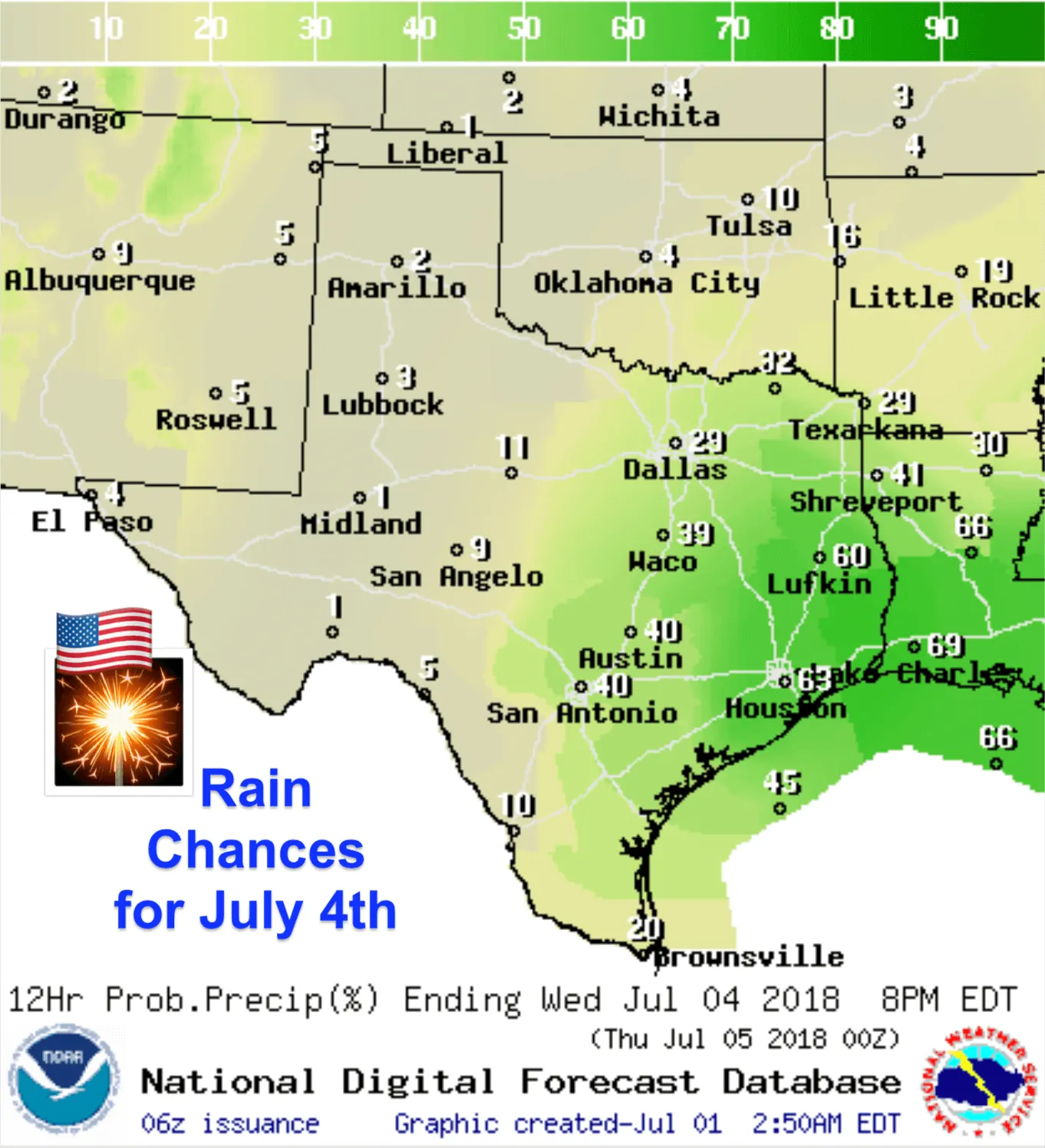
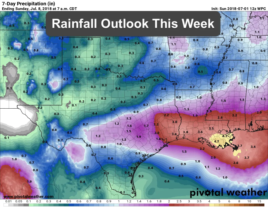
Looking ahead this week…temps will remain on the warm side Monday and Tuesday before our resident ridge of high pressure begins to shift off to the east/northeast. This will allow an area of low pressure currently located across the Florida panhandle to shift east riding the coast into Texas by Wednesday. This will be the focus for increasing rain chances by July 4th mainly for east and southeast Texas…but depending on the exact track of this low, and the strength of the upper level ridge, we could see increasing rain chances further inland across central, north central and northeast Texas. Overall though, our eastern and southeastern regions of the state will see the best chances for rainfall beginning Tuesday night and continuing through Wednesday night. Chances for rainfall may continue Thursday into Friday, but the details on those probabilities remain a bit unclear at the moment. Obviously, chances for rainfall will bring increasing cloud cover which is expected to keep our daily highs in check later this week with us possibly seeing temps drop below seasonal averages, especially across the southern half of the state where the better chances for impacts from rainfall will be located. Of course any relief from the oppressive 100 degree highs is always welcome!


0 Comments