
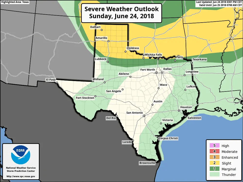
An updated severe weather outlook for the remainder of this afternoon and the evening hours.
The forecast for the potential severe weather today has not gone to plan. It would be an understatement to say that weather models have performed poorly today. A cluster of thunderstorms in northwest Oklahoma generated a fast-moving outflow boundary this morning. That boundary has now pushed west/south through much of the Texas Panhandle and Northwest Texas. That cooler and comparatively drier air has greatly reduced the severe weather threat this afternoon. Confidence is not high that discrete storms will be able to develop this afternoon in West Texas or the Panhandle. If thunderstorms do form they could still produce very large hail and locally damaging wind gusts. A brief tornado cannot be ruled out, but the tornado threat is much lower than earlier thought.
Main storm complex will stay in Oklahoma, but a few showers and storms may develop across the North Texas Red River counties through early evening. Rain chances 20-30% but gusty winds possible . #dfwwx #texomawx pic.twitter.com/vBhxPGjvOE
— NWS Fort Worth (@NWSFortWorth) June 24, 2018
We’ll also need to monitor the cluster of thunderstorms impacting southern Oklahoma. No weather model had that cluster, so confidence is low on what it’ll end up doing. Those in Texoma and Northeast Texas should keep an eye out just in case. Gusty winds may arrive well ahead of the storms – a particularly dangerous hazard to those on bodies of water.
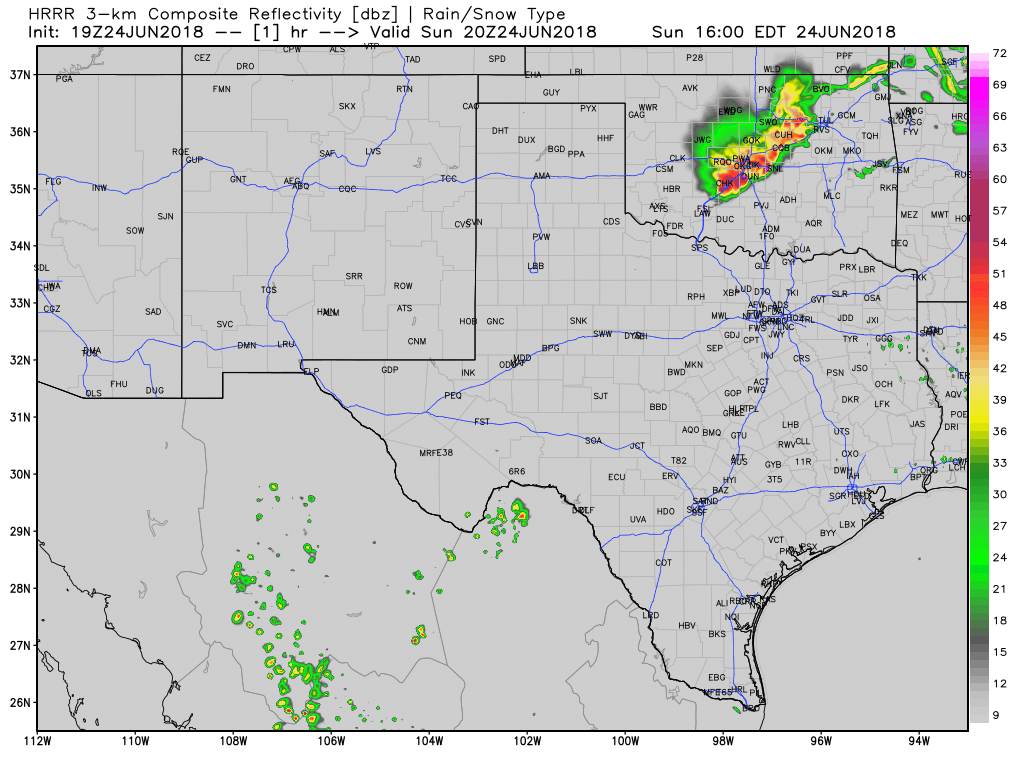
Simulated weather model radar through tonight (may not be correct)
What does seem more likely is that a cluster or line of thunderstorms will move across the Texas Panhandle tonight. That squall line may have damaging straight-line winds and even some large hail. The highest potential for large hail and potentially damaging wind gusts will be across the northern Texas Panhandle, or north of Interstate 40. Heavy rain is also expected with the chance of localized flooding. Most storms should move east out of the Texas Panhandle by 2 to 3 AM.


0 Comments