
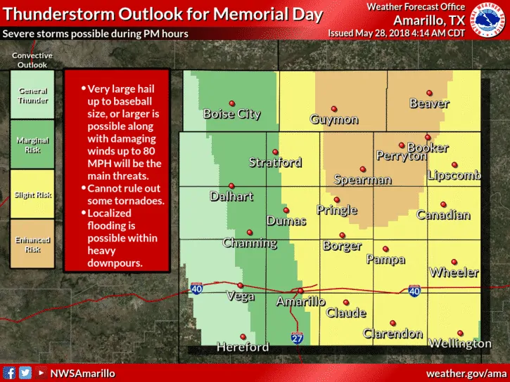
While a majority of the state will remain HOT and dry today, the panhandle region will see the threat for numerous strong to severe storms later this afternoon through the evening hours. The Storm Prediction Center has placed an Enhanced Risk (Level 3) across the far northern panhandle which includes the towns of Booker, Perryton, Spearman and Gruver. A Slight Risk (Level 2) surrounds the Enhanced Risk which includes all of the eastern panhandle down to just north of Matador, then up the I-27 corridor into Amarillo and northwards to Stratford. A Marginal Risk (Level 1) extends from the rolling plains south of Matador up through the western panhandle region. The main threats with todays storms will be large hail up to the size of baseballs and damaging winds in excess of 80mph. Storms should begin forming along the dryline near the TX/NM border by around 3pm, then advance eastward into the Slight and Enhanced risk areas by late afternoon and early evening. Storm coverage is expected to be more numerous than yesterday, so anyone with outdoor plans this afternoon across the region will need to keep an eye out. A few tornadoes are also possible, so be sure you have a way to receive weather warnings if you’re out and about.
Simulated Radar Animation for later this afternoon and evening….


0 Comments