
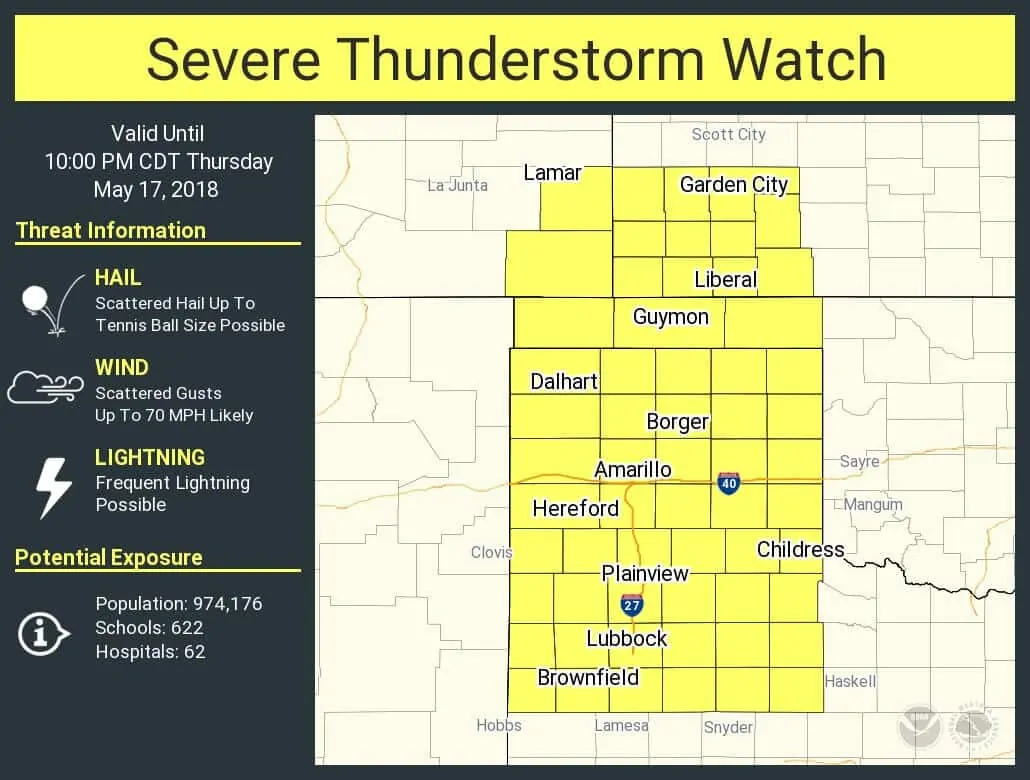
We now have a severe thunderstorm watch in effect through 10 PM across all of the Texas Panhandle and West Texas. This watch includes Dalhart, Borger, Amarillo, Hereford, Plainview, Lubbock, Brownfield, and Childress. The strongest storms will be capable of producing very large hail and wind gusts over 70 MPH. High cloud bases will keep the tornado threat very low.
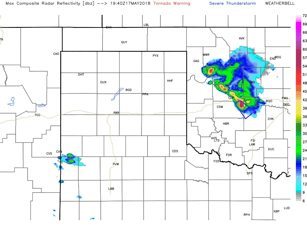
Severe thunderstorms have erupted west of Interstate 27 from near Lubbock to near Dimmitt. These storms are moving east/northeast and quickly intensifying. Additional storms are forming farther north from Interstate 40 to the west of Dumas. Most of this activity will continue to intensify over the next hour. The strongest storms may produce damaging hail up to the size of tennis-balls and localized wind gusts over 70 MPH. Blowing dust can be expected in the proximity of the storms.
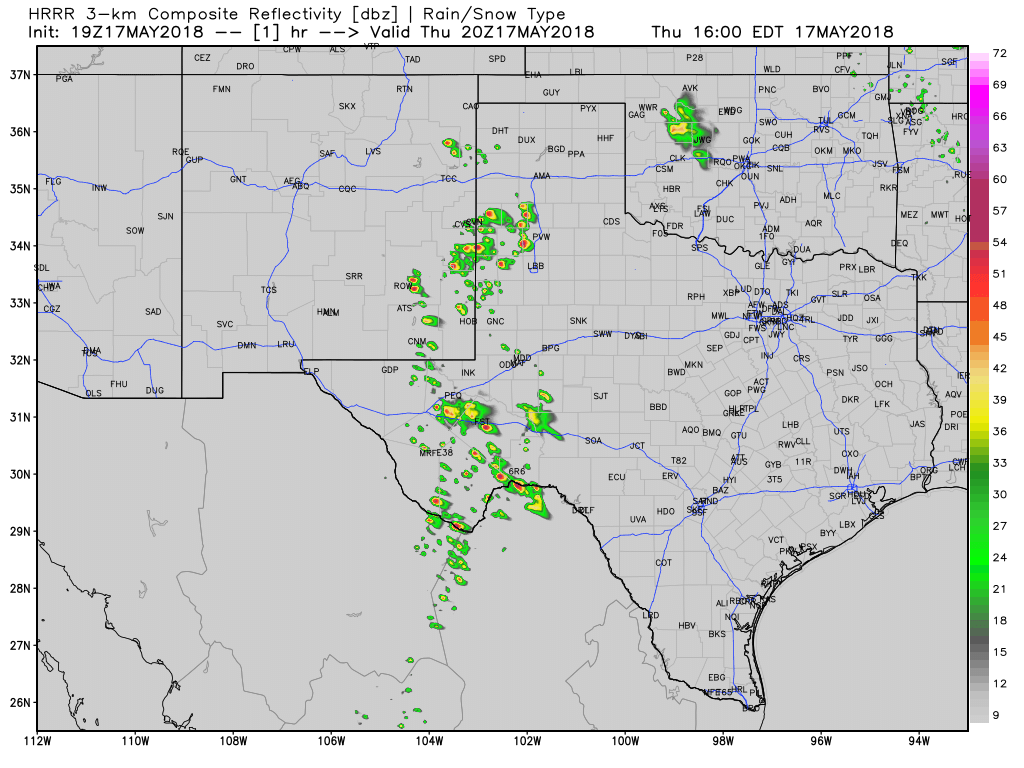
Simulated model radar through the overnight hours.
The semi-discrete storms will grow upscale into a line of storms by 6 PM. These storms will move east and eventually may begin to propagate more southeasterly. Once storms grow upscale into a squall line or cluster they may begin to have a more prominent damaging wind threat. This cluster of storms will move toward western Oklahoma, Northwest Texas, and even the Big Country. By 9-10 PM the cluster of thunderstorms should begin weakening. They may continue to produce strong winds and heavy rainfall as they push east.


0 Comments