
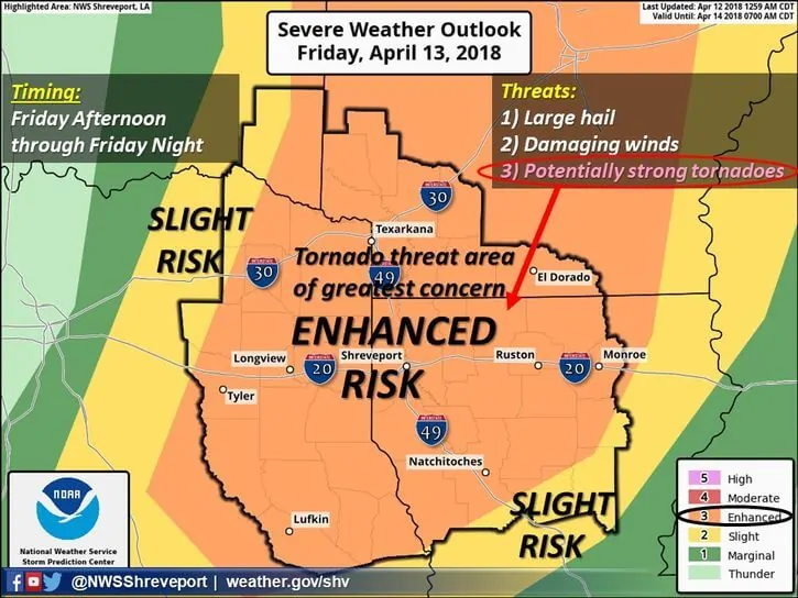
Severe weather threats return for areas along and east of the I-35 corridor Friday afternoon and evening. While exact location of storm initiation on Friday is still a bit uncertain, and will depend on how far east the dryline travels by early afternoon, we are expecting to see rapid and fairly widespread development of strong to severe storms across the eastern portions of north central Texas, northeast Texas and eastern Texas during the afternoon and evening hours on Friday. These storms will have the potential for very large hail, damaging winds and perhaps a few strong tornadoes given the atmospheric dynamics that will be in place across the region on Friday. While we cannot pinpoint exactly where the worst of the storms will develop, the most likely areas for more significant storms have been placed within an Enhanced Risk zone on Friday.
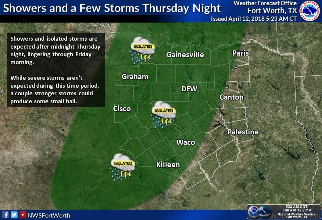
As it stands now, we’ll likely be looking at two rounds of storms beginning late Thursday and into Friday. Scattered rain and storms are forecast to develop Thursday evening and overnight across portions of central and north central Texas. A few may become strong with small hail and some gusty winds…mainly across areas north of I-20. These will continue to develop and move east during the morning hours on Friday…becoming stronger during the late morning to early afternoon hours as they encounter air with higher moisture content east of the I-35 corridor into parts of northeast and east Texas. Depending on how much the early day storms overturn the atmosphere, a second round is likely to develop by late afternoon along the dryline as it surges east to the I-35 corridor. How far east it surges will determine where the western extend of storm development will be on Friday afternoon. Should the first batch of storms move east quickly enough to allow ample time for the atmosphere to destabilize, we’ll likely see rapid development of a line of storms along the dryline by late afternoon or early evening across the eastern half of the DFW metroplex and to the northeast towards the Red River. Again, large hail and damaging winds are the main threats, but a tornado or two cannot be ruled out…especially with any isolated supercell development for areas east of the DFW metro into northeast and eastern Texas during the mid to late afternoon hours. A strong cold front will arrive behind the line of storms late Friday and once that arrives, the severe weather threats will come to an end.
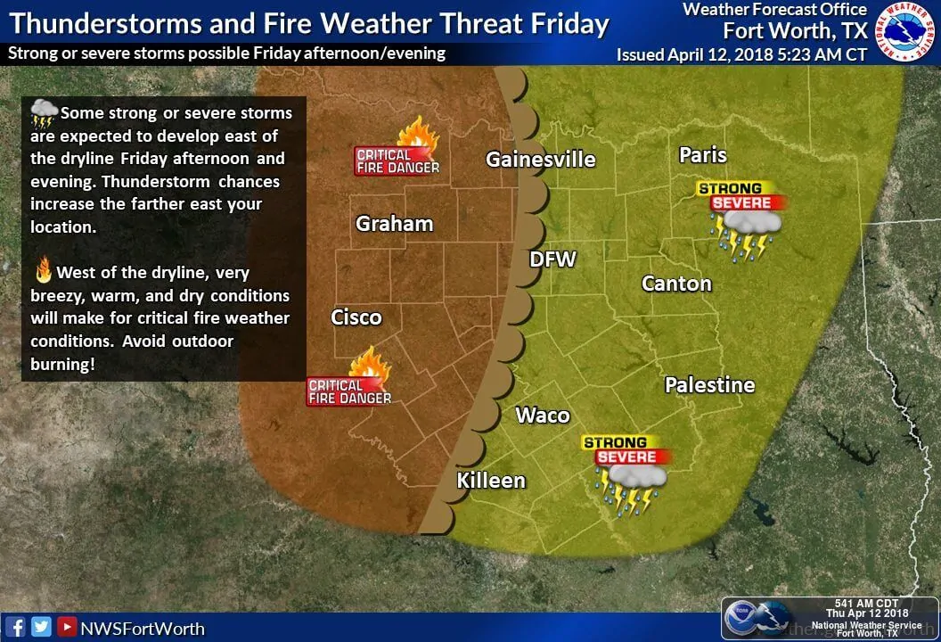
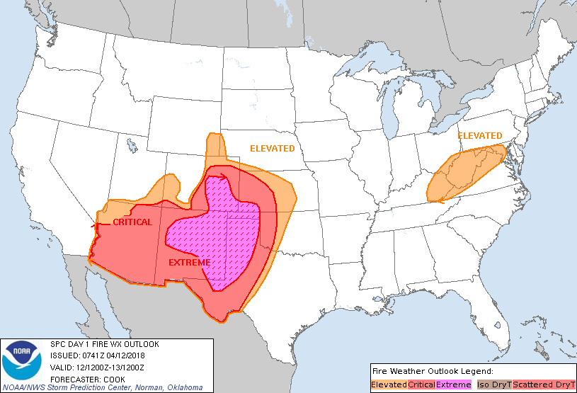
Behind the dryline on Friday, winds will be howling from the west and we’ll have the threat for explosive wildfire development. Critical to Extreme wildfire conditions will be present across the panhandle and western Texas both today and through Friday both ahead of and behind a strong Pacific cold front which will move across the region. The wildfire threat today and tomorrow is one of the worst seen across this region in quite some time. Needless to say, everyone across the western half of the state including the panhandle region will need to be on high alert and use extreme caution with any activity that could spark a fire. In fact, don’t even think the word fire or one might erupt.


0 Comments