An active and busy weather period is expected through Thursday. Severe weather and heavy rainfall will both be the expectant hazards. This setup is not one that favors an outbreak of tornadoes. Heavy rainfall and resultant flooding will become increasingly likely on Tuesday and Wednesday in Northeast Texas. All this ‘fun’ is thanks to a slow-moving upper-level storm system to our west and a stalled cold front at the surface.
Severe Weather Potential
The next three days will each have severe weather potential in Texas. Localized damaging wind gusts and hail up to the size of golfballs look to be the primary threats. An isolated tornado can’t be ruled out. Storms mode will tend to be messy and linear on Tuesday and Wednesday. A linear storm mode favors a wind/hail threat versus more of a tornado one.
Today (Monday, March 26)
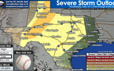
We’ve got the standard level two risk of severe weather across Northwest Texas, western North Texas, into the Big Country and northern Concho Valley.
A marginal level one risk encompasses the remainder of the Concho Valley, south through the Edwards Plateau, and about 50 miles east of the level two risk in North Texas.
These outlooks are primarily probability driven. A level two risk has a 15% chance of severe weather within 25 miles of a given point. A level one risk has a 5% chance of severe weather within 25 miles of a given point.
Severe weather is defined as a tornado, large hail, and/or winds in excess of 58 MPH.
Thunderstorm coverage will be higher today than the two storms we had yesterday around Wichita Falls. We could see several rounds of thunderstorms.

Simulated Radar from the 2 AM CT run of the High Resolution Rapid Refresh. This is just a model simulation. Times are in eastern (so subtract an hour).
The high-resolution rapid refresh model shows the first round of storms firing up around noon in the Big Country. Those would move northeast into Northwest Texas and Oklahoma. Should we actually see storms that early they might have some gusty winds and hail. Not all models show this first round, so we’ll have to see if it actually materializes.
By the late afternoon, we should see additional storms firing up just east of the dryline. These storms will tend to be scattered. A few storms may be supercelluar in nature with a threat of large hail and localized damaging winds. An isolated tornado cannot be ruled out.
By early evening we should see a more linear storm mode develop as storms move east/northeast. Large hail and damaging winds would remain possible through the night-time hours.
Observational data later this morning will give us a better idea of how today will evolve. The storm(s) last night along the Red River probably left a few outflow boundaries. These boundaries could become focal points for storm development today in western North Texas.
Tuesday, March 27
A slow-moving cold front will continue progressing south on Tuesday. The highest potential for thunderstorms will be near and north of this front. An unstable airmass will allow for a few stronger storms.
Those stronger storms may produce hail up to the size of ping-pong balls and localized damaging winds. This setup would not favor a tornado threat.
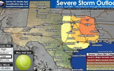
The standard level two risk includes the Edwards Plateau, Concho Valley, Central Texas, and Northeast Texas. A level one risk surrounds it. Today’s storms may impact tomorrow’s setup, so we’ll have to refine the outlook as confidence in one particular solution increases.
Wednesday, March 28
A couple stronger storms may occur on Wednesday. Like tomorrow the highest storm chances look to be with the cold front. Spotty hail and localized damaging wind gusts could occur.
We’ll refine this forecast as we get through the next two days. It may be that we transition to a heavy rain versus severe storm threat by this time-frame.
Heavy Rainfall
Widespread rainfall is expected across the eastern half of Texas in the coming days. Some folks really need that rain. Others are going to get a bit too much. Unfourtinietly the Texas Panhandle looks to miss out on it (again).
However – we note that Northwest Texas, the Big Country, the Concho Valley, the Permian Basin and West Texas all should receive some. Some rain is better than no rain.
Three to five inches of rain is expected to fall by Thursday in Northeast Texas and in the piney woods of East Texas. Localized flash flooding is possible. Another round of rises on rivers and lakes is a good bet. Don’t be surprised if flood watches are issued at some point.


0 Comments