
A new day and the same story. The roller-coaster weather continues. Instead of the typical ‘temperature’ roller coaster, we’re talking about the wildfire danger one. We had a few days of more marginal fire weather conditions – although that was offset by the ongoing drought. Now we’re heading back up on the danger scale as warm temperatures combine with stronger winds and even lower humidity values. If that wasn’t enough we even have the potential for dry thunderstorms this afternoon! A dry thunderstorm is one that produces lightning but little in the way of rainfall. Unfourtinietly any rain that falls from isolated storms today will evaporate before reaching the ground. Lightning doesn’t have that problem and is a major threat to emergency responders.
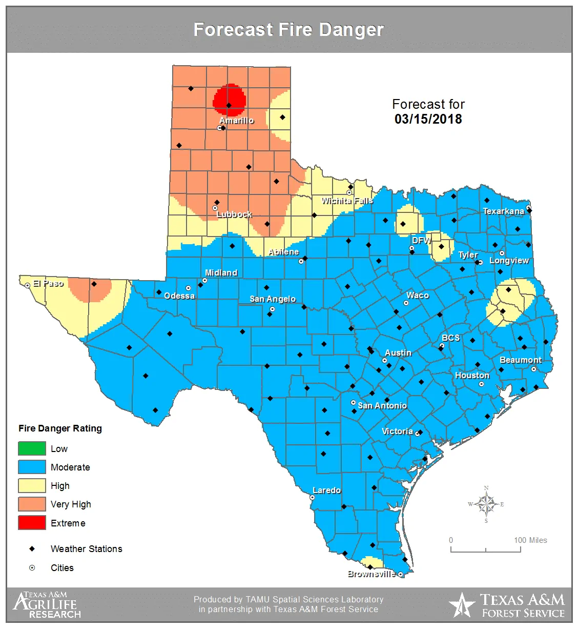
The Texas A&M Forest Service has placed all of the Texas Panhandle and West Texas in a ‘very high’ to ‘extreme’ fire danger rating today. We note that the remainder of Texas is in a ‘moderate’ to ‘high’ fire rating. This scale is useful in determining the potential of any wildfire to become large and destructive. In case you’re wondering – it isn’t good when any one location is in the highest risk category.
Humidity values will plummet into the teens this afternoon across the Texas Panhandle and West Texas. Slightly higher, but still low humidity values in the 15-25% range are expected in the Permian Basin, Trans-Pecos, into the Borderland. West/southwesterly surface winds gusting up to 45 MPH will be co-located with these low humidity values. Localized wind gusts over 50 MPH are possible, especially in the mountains in the Trans-Pecos. Blowing dust and reduced visibilities can be expected.
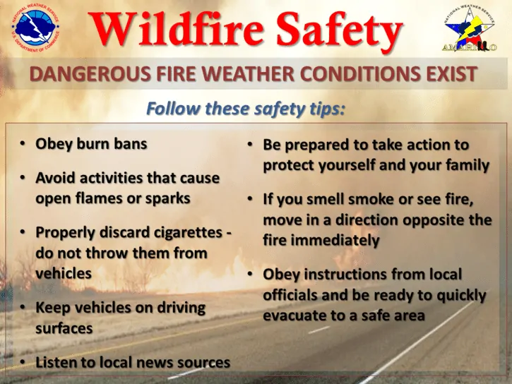
I know we sound like a broken record, but today’s fire danger really could lead to nasty situations in the Texas Panhandle and West Texas. The higher wind gusts lead to an increased chance of a sparking/arcing power line. Isolated dry thunderstorms mean potential lightning – which will surely ignite new grass fires. Given humidity values in the single digit to teens, winds up to 45 MPH, and a record dry-spell any fire that develops has a significant chance of becoming “the big one”. We’re talking fire speeds in the miles per hour – faster than most folks can run. If you have a fire develop in your area you need to be ready to evacuate. A direct attack on the head of the fire will be impossible until weather conditions slowly improve tonight.
Critical to extreme wildfire danger will develop again on Friday. Regions at the highest risk include the Texas Panhandle, West Texas, and Northwest Texas. Very high to near-critical fire danger is expected to include the northwestern half of Texas – including the Borderland, Permian Basin, Big Country, Concho Valley, and North Texas (including the D/FW Metroplex). This could be a busier/higher-end fire day.


0 Comments