
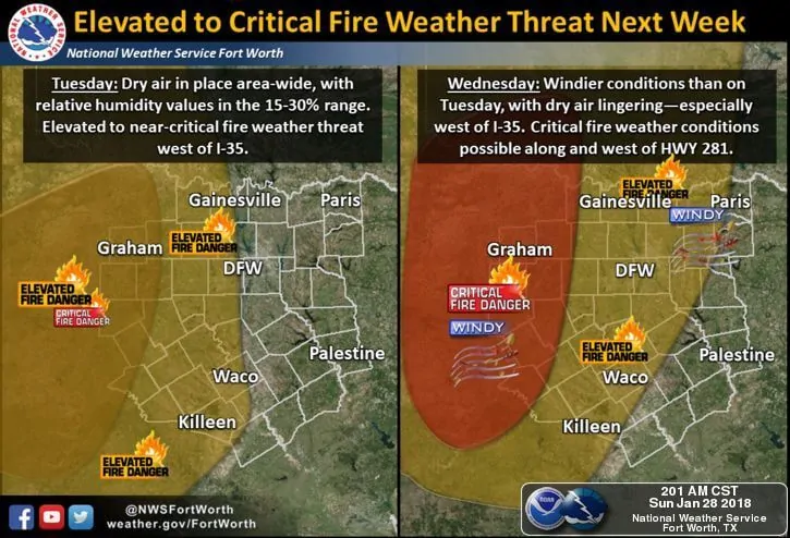
With few chances for rain this week, and pretty much zero chances for rain across the western half of the state, the threat for grassfires will continue this week. The greatest threat today will be across the eastern panhandle down into western north Texas where Fire Weather Watches will remain in place until 7pm this evening. Dewpoints are already down into the low teens to single digits across this part of the state which means really dry air and low humidity values are already in place. That combined with plenty of dried vegetation and winds picking up a bit this afternoon will mean any grass fire that manages to ignite will have the potential to spread quickly. Increased fire weather danger is expected again Tuesday and Wednesday as temps warm well above normal across the western half of the state and surface winds pick up in advance of our next cold front expected to arrive late Thursday into Friday. A friend who lives out in the panhandle mentioned the other day that merely shuffling across the carpet in socks would be enough to start a fire, so please continue to avoid any activities that could spark a fire.
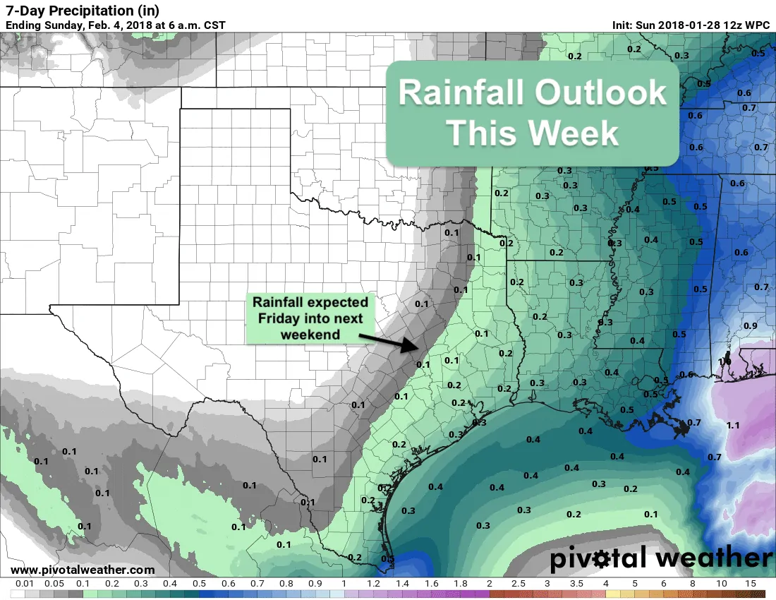
A secondary push of cold air will arrive late tonight into tomorrow merely reinforcing the front which arrived yesterday. Tomorrow’s highs will be relatively close to seasonal averages and overnight lows will be quite chilly tonight and tomorrow night across the state, but we’ll be warming up rather quickly on Tuesday and Wednesday ahead of our next cold front. The latest run of forecast models has slowed this next front down a bit and is now bringing it through late Thursday into Friday. The models are also backing off a bit on the strength of this front, but the northern half of the state will feel a bit of a chill on Friday. The longer range models are also hinting at a much stronger front plowing through the state Sunday into Monday of next week, so we’ll continue to monitor that trend this week and let the forecast refine itself before we get into too much detail. Rain chances overall look slim to none for most of the state until we get into the latter part of the work week. Friday into Saturday look to be the best days for seeing rainfall…but it will be scant at best and located mainly across our eastern and coastal counties. Conditions…unfortunately…will remain dry as a popcorn fart across the panhandle and western Texas.


0 Comments