
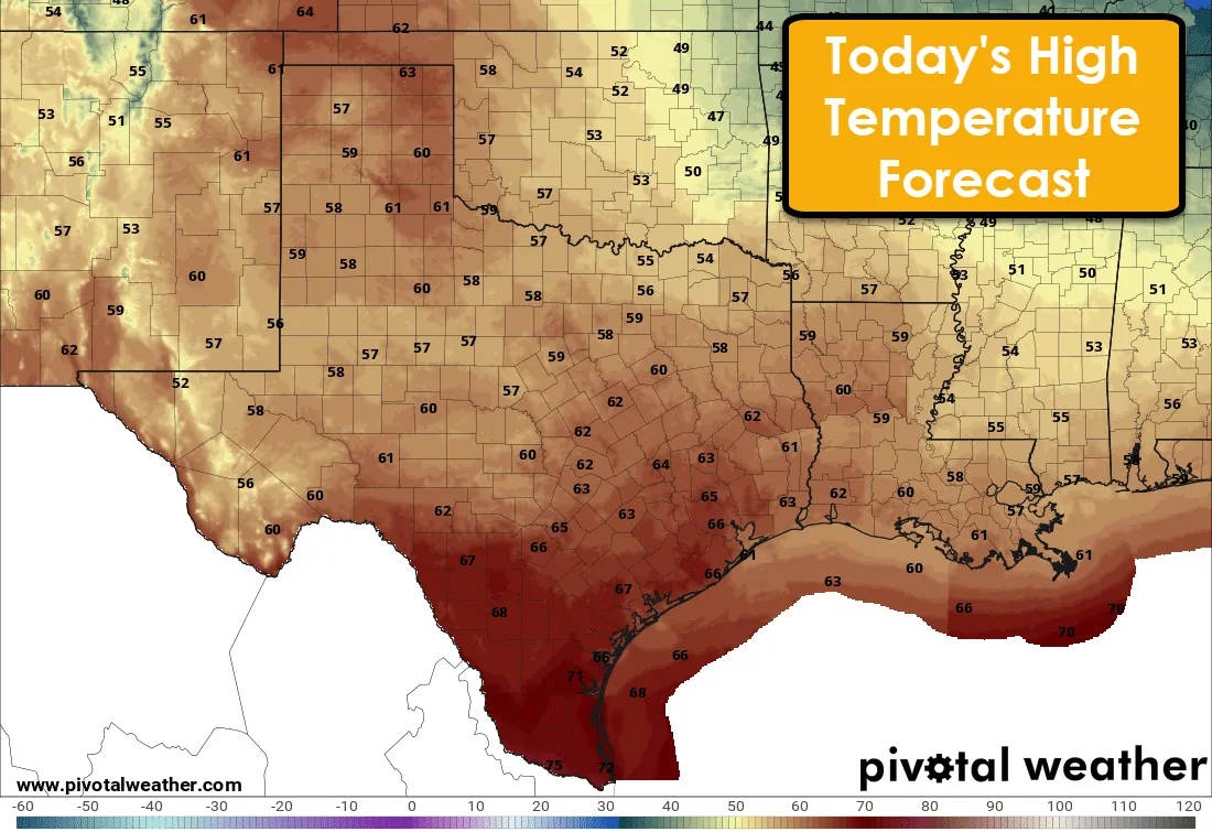
A relatively straight-forward forecast is indicated for the remainder of the work week. We’ll experience a couple temperature swings as cool fronts move through every couple of days. We had a front move through yesterday which will result in cooler conditions today. A sharp rebound in temperatures is anticipated tomorrow before a second front arrives tomorrow/tomorrow night. We’ll see cooler conditions again on Thursday before another rebound on Friday and Saturday. Precipitation chances may increase by Sunday across portions of East Texas and Southeast Texas, but weather model inconsistencies remain high in that time-frame. Throughout the work-week, we’ll see cool overnight low temperatures. The dry airmass in place will allow temperatures to fall off fairly quickly after sunset.
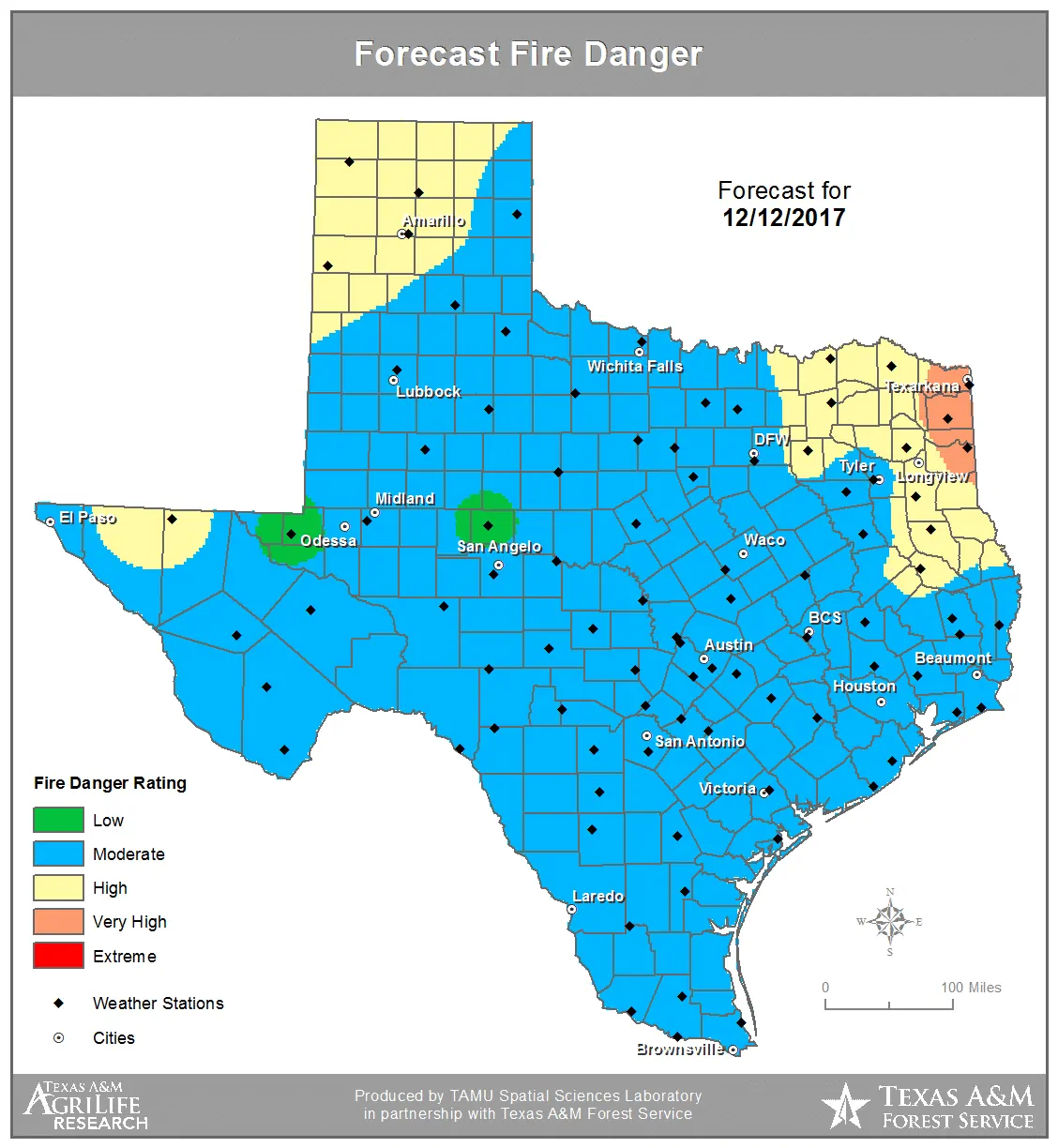
Of primary concern with this forecast will continue to be several episodes of elevated to near-critical fire weather conditions this week. A noticeable uptick in reported fires was noted in North Texas on Monday thanks to gusty southwest winds and relative humidity values in the teens. We’ll see a respite in those fire weather concerns today across the northern half of Texas thanks to cooler temperatures and higher relative humidity values compared to yesterday. Increased fire behavior remains possible due to very dry fuels indicated by near-record high-ERC (Energy Release Component) values. That just means and fire that gets going could move in a hurry – even on more modest risk days.
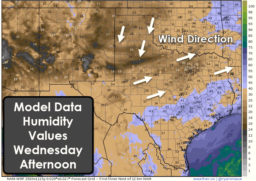
Temperatures soar back into the 70s on Wednesday ahead of our next surface cool front. Similar to Monday we’ll see humidity values plummet into the teens and twenties by the late morning and early afternoon hours. Gusty north/northeast winds up to 25 MPH in the Texas Panhandle are anticipated (north of the front) with gusty west/southwest winds south of the front across Northwest Texas, the Big Country, North Texas, and Northeast Texas. Combined with very dry fuels the risk for wildfires will be elevated to near-critical. An increased risk for fast-moving/larger wildfires will be a possibility. Emphasis needs to be placed on using common-sense when utilizing outdoor equipment/tools that could cause a spark. Call local authorities immediately if you sight a grass fire.
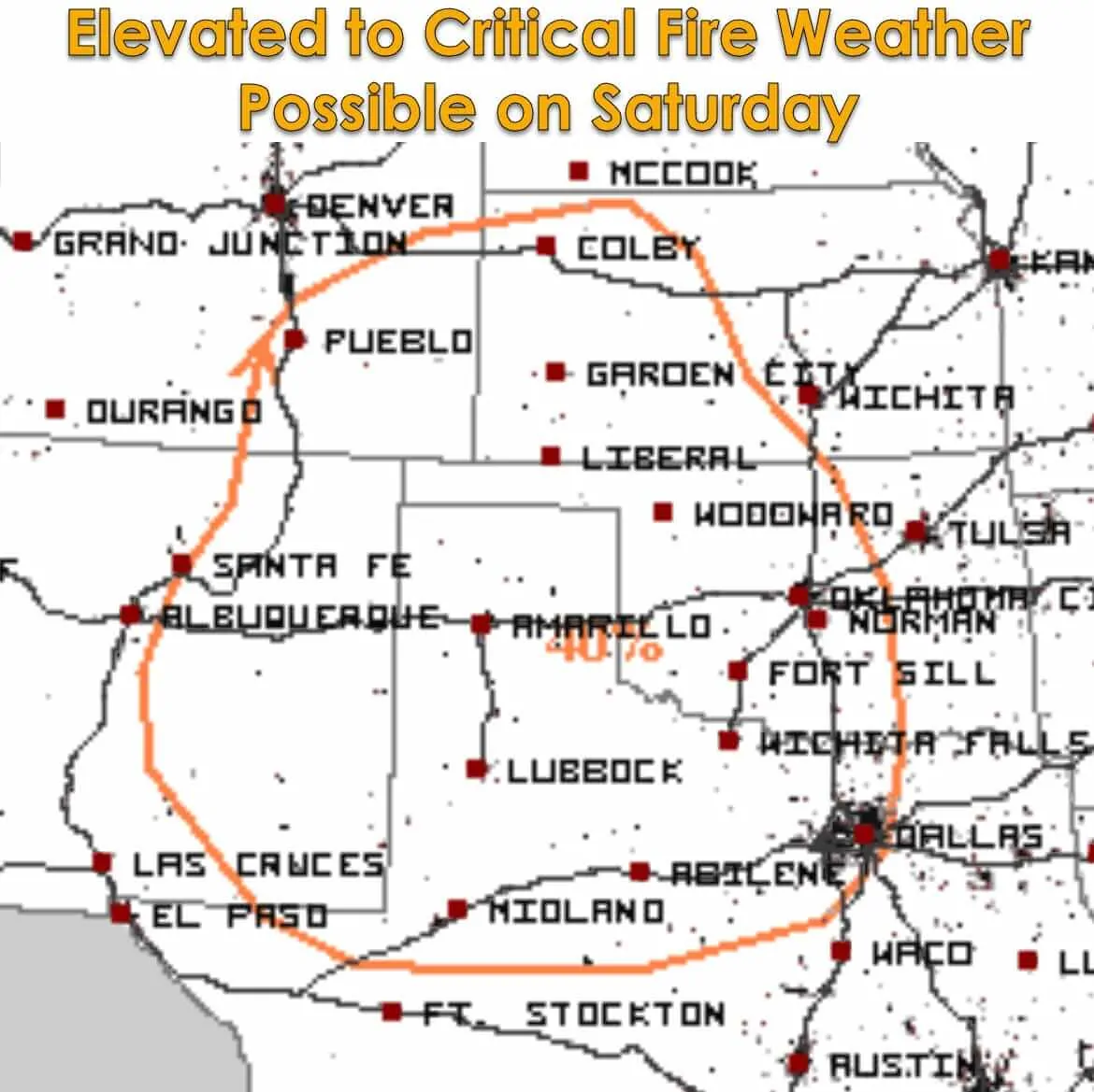
Thursday will be another ‘down’ day with cooler temperatures and more modest fire weather concerns, but like today the cooler weather will be short-lived. Friday will feature an elevated fire weather risk in the Texas Panhandle into West Texas. Saturday has the potential to be an active fire-weather day across the northern half of Texas as an upper-level storm system helps bring more dynamics into play. Warm temperatures, dry conditions, and increasing wind may promote critical fire weather conditions. We’ll have to keep close tabs on Saturday’s fire weather setup. Amarillo has now gone just about two months without measurable rainfall. Grasses are comparable to a tinderbox.


0 Comments