
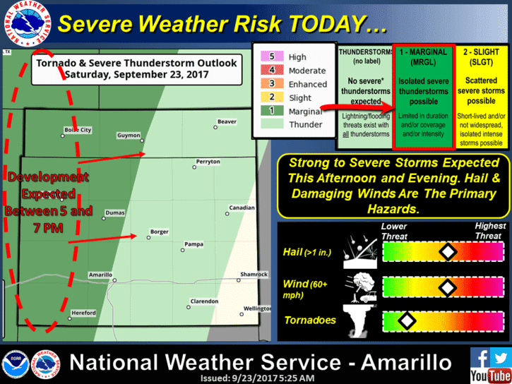
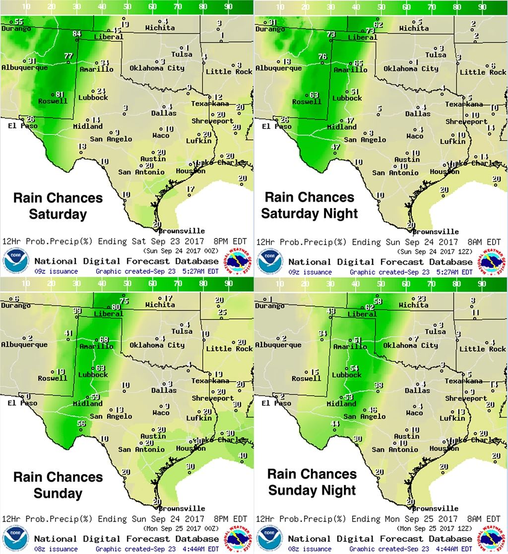
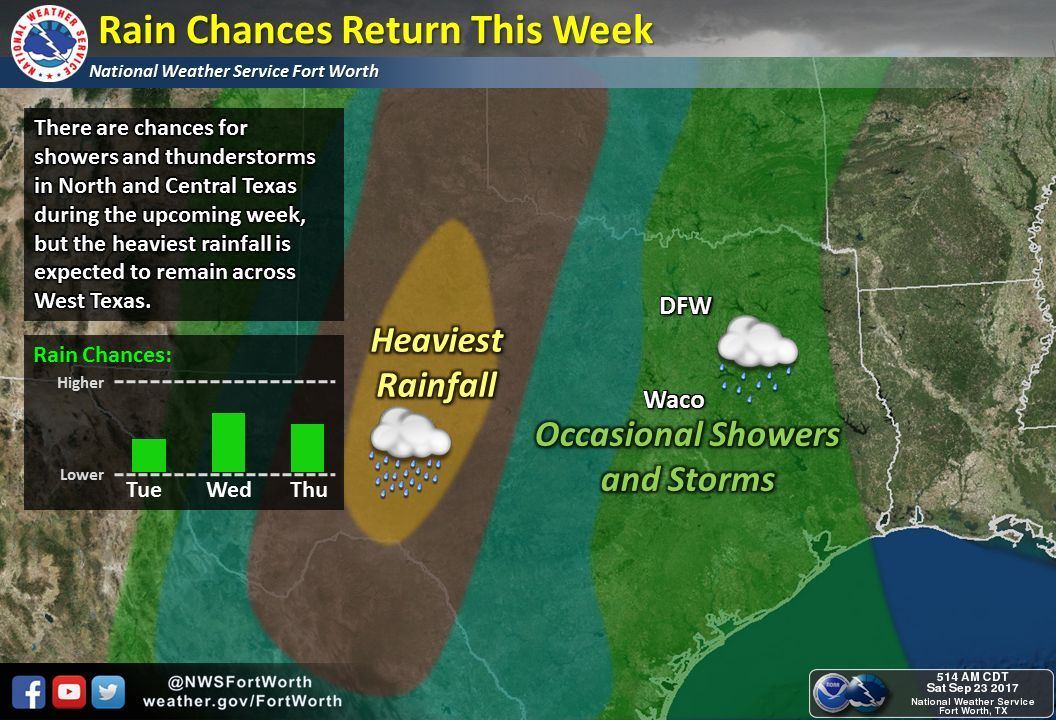
The forecast highlights this weekend will be increasing chances for heavy rainfall across the western half of the state, and for next week, the arrival of a nice fall cold front during the middle of the week with rain chances spreading further east. The heaviest rainfall over the next several days is expected across much of the panhandle region down into the permian basin region. The upper level system to our west generating these chances for rain will be slow to move east this week which will mean the western half of the state can expect an extended period of rainfall through at least Monday evening…possibly Tuesday depending on the speed of the cold front. Flash flooding will become a concern especially late tonight and through early Monday with widespread 1-3 inch rainfall totals likely along with pockets of higher 3-5 inch rainfall totals possible. A Marginal Risk (Level 1) for a few severe storms is in place for parts of the northern and western panhandle region later this afternoon. Quarter size hail and damaging winds will be the primary threats within the strongest storms that develop.
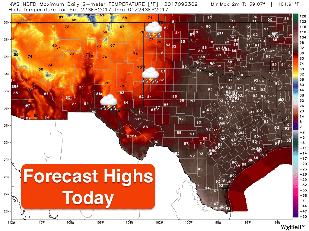
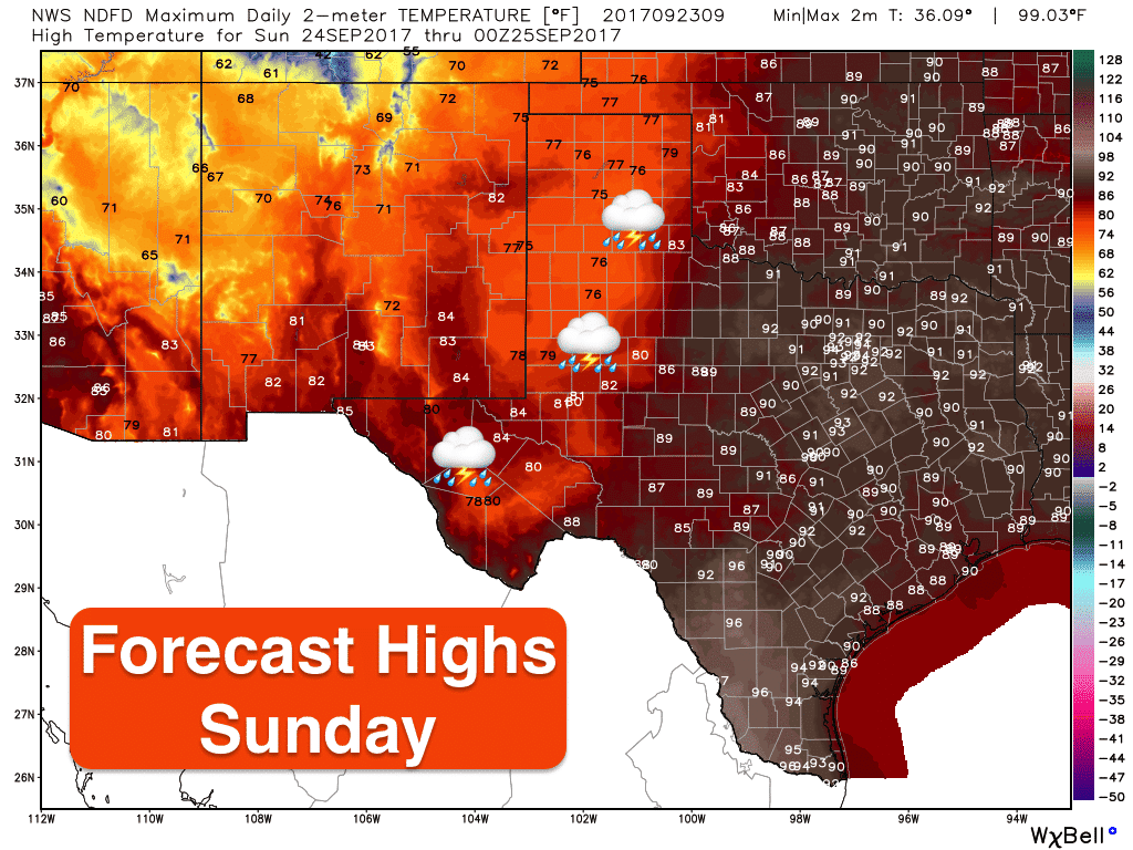
Forecast highs today and tomorrow…cooler across the panhandle and western Texas regions due to cloud cover and rain chances…but still above seasonal averages across the remainder of the state. A slow moving cold front will move into the panhandle region on Monday, but will take several days to finally move through the entire state. Current forecast models have it exiting the panhandle region by early Monday, moving into northern Texas by Wednesday, then clearing the coast by late Friday. Like we said…it will be a slow-mover and stall out a bit before it finally gets a push south by mid-week. Rain chances will begin to shift east during the week along and head of the front bringing scattered showers to parts of north, central, southwest and coastal regions of the state, but these areas are not expected to see nearly the amount of rainfall the western half of the state will experience over the next several days. Once the front moves through each region of the state, we’ll see conditions begin to dry out and become much less humid and more “fall-like” for the remainder of the week! Hang in there just a few more days!


0 Comments