
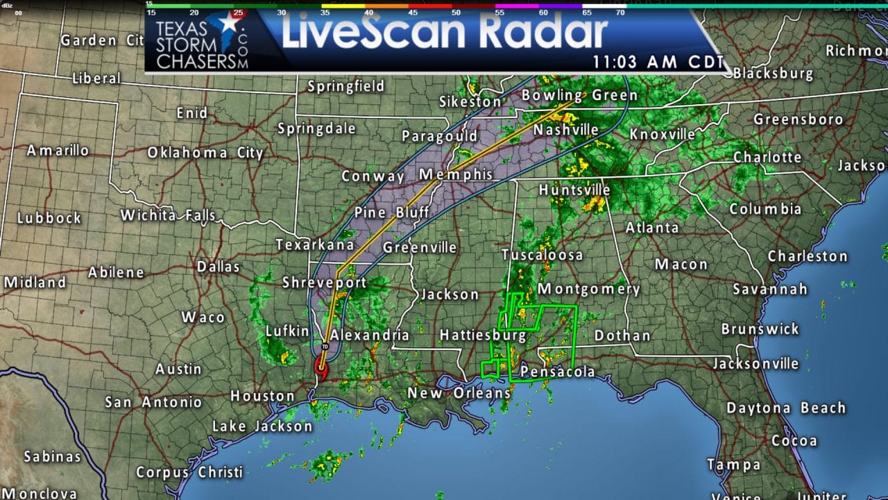
Tropical Storm Cindy made landfall early this morning near the Texas and Lousiana state lines. It has since moved north and weakened into a tropical depression. As expected there really isn’t much rain west of the circulation center with the heaviest activity located several hundred miles east of Mississippi and Alabama. Scattered showers will remain possible through the afternoon across East Texas. Cindy will turn northeast this evening and will be located near Memphis by Friday morning. Rain chances will decrease this evening across East and Northeast Texas and should be mainly out of the picture by Friday morning. However; scattered storms will return to the forecast by Saturday across a majority of Texas as a weak cool front moves south. This weekend’s activity will not be associated with a tropical cyclone. An additional one to three inches of rain may fall in parts of East Texas through the evening, but that is probably going to be a stretch. Localized flooding can’t be ruled out, but I think that threat has become fairly low as the heaviest activity is located well east of Cindy’s center. Rough surf and dangerous swimming conditions will continue into Friday across a majority of the Gulf Coast. The risk of rip currents is high! Try and keep your children and less-experienced swimmers in knee-high water or less to reduce the risk of any issues.
Tropical Depression Cindy Advisory Number 12
NWS National Hurricane Center Miami FL AL032017
1000 AM CDT Thu Jun 22 2017
…CINDY WEAKENS BUT HEAVY RAINS CONTINUE…
SUMMARY OF 1000 AM CDT…1500 UTC…INFORMATION
———————————————–
LOCATION…31.0N 93.5W
ABOUT 165 MI…265 KM NW OF MORGAN CITY LOUISIANA
MAXIMUM SUSTAINED WINDS…35 MPH…55 KM/H
PRESENT MOVEMENT…N OR 10 DEGREES AT 13 MPH…20 KM/H
MINIMUM CENTRAL PRESSURE…997 MB…29.44 INCHES
WATCHES AND WARNINGS
——————–
CHANGES WITH THIS ADVISORY:
The Tropical Storm Warning from High Island Texas to Morgan City
Louisiana has been discontinued.
SUMMARY OF WATCHES AND WARNINGS IN EFFECT:
There are no coastal watches of warnings in effect.
For storm information specific to your area, including possible
inland watches and warnings, please monitor products issued by your
local National Weather Service forecast office.
DISCUSSION AND 48-HOUR OUTLOOK
——————————
At 1000 AM CDT (1500 UTC), the center of Tropical Depression Cindy
was located near latitude 31.0 North, longitude 93.5 West. The
depression is moving toward the north near 13 mph (20 km/h), and a
turn toward the north-northeast is expected later today, followed by
a turn toward the northeast on Friday. On the forecast track, Cindy
or its remnants will move into southeastern Arkansas early Friday,
and into Tennessee later on Friday.
Maximum sustained winds are near 35 mph (55 km/h) with higher gusts.
Additional weakening is forecast and the depression is expected to
become a remnant low by Friday if not sooner.
The estimated minimum central pressure is 997 mb (29.44 inches).
HAZARDS AFFECTING LAND
———————-
RAINFALL: Cindy is expected to produce rain accumulations of 3 to 6
inches with isolated maximum amounts up to 8 inches over extreme
eastern Texas, Louisiana, and southern and eastern Arkansas
through Friday morning. Additional rainfall amounts of 2 to 4
inches with isolated maximum amounts of 8 inches over southern
Mississippi, southern and central Alabama, and extreme western
Florida Panhandle are expected through Friday morning. This may
bring storm total rainfall in excess of 15 inches in some isolated
locations. This rainfall could cause life-threatening flash flooding
in these areas.
Heavy rainfall will expand across the Tennessee and Ohio valleys
today and across the central Appalachians Friday into Saturday.
Rainfall amounts of 2 to 4 inches with isolated maximum amounts of
6 inches are expected through Friday morning.
WIND: Gusts of tropical storm force in a few squalls are still
possible mainly to the east of the depression.
STORM SURGE: Inundation of 1 to 3 feet above ground level is still
possible along the northern Gulf of Mexico coast in areas of strong
onshore winds.
TORNADOES: A few tornadoes are possible through tonight from the
lower Mississippi and Tennessee Valley regions to the central Gulf
Coast.


0 Comments