
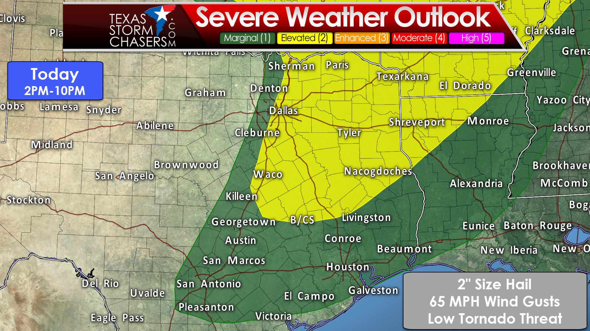
The Storm Prediction Center has placed a “slight/elevated” level 2 risk of severe weather across the eastern half of North Texas, Northeast Texas, East Texas, and teh northern portions of the Brazos Valley for this afternoon and evening. A “marginal” level 1 risk includes Central Texas east through Southeast Texas. Sherman, Dallas, Waco, Bryan/College Station, Nacogdoches, Tyler, Mount Pleasant, Paris, and Texarkana are a few towns in the level 2 risk. This setup is not one where we expect a significant threat for tornadoes. Low-level wind shear is weak and should remain that way most of the day. What we do have plenty of is moisture and instability. That means once storms get going we may see them start throwing out some pretty big hail stones. We’re going to say the strongest storms may produce hail up around 2 inches in diameter. If we get more intense supercells that hail size may be conservative. Localized damaging wind gusts are possible as well. As mentioned previously the tornado threat today is low, but not zero. Any storm that interacts with an outflow boundary may have a slightly higher threat of producing a tornado. The main threat with the strongest storms today will be large hail.
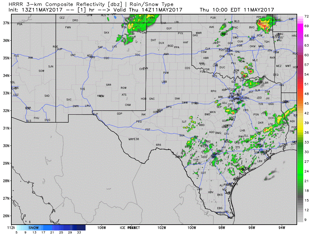
HRRR Simulated Model Radar through this evening
Thunderstorm development will likely begin to occur around 2-3PM along a dryline in North Texas. This dryline will likely be located near Interstate 45, so the western half of the D/FW metroplex will likely remain dry. That might change if the dryline slows down in the coming hours, so we’ll have to watch it closely. Storms that fire up will probably become severe rather quickly with a threat of large hail. They’ll move east and impact portions of Northeast Texas and East Texas. Additional development into eastern Central Texas and the northern Brazos Valley is possible this afternoon as well. We may see numerous storms across Northeast Texas and East Texas by late afternoon and early evening. By tonight a cold front will move south out of Oklahoma. A few storms may fire up on the cold front as it moves south, but the threat for severe weather will be lower than this afternoon. When it comes to thunderstorms expect the unexpected. Be sure to keep an eye to the sky today and have a way to receive weather warnings. We’ve got a few app suggestions and ideas over on our severe weather safety page.


0 Comments