
A new severe thunderstorm watch has been issued and is in effect until midnight. This watch includes all of Southeast Texas, the Brazos Valley, and portions of East Texas. Lufkin, Bryan/College Station, La Grange, Conroe, Houston, and Beaumont are included in this watch. A cold front with an associated line of thunderstorms is moving south. This line will continue to move south this evening across the watch area. Not everyone will experience severe thunderstorms, but some of the storms will likely produce large hail and locally damaging wind gusts. The tornado threat is low, but not zero. Localized flooding is also a threat as storms have been producing heavy rainfall. In addition, some locations in far Southeast Texas received several inches of rain this morning.
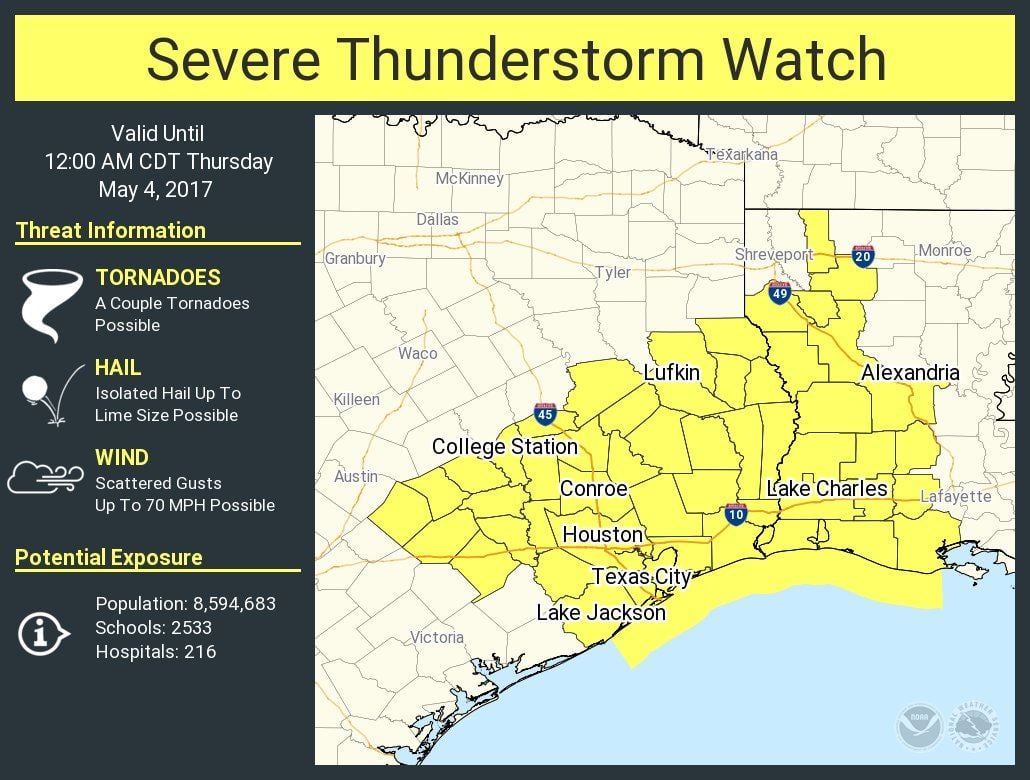
Severe Thunderstorm Watch Number 192
NWS Storm Prediction Center Norman OK
500 PM CDT Wed May 3 2017
The NWS Storm Prediction Center has issued a
* Severe Thunderstorm Watch for portions of
Western Louisiana
Southeast Texas
Coastal Waters
* Effective this Wednesday afternoon from 500 PM until Midnight
CDT.
* Primary threats include…
Scattered damaging wind gusts to 70 mph possible
Isolated very large hail events to 2 inches in diameter possible
A tornado or two possible
SUMMARY…A band of strong-severe thunderstorms near a cold front
will move southeastward across the watch area through the evening,
offering damaging gusts and large hail. A tornado or two also may
occur near an outflow boundary over parts of southeast Texas and
southwestern Louisiana.
The severe thunderstorm watch area is approximately along and 70
statute miles either side of a line from 55 miles northwest of
Palacios TX to 25 miles northeast of Fort Polk LA. For a complete
depiction of the watch see the associated watch outline update
(WOUS64 KWNS WOU2).
PRECAUTIONARY/PREPAREDNESS ACTIONS…


0 Comments