
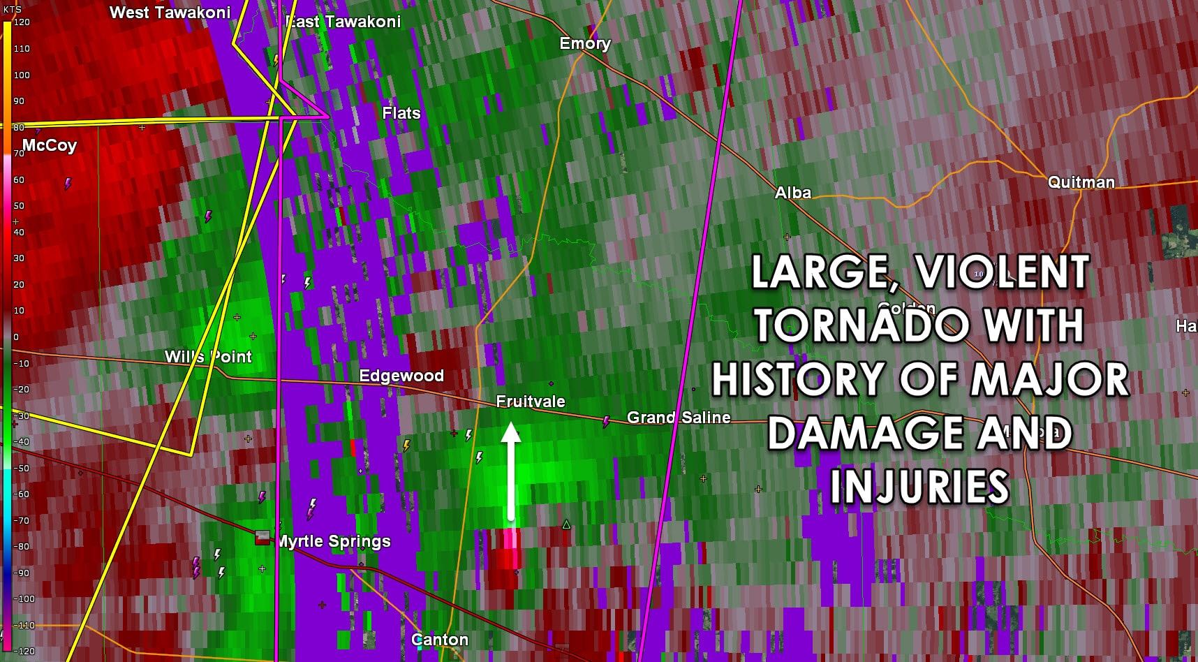
A large and violent tornado is 5 miles northeast of Canton and moving north toward Fruitville. This tornado has a history of producing major damage and injuries around Canton. This long-track tornado is a direct threat to life and property. Those in Fruitville and west of Grand Saline need to be in shelter NOW! THIS IS AN EMERGENCY SITUATION! Should the tornado continue it may pose a direct threat to Emory in 25-30 minutes.
Severe Weather Statement
National Weather Service Fort Worth TX
638 PM CDT SAT APR 29 2017
TXC379-467-300000-
/O.CON.KFWD.TO.W.0027.000000T0000Z-170430T0000Z/
Van Zandt TX-Rains TX-
638 PM CDT SAT APR 29 2017
…A TORNADO WARNING REMAINS IN EFFECT UNTIL 700 PM CDT FOR
NORTHWESTERN VAN ZANDT AND RAINS COUNTIES…
At 638 PM CDT, a confirmed large and extremely dangerous tornado was
located just south of Fruitvale, moving north at 25 mph. If you are
in Fruitvale, seek shelter NOW!
This is a PARTICULARLY DANGEROUS SITUATION. TAKE COVER NOW!
HAZARD…Damaging tornado.
SOURCE…Weather spotters confirmed tornado.
IMPACT…You are in a life-threatening situation. Flying debris may
be deadly to those caught without shelter. Mobile homes
will be destroyed. Considerable damage to homes,
businesses, and vehicles is likely and complete destruction
is possible.
Locations impacted include…
Canton, Grand Saline, Edgewood, Emory, East Tawakoni, Fruitvale and
Point.


0 Comments