
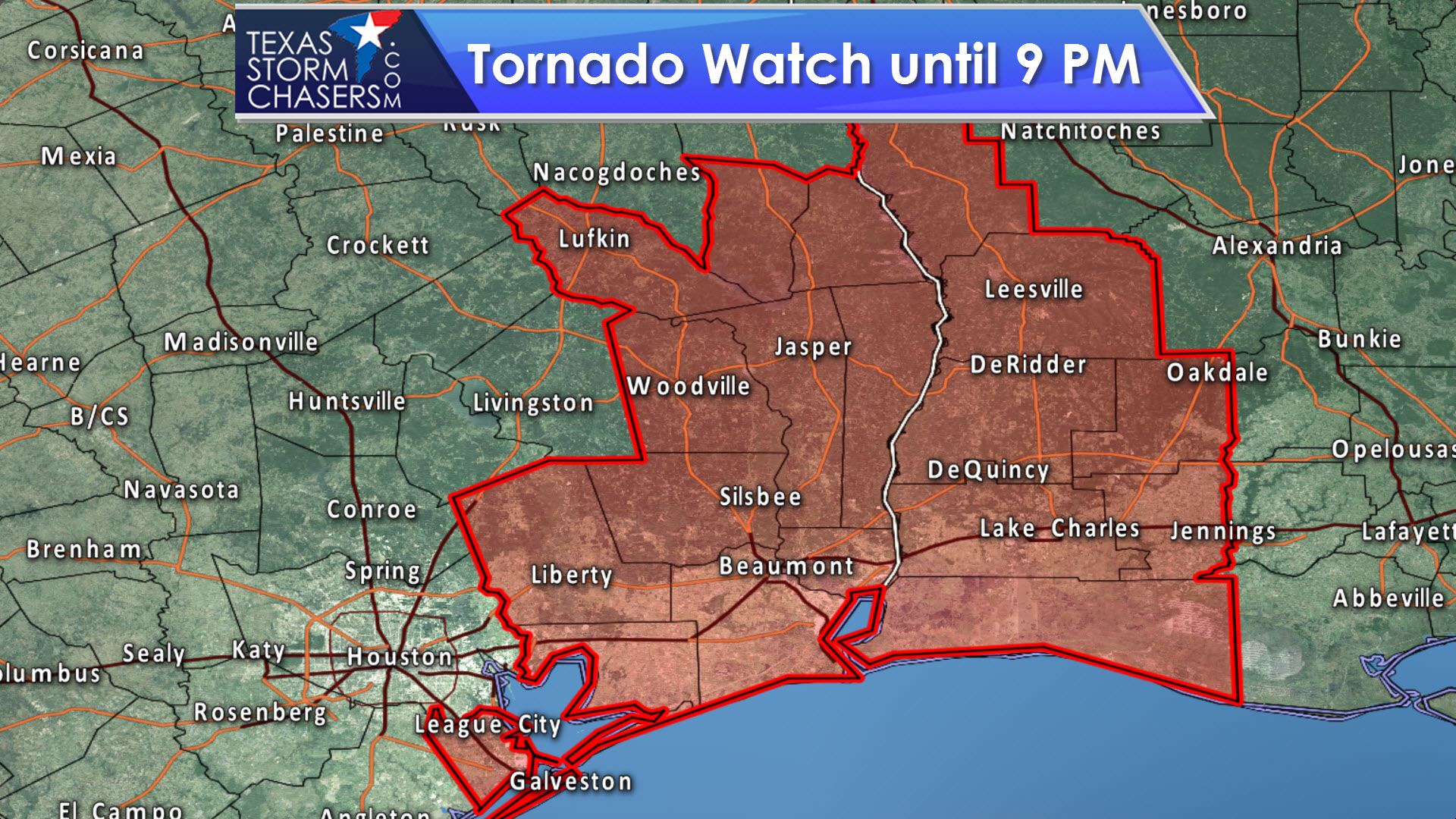
A tornado watch is now in effect until 9 PM for portions of Southeast Texas. This watch runs along and east of a Lufkin to Zavala to Woodville to Liberty to League City line. Houston is not included in this watch. Widespread severe weather is not expected, but isolated storms capable of producing damaging wind gusts and a tornado or two are possible through the early evening hours. Later on tonight a cold front will push east – ending the threat of severe weather in Texas. You can keep up with any new storms by following along on our free radar at texasstormchasers.com/radar
Tornado Watch Number 98
NWS Storm Prediction Center Norman OK
210 PM CDT Wed Mar 29 2017
The NWS Storm Prediction Center has issued a
* Tornado Watch for portions of
Western Louisiana
Southeast Texas
Coastal Waters
* Effective this Wednesday afternoon and evening from 210 PM
until 900 PM CDT.
* Primary threats include…
A couple tornadoes possible
Isolated very large hail events to 2 inches in diameter possible
Isolated damaging wind gusts to 70 mph possible
SUMMARY…The environment across the region continues to become
increasingly favorable for a severe risk including the possibility
of a couple of tornadoes. Storms should continue to gradually
increase and expand northeastward through the late afternoon and
evening hours.
. TEXAS COUNTIES INCLUDED ARE
ANGELINA CHAMBERS GALVESTON
HARDIN JASPER JEFFERSON
LIBERTY NEWTON ORANGE
SABINE SAN AUGUSTINE TYLER


0 Comments