
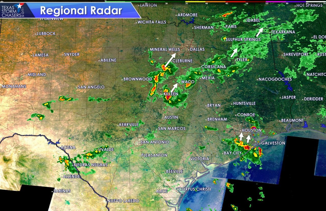
We’re monitoring a couple different zones of convection this morning. Unfortunately two separate clusters are about to move into the D/FW Metroplex and Houston metros. The early bird gets the worm if you have an early committee today. Once the rain moves in I’m sure the traffic is going to become much less pleasant. Most convection is moving north/northeast and will continue to do so today. Rain will be moving into D/FW and Houston from the south/southwest over the next hour. None of this morning’s thunderstorm activity is severe, but we are watching for locally heavy rains. Don’t be surprised if the typical low-lying construction zones have issues draining water this morning as rain moves in.
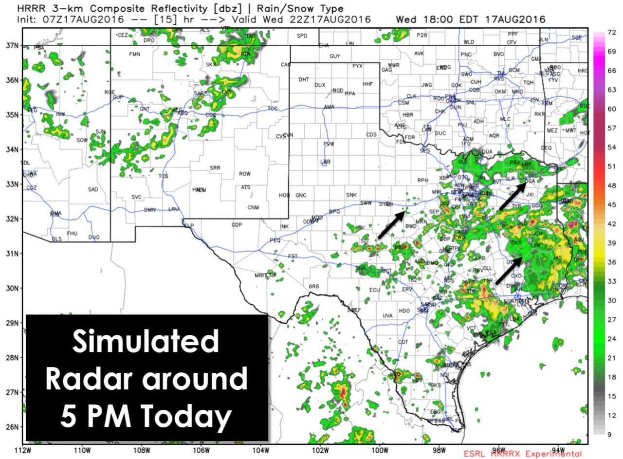
Numerous showers and thunderstorms will continue to impact portions of North Texas, Central Texas, Northeast Texas, and East Texas today as our stationary front remains a focal point for additional development. Compared to Tuesday the front has progressed a little north which will likewise allow for more rain showers today. The front will slowly move west/north this evening with increasing chances of scattered showers/storms across the Big Country, Concho Valley, and Northwest Texas. Rain coverage will tend to lessen (but not stop) tonight with scattered activity continuing.
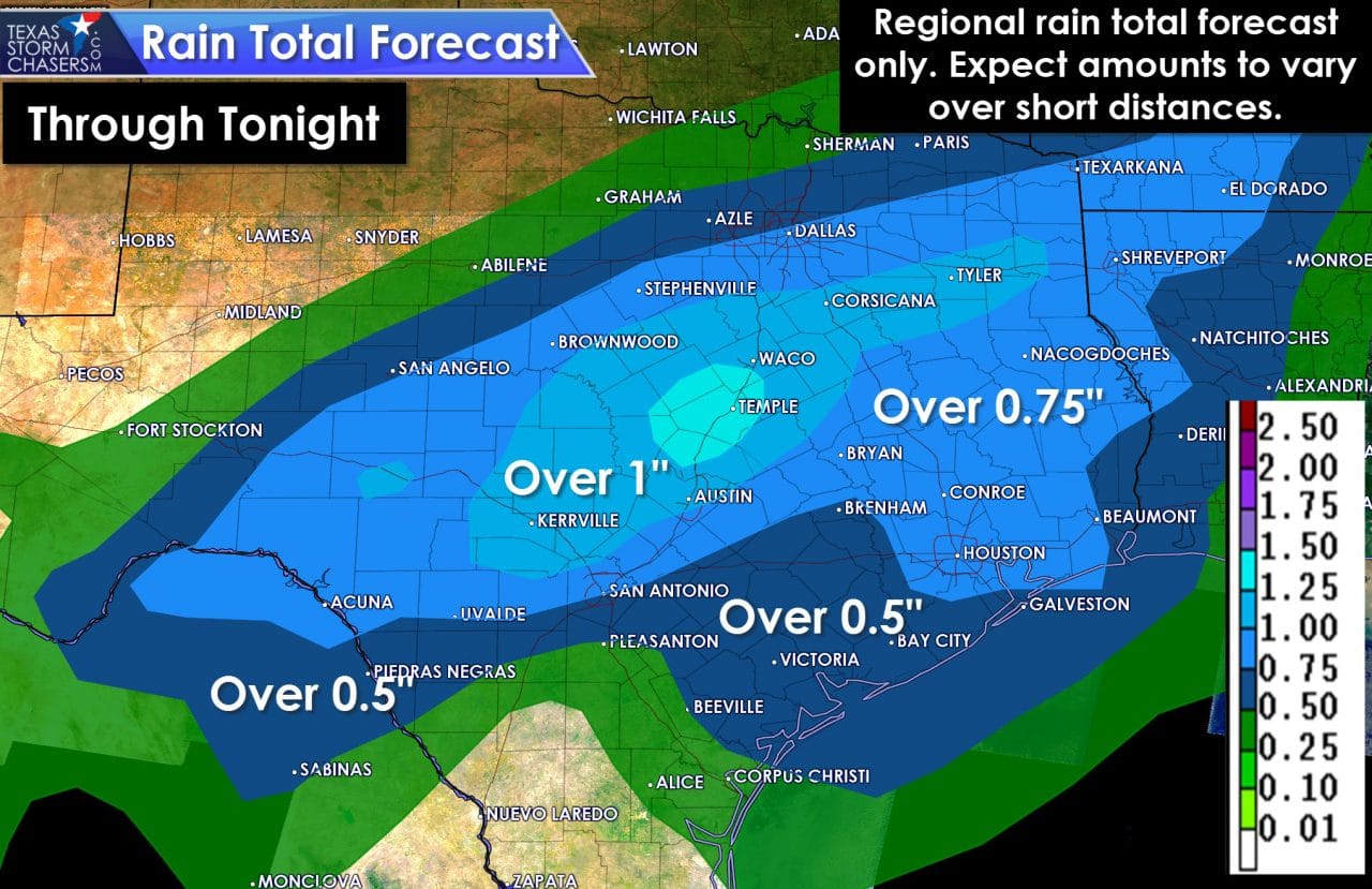
Widespread flash flooding is not expected today. As a whole we should see most locations pick up under 1 to 1.5 inches of rain through tonight. Not everyone will get rain nor will everyone get a decent amount of measurable rain. What we will be watching for is locally heavy rains that move over the same locations today and tonight. That scenario caused 5 to 8 inches of rain to fall just west of Austin yesterday and last night. Flash Flood Watches are in effect for Central Texas and Southeast Texas to account for that possibility. Very localized rain totals over 3-4 inches may occur through tonight across North Texas, Central Texas, the Brazos Valley, and Southeast Texas. By far most folks will receive far less rain.
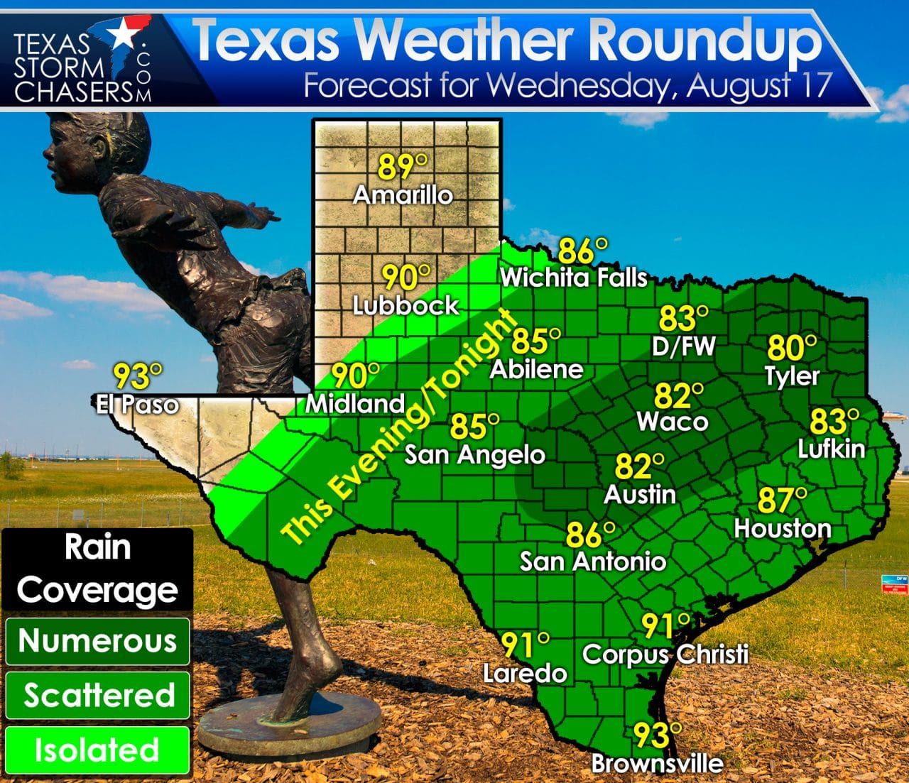
Temperatures will remain below-average again today with highs only climbing into the 80s to lower 90s. Even across far West Texas and the Texas Panhandle temperatures will struggle to get into the lower 90s with sunny skies. This anomaly active August pattern continues into next week with another cool front entering the region late this weekend. Rain chances will ramp up again in association with the front.


0 Comments